| Home | City Bus | Maps | Villages | Cities | Rail | Tourist Places | School | College | Pin Codes | Corona Cases Count |
| Distance Calculator Bus Services IFSC Codes Trace Mobile Number Weather Search Place Trace IP Available Cash ATM/Banks Locate Polling Booth Report an Error contact People |
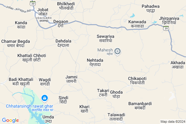
Nehtada
Nehtada Map
EDIT Map
Add Your House
 ..
..
Current Corona Virus Infected Patients Count in Alirajpur District
| City Name | District Name | Total Covid cases |
|---|---|---|
| Alirajpur District | Alirajpur | 2 |
Locality Name :
Nehtada
( नेहतडा )
Tehsil Name : Jobat
District : Alirajpur
State : Madhya Pradesh
Division : Indore
Language : Hindi
Current Time 11:37 PM
Date: Wednesday , Feb 05,2025 (IST)
Time zone: IST (UTC+5:30)
Elevation / Altitude: 288 meters. Above Seal level
Telephone Code / Std Code: 07393
Assembly constituency : Jobat assembly constituency
Assembly MLA : Sena - Mahesh Patel
Lok Sabha constituency : Ratlam parliamentary constituency
Parliament MP : GUMAN SINGH DAMOR
Serpanch Name :
Commodities Prices : Jobat Market / Mandi
Nehtada Live Weather
Temperature: 19.8 °C
clear sky
Humidity: 27%
Wind : 4.59 mt/sec towards NE
StationName : "Jobat"
observed on 13 Mins Back
Temperature: 19.8 °C
clear sky
Humidity: 27%
Wind : 4.59 mt/sec towards NE
StationName : "Jobat"
observed on 13 Mins Back
Nehtada Weather Forecast for Next 5 days
06-02-2025
18.2°C to 19.8°C
clear sky
18.2°C to 19.8°C
clear sky
07-02-2025
16.9°C to 29.0°C
clear sky
16.9°C to 29.0°C
clear sky
08-02-2025
17.6°C to 30.2°C
clear sky
17.6°C to 30.2°C
clear sky
09-02-2025
18.7°C to 31.1°C
clear sky, broken clouds, scattered clouds, few clouds
18.7°C to 31.1°C
clear sky, broken clouds, scattered clouds, few clouds
10-02-2025
20.5°C to 33.2°C
few clouds, broken clouds, clear sky
20.5°C to 33.2°C
few clouds, broken clouds, clear sky
Rivers Near Nehtada
Hindola Nadi
Ghatwal
Hindola Nadi
Ghatwal
About Nehtada
Correct below Info and add more info about NehtadaNehtada is a Village in Jobat Tehsil in Alirajpur District of Madhya Pradesh State, India. It belongs to Indore Division . It is located 33 KM towards East from District head quarters Alirajpur. 7 KM from Kasba Jobat. 354 KM from State capital Bhopal
Jamni ( 3 KM ) , Wagdi ( 7 KM ) , Kanwada ( 7 KM ) , Baledi ( 8 KM ) , Bhilkhedi ( 8 KM ) are the nearby Villages to Nehtada. Nehtada is surrounded by Udaigarh Tehsil towards North , Kukshi Tehsil towards East , Bagh Tehsil towards East , Alirajpur Tehsil towards west .
Jhabua , Rajgarh , Barwani , Manawar are the near by Cities to Nehtada.
Nehtada 2011 Census Details
Nehtada Local Language is Hindi. Nehtada Village Total population is 2388 and number of houses are 370. Female Population is 50.2%. Village literacy rate is 27.6% and the Female Literacy rate is 12.3%.
Population
| Census Parameter | Census Data |
| Total Population | 2388 |
| Total No of Houses | 370 |
| Female Population % | 50.2 % ( 1198) |
| Total Literacy rate % | 27.6 % ( 659) |
| Female Literacy rate | 12.3 % ( 293) |
| Scheduled Tribes Population % | 98.1 % ( 2342) |
| Scheduled Caste Population % | 0.9 % ( 22) |
| Working Population % | 46.9 % |
| Child(0 -6) Population by 2011 | 535 |
| Girl Child(0 -6) Population % by 2011 | 48.6 % ( 260) |
Nehtada Census More Deatils.
Politics in Nehtada
Bharatiya Janata Party , BJP , INC are the major political parties in this area.Polling Stations /Booths near Nehtada
1)Khushalabayadi2)Vej
3)Bhandakhapar
4)Chhota Bhavata
5)Kanwada
HOW TO REACH Nehtada
By Rail
There is no railway station near to Nehtada in less than 10 km.Pincodes near Nehtada
457990 ( Jobat ) , 454331 ( Kukshi ) , 454221 ( Bagh )Colleges near Nehtada
Govt. College
Address : Govt. Collegealirajpur Madhya Pradesh
Government Post Graduate College
Address : Hospital Road Alirajpurdist.- Jhabua (m.p.) Pin Co
Schools near Nehtada
Nms Ranjeetgarh
Address : ranjitgarh , jobat , alirajpur , Madhya Pradesh . PIN- 457991
Nms Kherwa
Address : kherwa , jobat , alirajpur , Madhya Pradesh . PIN- 457991
Nms Choti Hirapur
Address : chhoti heerapur , jobat , alirajpur , Madhya Pradesh . PIN- 457991
Nms Ghonghasha
Address : ghonghasha , jobat , alirajpur , Madhya Pradesh . PIN- 457991
Govt Health Centers near Nehtada
1) SHC Takari , Sub Health Center Takari , Patel Pura , Near Talawdi Road2) PHC Talavadi , , ,
3) SHC Kattali , SHC Kattali , sector Kattali , SHC BADI KHATTALI PHC khattali
Petrol Bunks in Nehtada,Jobat
PRABHUDAYAL ANANDILAL JHANWAR
Biyabani Main Rd; Veer Savarkar Market; DHAR; Madhya Pradesh 454221; India
20.6 KM distance Detail
more ..
Electronic Shops in Nehtada,Jobat
Sidhart computer
Road Number 6; Anand Nagar Society; Sector 24; Gandhinagar; 382024; India
20.5 KM distance Detail
Local Parks in Nehtada,Jobat
About Nehtada &
History
How to reach Nehtada
Tourist Places Near By Nehtada
Schools in Nehtada
Colleges in Nehtada
Temperature & weather of Nehtada
places in Nehtada
Nehtada photos
More Information
How to reach Nehtada
Tourist Places Near By Nehtada
Schools in Nehtada
Colleges in Nehtada
Temperature & weather of Nehtada
places in Nehtada
Nehtada photos
More Information
Village Talk
Post News or Events about this Village
Near Cities
Jhabua 50 KM near
Rajgarh 54 KM near
Barwani 54 KM near
Manawar 57 KM near
Jhabua 50 KM near
Rajgarh 54 KM near
Barwani 54 KM near
Manawar 57 KM near
Near By Taluks
Jobat 7 KM near
Udaigarh 17 KM near
Kukshi 22 KM near
Bagh 23 KM near
Jobat 7 KM near
Udaigarh 17 KM near
Kukshi 22 KM near
Bagh 23 KM near
Near By Air Ports
Indore Airport 143 KM near
Vadodara Airport 161 KM near
Ahmedabad Airport 245 KM near
Bhavnagar Airport 291 KM near
Indore Airport 143 KM near
Vadodara Airport 161 KM near
Ahmedabad Airport 245 KM near
Bhavnagar Airport 291 KM near
Near By Tourist Places
Toranmal 63 KM near
Dahod 75 KM near
Maheshwar 113 KM near
Kevadia Narmada 123 KM near
Champaner 125 KM near
Toranmal 63 KM near
Dahod 75 KM near
Maheshwar 113 KM near
Kevadia Narmada 123 KM near
Champaner 125 KM near
Near By Districts
Alirajpur 31 KM near
Jhabua 49 KM near
Barwani 51 KM near
Dohad 70 KM near
Alirajpur 31 KM near
Jhabua 49 KM near
Barwani 51 KM near
Dohad 70 KM near
Near By RailWay Station
Meghnagar Rail Way Station 67 KM near
Dahod Rail Way Station 72 KM near
Meghnagar Rail Way Station 67 KM near
Dahod Rail Way Station 72 KM near