| Home | City Bus | Maps | Villages | Cities | Rail | Tourist Places | School | College | Pin Codes | Corona Cases Count |
| Distance Calculator Bus Services IFSC Codes Trace Mobile Number Weather Search Place Trace IP Available Cash ATM/Banks Locate Polling Booth Report an Error contact People |
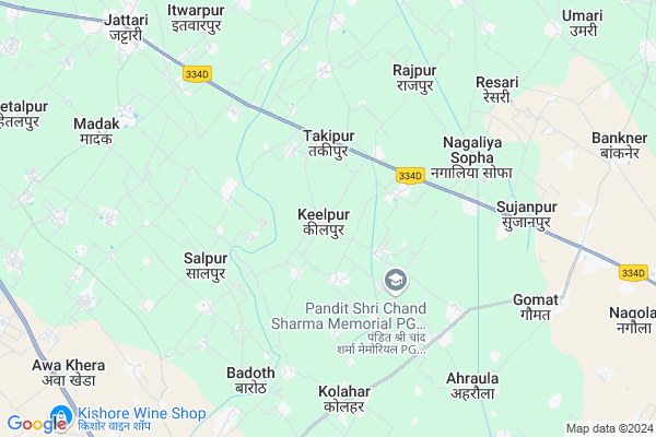
Keelpur
Keelpur Map
EDIT Map
Add Your House
 ..
..
Current Corona Virus Infected Patients Count in Aligarh District
| City Name | District Name | Total Covid cases |
|---|---|---|
| Aligarh District | Aligarh | 13 |
Locality Name :
Keelpur
( कीलपुर )
Block Name : Tappal
District : Aligarh
State : Uttar Pradesh
Division : Aligarh
Language : Hindi and Urdu
Current Time 10:32 PM
Date: Sunday , Apr 27,2025 (IST)
Time zone: IST (UTC+5:30)
Elevation / Altitude: 201 meters. Above Seal level
Telephone Code / Std Code: 05724
Assembly constituency : Khair assembly constituency
Assembly MLA : Anoop Singh Urf Anoop Pradhan Valmeeki
Lok Sabha constituency : Aligarh parliamentary constituency
Parliament MP : SATISH KUMAR GAUTAM
Serpanch Name :
Pin Code : 202141
Post Office Name : Dayal Nagar
Commodities Prices : Khair Market / Mandi
Keelpur Live Weather
Temperature: 33.1 °C
clear sky
Humidity: 14%
Wind : 2.92 mt/sec towards SE
StationName : "BÄ\u0081jna"
observed on 2 Hours Back
Temperature: 33.1 °C
clear sky
Humidity: 14%
Wind : 2.92 mt/sec towards SE
StationName : "BÄ\u0081jna"
observed on 2 Hours Back
Keelpur Weather Forecast for Next 5 days
28-04-2025
29.6°C to 32.3°C
clear sky
29.6°C to 32.3°C
clear sky
29-04-2025
27.1°C to 42.5°C
clear sky
27.1°C to 42.5°C
clear sky
30-04-2025
28.6°C to 43.7°C
clear sky
28.6°C to 43.7°C
clear sky
01-05-2025
28.6°C to 44.2°C
clear sky, broken clouds
28.6°C to 44.2°C
clear sky, broken clouds
02-05-2025
29.6°C to 42.4°C
broken clouds, overcast clouds, scattered clouds, few clouds, clear sky
29.6°C to 42.4°C
broken clouds, overcast clouds, scattered clouds, few clouds, clear sky
National Highways Reachable To Keelpur
Nationa High Way :NH44
Nationa High Way :NH509
Nationa High Way :NH44
Nationa High Way :NH509
Rivers Near Keelpur
Karwan Nadi
यमुना (Yamuna) :যমুনা :Yamuna :યમુના :यमुना :ಯಮುನಾ :यमुना :யமுனை :Ямуна :https://1drv.ms/b/s!Ar-WXIFaX7UdgQuO6WpVrTr6YYsQ
Karwan Nadi
यमुना (Yamuna) :যমুনা :Yamuna :યમુના :यमुना :ಯಮುನಾ :यमुना :யமுனை :Ямуна :https://1drv.ms/b/s!Ar-WXIFaX7UdgQuO6WpVrTr6YYsQ
About Keelpur
Correct below Info and add more info about KeelpurKeelpur is a Village in Tappal Block in Aligarh District of Uttar Pradesh State, India. It belongs to Aligarh Division . It is located 41 KM towards west from District head quarters Aligarh. 11 KM from Tappal. 400 KM from State capital Lucknow
Keelpur Pin code is 202141 and postal head office is Dayal Nagar .
Mathna ( 2 KM ) , Jadana ( 2 KM ) , Dhumra ( 2 KM ) , Haziyapur ( 2 KM ) , Takipur ( 2 KM ) are the nearby Villages to Keelpur. Keelpur is surrounded by Nohjhil Block towards South , Khair Block towards East , Chandaus Block towards East , Gonda Block towards South .
Hodal , Aligarh , Vrindavan , Palwal are the near by Cities to Keelpur.
This Place is in the border of the Aligarh District and Palwal District. Palwal District Hassanpur is west towards this place . Also it is in the Border of other district Gautam Buddha Nagar . It is near to the Haryana State Border.
Keelpur 2011 Census Details
Keelpur Local Language is Hindi. Keelpur Village Total population is 2319 and number of houses are 406. Female Population is 46.4%. Village literacy rate is 60.6% and the Female Literacy rate is 21.8%.
Population
| Census Parameter | Census Data |
| Total Population | 2319 |
| Total No of Houses | 406 |
| Female Population % | 46.4 % ( 1077) |
| Total Literacy rate % | 60.6 % ( 1405) |
| Female Literacy rate | 21.8 % ( 505) |
| Scheduled Tribes Population % | 0.0 % ( 0) |
| Scheduled Caste Population % | 23.0 % ( 534) |
| Working Population % | 28.9 % |
| Child(0 -6) Population by 2011 | 341 |
| Girl Child(0 -6) Population % by 2011 | 46.9 % ( 160) |
Keelpur Census More Deatils.
Politics in Keelpur
BJP , RLD , BSP , INC are the major political parties in this area.Polling Stations /Booths near Keelpur
1)Junior High School Khediya Kurd R.n. 22)Junior High School Kilpur R.n. 1
3)Primary School Meerpur Dahaura
4)Primary School Kadirpur Karh
5)Primary School Gharbara
HOW TO REACH Keelpur
By Rail
There is no railway station near to Keelpur in less than 10 km.Colleges near Keelpur
Satyam Attri Inter College
Address :
Arl Degree College Malav Khurd Tappal Aligarh
Address :
Shikha Prasar Pramiry Pathshala Lalpur Raiyatpur Tappal Aligarh
Address :
S S I C Malav Khurd Tappal Aligarh
Address :
S.m.h.s School
Address :
Schools in Keelpur
Ups Keelpur
Address : keelpur , tappal , aligarh , Uttar Pradesh . PIN- 202137 , Post - Jattari
Govt Health Centers near Keelpur
1) Badauth , Sub Centre , Badauth ,2) Kolahar , Sub Centre , Kolahar , Bajna kher Rod
3) KHERIYA KHURD , , ,
Schools in Keelpur,Tappal
Electronic Shops in Keelpur,Tappal
Super Markets in Keelpur,Tappal
Local Parks in Keelpur,Tappal
Police Stations near Keelpur,Tappal
Governement Offices near Keelpur,Tappal
About Keelpur &
History
How to reach Keelpur
Tourist Places Near By Keelpur
Schools in Keelpur
Colleges in Keelpur
Temperature & weather of Keelpur
places in Keelpur
Keelpur photos
More Information
How to reach Keelpur
Tourist Places Near By Keelpur
Schools in Keelpur
Colleges in Keelpur
Temperature & weather of Keelpur
places in Keelpur
Keelpur photos
More Information
Village Talk
Post News or Events about this Village
Near Cities
Hodal 39 KM near
Aligarh 39 KM near
Vrindavan 48 KM near
Palwal 49 KM near
Hodal 39 KM near
Aligarh 39 KM near
Vrindavan 48 KM near
Palwal 49 KM near
Near By Taluks
Tappal 11 KM near
Nohjhil 11 KM near
Khair 12 KM near
Chandaus 20 KM near
Tappal 11 KM near
Nohjhil 11 KM near
Khair 12 KM near
Chandaus 20 KM near
Near By Air Ports
Indira Gandhi International Airport 99 KM near
Kheria Airport 104 KM near
Muzaffarnagar Airport 182 KM near
Gwalior Airport 216 KM near
Indira Gandhi International Airport 99 KM near
Kheria Airport 104 KM near
Muzaffarnagar Airport 182 KM near
Gwalior Airport 216 KM near
Near By Tourist Places
Dabchick 39 KM near
Aligarh 41 KM near
Vrindavan 48 KM near
Bulandshahr 55 KM near
Mathura 59 KM near
Dabchick 39 KM near
Aligarh 41 KM near
Vrindavan 48 KM near
Bulandshahr 55 KM near
Mathura 59 KM near
Near By Districts
Aligarh 39 KM near
Palwal 49 KM near
Gautam Buddha Nagar 54 KM near
Bulandshahr 55 KM near
Aligarh 39 KM near
Palwal 49 KM near
Gautam Buddha Nagar 54 KM near
Bulandshahr 55 KM near
Near By RailWay Station
Khurja Junction Rail Way Station 31 KM near
Kosi Kalan Rail Way Station 37 KM near
Khurja Junction Rail Way Station 31 KM near
Kosi Kalan Rail Way Station 37 KM near