| Home | City Bus | Maps | Villages | Cities | Rail | Tourist Places | School | College | Pin Codes | Corona Cases Count |
| Distance Calculator Bus Services IFSC Codes Trace Mobile Number Weather Search Place Trace IP Available Cash ATM/Banks Locate Polling Booth Report an Error contact People |
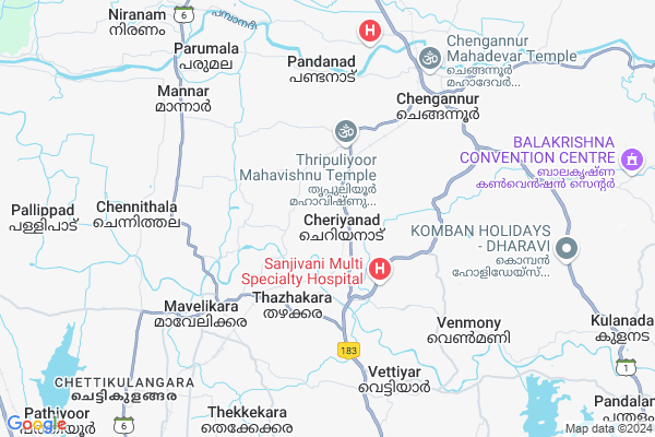
Cheriyanad
Cheriyanad Map
EDIT Map
Add Your House
 ..
..
Current Corona Virus Infected Patients Count in Alappuzha District
| City Name | District Name | Total Covid cases |
|---|---|---|
| Alappuzha District | Alappuzha | 4 |
| Alappuzha | Alappuzha | 1 |
Locality Name :
Cheriyanad
( ചെറിയനാട് )
Block Name : Chengannur
District : Alappuzha
State : Kerala
Division : South Kerala
Language : Malayalam and Hindi, English,tamil, Konkani
Current Time 06:53 AM
Date: Saturday , Apr 26,2025 (IST)
Time zone: IST (UTC+5:30)
Elevation / Altitude: 21 meters. Above Seal level
Telephone Code / Std Code: 0469
Assembly constituency : Chengannur assembly constituency
Assembly MLA : Saji Cherian
Lok Sabha constituency : Mavelikkara parliamentary constituency
Parliament MP : KODIKUNNIL SURESH
Serpanch Name :
Pin Code : 690104
Post Office Name : Cherukole
Alternate Village Name : Cheriyanad west
Commodities Prices : Chengannur Market / Mandi
Cheriyanad Live Weather
Temperature: 25.6 °C
overcast clouds
Humidity: 93%
Wind : 1.28 mt/sec towards NE
StationName : "Chengannūr"
observed on 1 Hours Back
Temperature: 25.6 °C
overcast clouds
Humidity: 93%
Wind : 1.28 mt/sec towards NE
StationName : "Chengannūr"
observed on 1 Hours Back
Cheriyanad Weather Forecast for Next 5 days
27-04-2025
25.3°C to 33.8°C
overcast clouds, light rain, moderate rain
25.3°C to 33.8°C
overcast clouds, light rain, moderate rain
28-04-2025
25.1°C to 32.4°C
light rain, overcast clouds
25.1°C to 32.4°C
light rain, overcast clouds
29-04-2025
24.9°C to 33.7°C
overcast clouds, light rain
24.9°C to 33.7°C
overcast clouds, light rain
30-04-2025
24.5°C to 33.2°C
light rain, moderate rain
24.5°C to 33.2°C
light rain, moderate rain
Edit below overview about Cheriyanad
Edit below overview about Cheriyanad
OverView of Cheriyanad
Cherianad village located between chenganoor and Mavelikara, 8KM from Chenganoor and 7 KM from Maveliakra. Cheriyanad was once located on the boundary of the kingdom of the Kayamkulam Rajah and in 1746 along with the rest of the kingdom it was annexed to travancore. Cheriyanad possesses a Pada Nilam or a battlefield which is now occupied by a school. Till 1980s there was a "Kalithattu" (a raised square platform fortified with four heavy stones at the boarders and a Banyan tree as well. During temple festival, the famous "Pallivilakku (High rise wooden RATH with lighted lamps) from each Kara brought to the ground. Even now, the tradition continues. Some prominent families owned Kalaris i.e. martial arts gymnasiums and also private temples.
Traditionally Cheriyanad consisted of nine original Karas or villages which are now: Athimanchery, Edavankadu, Mandapariyaram, Thuruthimal, Moolikode, Edamuri, Mampara, Ariunnisery, and Alakode. For administrative purposes it is subdivided into fourteen Karas. Cheriyanad is home to an important Temple, located west of Padanilam jn; (500 m) Mavelikara-Puliyoor-Chengannur road, of the hindu deity subrahmanian which is included in the jurisdiction of the high priests of the sabarimala Temple, the Thazhamon Madhom namboodiri family of chengannur. This temple is located in the heart of Cheriyanad , also known as Athimuncherry.
Traditionally Cheriyanad consisted of nine original Karas or villages which are now: Athimanchery, Edavankadu, Mandapariyaram, Thuruthimal, Moolikode, Edamuri, Mampara, Ariunnisery, and Alakode. For administrative purposes it is subdivided into fourteen Karas. Cheriyanad is home to an important Temple, located west of Padanilam jn; (500 m) Mavelikara-Puliyoor-Chengannur road, of the hindu deity subrahmanian which is included in the jurisdiction of the high priests of the sabarimala Temple, the Thazhamon Madhom namboodiri family of chengannur. This temple is located in the heart of Cheriyanad , also known as Athimuncherry.
Edit below overview about Cheriyanad
National Highways Reachable To Cheriyanad
Nationa High Way :NH183A
Nationa High Way :NH183
Nationa High Way :NH183A
Nationa High Way :NH183
Rivers Near Cheriyanad
Kallada :കല്ലട
Varattar River
Kallada :കല്ലട
Varattar River
About Cheriyanad
Cheriyanad is a Village in Chengannur Block in Alappuzha District of Kerala State, India. It belongs to South Kerala Division . It is located 43 KM towards East from District head quarters Alappuzha. 5 KM from Chengannur. 112 KM from State capital Thiruvananthapuram
Cheriyanad Pin code is 690104 and postal head office is Cherukole .
Ala ( 3 KM ) , Thazhakkara ( 4 KM ) , Eravankara ( 4 KM ) , Cherukol ( 6 KM ) , Chengannur ( 6 KM ) are the nearby Villages to Cheriyanad. Cheriyanad is surrounded by Mavelikkara Block towards west , Bharanicavu Block towards South , Kulanada Block towards East , Pulikeezhu Block towards North .
Chengannur , Mavelikkara , Thiruvalla , Kayamkulam are the near by Cities to Cheriyanad.
This Place is in the border of the Alappuzha District and Pathanamthitta District. Pathanamthitta District Thiruvalla is North towards this place .
Cheriyanad 2011 Census Details
Cheriyanad Local Language is Malayalam. Cheriyanad Village Total population is 21885 and number of houses are 5823. Female Population is 53.9%. Village literacy rate is 87.7% and the Female Literacy rate is 47.2%.
Population
| Census Parameter | Census Data |
| Total Population | 21885 |
| Total No of Houses | 5823 |
| Female Population % | 53.9 % ( 11792) |
| Total Literacy rate % | 87.7 % ( 19201) |
| Female Literacy rate | 47.2 % ( 10326) |
| Scheduled Tribes Population % | 0.2 % ( 43) |
| Scheduled Caste Population % | 14.8 % ( 3235) |
| Working Population % | 30.7 % |
| Child(0 -6) Population by 2011 | 1870 |
| Girl Child(0 -6) Population % by 2011 | 47.6 % ( 891) |
Cheriyanad Census More Deatils.
Politics in Cheriyanad
CPM , Indian National Congress , CPI(M) , CPI , INC are the major political parties in this area.Polling Stations /Booths near Cheriyanad
1)Church Mission L.p.s Kozhuvalloor(eastern Side)2)Devaswom Board High School Cheriyanad (east Part)
3)Jbs Keezhcherimel (south Part Of The South Building)
4)Juior Basic Girls School Cheriyanadu
5)Sree Narayana Vilasom U P S Thuruthimel
HOW TO REACH Cheriyanad
By Rail
Cheriyanad Rail Way Station , Chengannur Rail Way Station are the very nearby railway stations to Cheriyanad.Colleges near Cheriyanad
Sree Narayana College
Address :
St. Michael's College
Address :
T.k. Madhava Memorial College
Address :
Soware College Of Computers'
Address :
Sdv College Of Arts & Science
Address :
Schools near Cheriyanad
Govt.hss Angadical South
Address : chenganoor , chengannur , alappuzha , Kerala . PIN- 689122 , Post - Angadical Chengannur
Vhss Kallissery Chengannur
Address : thiruvanvandoor , chengannur , alappuzha , Kerala . PIN- 689124 , Post - Kallisserry
Govt. Hss Ala
Address : ala , chengannur , alappuzha , Kerala . PIN- 689126 , Post - Ala (Alappuzha)
Cheriyanadu Dbhss
Address : cheriyanadu , chengannur , alappuzha , Kerala . PIN- 689511 , Post - Cheriyanadu
Govt Health Centers near Cheriyanad
1) PHC CHITTAR , Chittar Community health centre , Chittar Maniyar road , police stationSub Villages in Cheriyanad
Hospitals in Cheriyanad,Chengannur
FWC elengimel
Mavelikara - Chenganoor - Sabarimala Village Rd; Elanjimel; Kerala 689511; India
1.4 KM distance Detail
more ..
Colleges in Cheriyanad,Chengannur
Kerala University College of Teacher Education
Kunnam; Thazhakara; Kerala 690108; India
3.1 KM distance Detail
Viswavidyalaya College of Science And Technology
Eravankara Junction-Kochalummodu Rd; Kochalummoodu; Mavelikara; Kerala 690509; India
4.5 KM distance Detail
S.N Pvt I.T.I
Kochalummodu JN; Eravankara Junction-Kochalummodu Rd; Kochalummoodu; Mavelikara; Kerala 690509; India
4.5 KM distance Detail
more ..
Schools in Cheriyanad,Chengannur
St. Joseph's English Medium School
Maliyakalchira Road; Cheriyanad; Kerala 689511; India
0.4 KM distance Detail
Sree Neelakanta Vidyapeedom
Thonackad - Cheriyanad Rd; Cheriyanad; Kerala 689511; India
0.4 KM distance Detail
Electronic Shops in Cheriyanad,Chengannur
Prajapathy Photo Studio
Mavelikara - Chenganoor - Sabarimala Village Rd; Thonackadu; Kerala 689511; India
1.7 KM distance Detail
Local Parks in Cheriyanad,Chengannur
Mundiyapallil Gilgal House
877/8u; Thazakara Rd; Mavelikara; Kerala 690102; India
3.2 KM distance Detail
Police Stations near Cheriyanad,Chengannur
Venmony Police Station
Venmoney Pulakadavu Road; Venmony; Alappuzha; Kerala 689509; India
6.3 KM distance Detail
Office of the inspector RPF - Chengannur
railway station; Chengannur; Kerala 689121; India
6.4 KM distance Detail
Governement Offices near Cheriyanad,Chengannur
Cheriyanad Panchayath Office
Cheriyanad - Ala - Madathumpady Rd; Cheriyanad; Kerala 689511; India
1.7 KM distance Detail
About Cheriyanad &
History
How to reach Cheriyanad
Tourist Places Near By Cheriyanad
Schools in Cheriyanad
Colleges in Cheriyanad
Temperature & weather of Cheriyanad
places in Cheriyanad
Cheriyanad photos
More Information
How to reach Cheriyanad
Tourist Places Near By Cheriyanad
Schools in Cheriyanad
Colleges in Cheriyanad
Temperature & weather of Cheriyanad
places in Cheriyanad
Cheriyanad photos
More Information
Village Talk
Post News or Events about this Village
Near Cities
Chengannur 4 KM near
Mavelikkara 6 KM near
Thiruvalla 12 KM near
Kayamkulam 17 KM near
Chengannur 4 KM near
Mavelikkara 6 KM near
Thiruvalla 12 KM near
Kayamkulam 17 KM near
Near By Taluks
Chengannur 5 KM near
Mavelikkara 6 KM near
Pulikeezhu 11 KM near
Bharanicavu 11 KM near
Chengannur 5 KM near
Mavelikkara 6 KM near
Pulikeezhu 11 KM near
Bharanicavu 11 KM near
Near By Air Ports
Trivandrum International Airport 108 KM near
Kochi Airport 111 KM near
Tuticorin Airport 192 KM near
Madurai Airport 198 KM near
Trivandrum International Airport 108 KM near
Kochi Airport 111 KM near
Tuticorin Airport 192 KM near
Madurai Airport 198 KM near
Near By Tourist Places
Kuttanad 23 KM near
Sasthamkotta 30 KM near
Kottayam 38 KM near
Alleppey 40 KM near
Kumarakom 41 KM near
Kuttanad 23 KM near
Sasthamkotta 30 KM near
Kottayam 38 KM near
Alleppey 40 KM near
Kumarakom 41 KM near
Near By Districts
Pathanamthitta 26 KM near
Kottayam 39 KM near
Alappuzha 40 KM near
Kollam 47 KM near
Pathanamthitta 26 KM near
Kottayam 39 KM near
Alappuzha 40 KM near
Kollam 47 KM near
Near By RailWay Station
Cheriyanad Rail Way Station 0.8 KM near
Chengannur Rail Way Station 6.2 KM near
Mavelikara Rail Way Station 6.8 KM near
Cheriyanad Rail Way Station 0.8 KM near
Chengannur Rail Way Station 6.2 KM near
Mavelikara Rail Way Station 6.8 KM near