| Home | City Bus | Maps | Villages | Cities | Rail | Tourist Places | School | College | Pin Codes | Corona Cases Count |
| Distance Calculator Bus Services IFSC Codes Trace Mobile Number Weather Search Place Trace IP Available Cash ATM/Banks Locate Polling Booth Report an Error contact People |
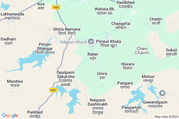
Raher
Raher Map
EDIT Map
Add Your House
 ..
..
Current Corona Virus Infected Patients Count in Akola District
| City Name | District Name | Total Covid cases |
|---|---|---|
| Akola District | Akola | 24 |
Locality Name :
Raher
( राहेर )
Taluka Name : Patur
District : Akola
State : Maharashtra
Region : Vidarbha
Division : Amravati
Language : English and Hindi, Marathi, Urdu
Current Time 06:02 AM
Date: Saturday , Apr 26,2025 (IST)
Time zone: IST (UTC+5:30)
Telephone Code / Std Code: 07255
Assembly constituency : Balapur assembly constituency
Assembly MLA : Nitinkumar Bhikanrao Tale
Lok Sabha constituency : Akola parliamentary constituency
Parliament MP : Dhotre Sanjay Shamrao
Serpanch Name :
Pin Code : 444501
Post Office Name : Patur
Commodities Prices : Patur Market / Mandi
Raher Live Weather
Temperature: 32.8 °C
overcast clouds
Humidity: 24%
Wind : 2.24 mt/sec towards N
StationName : "BÄ\u0081lÄ\u0081pur"
observed on Now
Temperature: 32.8 °C
overcast clouds
Humidity: 24%
Wind : 2.24 mt/sec towards N
StationName : "BÄ\u0081lÄ\u0081pur"
observed on Now
Raher Weather Forecast for Next 5 days
27-04-2025
32.7°C to 41.4°C
overcast clouds, broken clouds, clear sky, scattered clouds, few clouds
32.7°C to 41.4°C
overcast clouds, broken clouds, clear sky, scattered clouds, few clouds
28-04-2025
31.5°C to 41.2°C
broken clouds, few clouds, clear sky
31.5°C to 41.2°C
broken clouds, few clouds, clear sky
29-04-2025
30.2°C to 41.7°C
clear sky, few clouds
30.2°C to 41.7°C
clear sky, few clouds
30-04-2025
31.0°C to 42.9°C
clear sky, scattered clouds, few clouds
31.0°C to 42.9°C
clear sky, scattered clouds, few clouds
01-05-2025
30.2°C to 43.3°C
clear sky, scattered clouds, few clouds
30.2°C to 43.3°C
clear sky, scattered clouds, few clouds
Edit below overview about Raher
Edit below overview about Raher
OverView of Raher
Raher is a small village situated at sides of Utawali riverEdit below overview about Raher
National Highways Reachable To Raher
Nationa High Way :NH53
Nationa High Way :NH161E;NH753C
Nationa High Way :NH53
Nationa High Way :NH161E;NH753C
Rivers Near Raher
Utavli
Kedar River
Utavli
Kedar River
About Raher
Raher is a Village in Patur Taluka in Akola District of Maharashtra State, India. It belongs to Vidarbha region . It belongs to Amravati Division . It is located 47 KM towards west from District head quarters Akola. 19 KM from Patur. 507 KM from State capital Mumbai
Raher Pin code is 444501 and postal head office is Patur .
Malsur ( 8 KM ) , Khetri ( 8 KM ) , Sayvani ( 8 KM ) , Pangartati ( 9 KM ) , Chatari ( 10 KM ) are the nearby Villages to Raher. Raher is surrounded by Khamgaon Taluka towards North , Mehkar Taluka towards South , Balapur Taluka towards North , Malegaon Taluka towards East .
Patur , Mehkar , Shegaon , Akola are the near by Cities to Raher.
Raher 2011 Census Details
Raher Local Language is English. Raher Village Total population is 1262 and number of houses are 272. Female Population is 49.1%. Village literacy rate is 64.9% and the Female Literacy rate is 29.6%.
Population
| Census Parameter | Census Data |
| Total Population | 1262 |
| Total No of Houses | 272 |
| Female Population % | 49.1 % ( 620) |
| Total Literacy rate % | 64.9 % ( 819) |
| Female Literacy rate | 29.6 % ( 374) |
| Scheduled Tribes Population % | 4.0 % ( 50) |
| Scheduled Caste Population % | 13.5 % ( 171) |
| Working Population % | 57.1 % |
| Child(0 -6) Population by 2011 | 171 |
| Girl Child(0 -6) Population % by 2011 | 43.3 % ( 74) |
Raher Census More Deatils.
Politics in Raher
Bharatiya Janata Party , BJP , BBM , SHS , INC are the major political parties in this area.Polling Stations /Booths near Raher
1)G. P. Pra. Shala Kosaganv2)Jilha Parishad Prathamik Shala Uttar Bhag Aleganv
3)Jilha Parishad Prathamik Shala Khirapuri Khu
4)Jilha Parishad Prathamik Shala Kholi Kru. 1 Pimpalakhuta
5)Jilha Parishad Prathamik Shala East Bhag Channi
HOW TO REACH Raher
By Road
Patur is the Nearest Town to Raher. Patur is 42 km from Raher. Road connectivity is there from Patur to Raher.By Rail
There is no railway station near to Raher in less than 10 km.Colleges near Raher
Late Sau Vijayatai Deshmukh Junior College Alegaon
Address :
Shri Sudhakarrao Naik Art & Science Junar Collage Shekapur Phata Karla
Address :
Bsc Agree College ,sumitrabai Andhare Krushi Mahavidyalay. Shirla
Address : At Shirla Akola Washim Highway,shirla Khadan
Schools in Raher
Zpps
Address : raher , patur , akola , Maharashtra . PIN- 444501 , Post - Patur
Govt Health Centers near Raher
1) Umara , Arogya Uapkandra Umara , Mehakar Road , Bus Stand Malsur2) Pipalkhuta , Arogya Uapkandra Pipalkhuta , Channi Road , Bus Stand
3) Deulgaon sakarsha , Deulgaon sakarsha khamgaon road , Deulgaon sakarsha primary health centre , Deulgaon sakarsha primary health centre
Local Parks in Raher,Patur
About Raher &
History
How to reach Raher
Tourist Places Near By Raher
Schools in Raher
Colleges in Raher
Temperature & weather of Raher
places in Raher
Raher photos
More Information
How to reach Raher
Tourist Places Near By Raher
Schools in Raher
Colleges in Raher
Temperature & weather of Raher
places in Raher
Raher photos
More Information
Village Talk
Post News or Events about this Village
Near Cities
Patur 30 KM near
Mehkar 39 KM near
Shegaon 43 KM near
Akola 46 KM near
Patur 30 KM near
Mehkar 39 KM near
Shegaon 43 KM near
Akola 46 KM near
Near By Taluks
Patur 18 KM near
Khamgaon 29 KM near
Mehkar 31 KM near
Balapur 36 KM near
Patur 18 KM near
Khamgaon 29 KM near
Mehkar 31 KM near
Balapur 36 KM near
Near By Air Ports
Chikkalthana Airport 169 KM near
Nanded Airport 173 KM near
Latur Airport 255 KM near
Sonegaon Airport 284 KM near
Chikkalthana Airport 169 KM near
Nanded Airport 173 KM near
Latur Airport 255 KM near
Sonegaon Airport 284 KM near
Near By Tourist Places
Washim 66 KM near
Hingoli 104 KM near
Burhanpur 107 KM near
Melghat Tiger Reserve 129 KM near
Amravati 136 KM near
Washim 66 KM near
Hingoli 104 KM near
Burhanpur 107 KM near
Melghat Tiger Reserve 129 KM near
Amravati 136 KM near
Near By Districts
Akola 46 KM near
Buldhana 61 KM near
Washim 66 KM near
Hingoli 103 KM near
Akola 46 KM near
Buldhana 61 KM near
Washim 66 KM near
Hingoli 103 KM near
Near By RailWay Station
Shegaon Rail Way Station 43 KM near
Jalamb Junction Rail Way Station 47 KM near
Shegaon Rail Way Station 43 KM near
Jalamb Junction Rail Way Station 47 KM near