| Home | City Bus | Maps | Villages | Cities | Rail | Tourist Places | School | College | Pin Codes | Corona Cases Count |
| Distance Calculator Bus Services IFSC Codes Trace Mobile Number Weather Search Place Trace IP Available Cash ATM/Banks Locate Polling Booth Report an Error contact People |
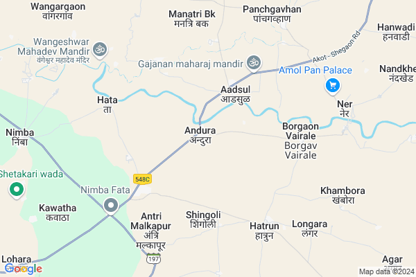
Andura
Andura Map
EDIT Map
Add Your House
 ..
..
Current Corona Virus Infected Patients Count in Akola District
| City Name | District Name | Total Covid cases |
|---|---|---|
| Akola District | Akola | 24 |
Locality Name :
Andura
( अणदूर )
Taluka Name : Balapur
District : Akola
State : Maharashtra
Region : Vidarbha
Division : Amravati
Language : English and Hindi, Marathi, Urdu
Current Time 09:26 AM
Date: Wednesday , Apr 30,2025 (IST)
Time zone: IST (UTC+5:30)
Elevation / Altitude: 281 meters. Above Seal level
Telephone Code / Std Code: 07257
Assembly constituency : Balapur assembly constituency
Assembly MLA : Nitinkumar Bhikanrao Tale
Lok Sabha constituency : Akola parliamentary constituency
Parliament MP : Dhotre Sanjay Shamrao
Serpanch Name :
Pin Code : 444311
Post Office Name : Nimba
Commodities Prices : Telhara Market / Mandi
Edit below overview about Andura
Edit below overview about Andura
OverView of Andura
Andura is on bank of ariver purna ,the river purna and morna meet at place shiv mandir called ananteshwar mandir.big bridge build in 1931on the river purna .across the bridge at a distance 1km there is rest house called dack banglowEdit below overview about Andura
National Highways Reachable To Andura
Nationa High Way :NH53
Nationa High Way :NH161A
Nationa High Way :NH53
Nationa High Way :NH161A
Rivers Near Andura
Purna :पुर्णा नदी
Purna :पुर्णा नदी
Purna :पुर्णा नदी
Purna :पुर्णा नदी
About Andura
Andura is a Village in Balapur Taluka in Akola District of Maharashtra State, India. It belongs to Vidarbha region . It belongs to Amravati Division . It is located 27 KM towards North from District head quarters Akola. 20 KM from Balapur. 545 KM from State capital Mumbai
Andura Pin code is 444311 and postal head office is Nimba .
Borgaon Vairale ( 6 KM ) , Antri Malkapur ( 6 KM ) , Hatrun ( 6 KM ) , Malwada ( 7 KM ) , Dhamna ( 8 KM ) are the nearby Villages to Andura. Andura is surrounded by Balapur Taluka towards South , Shegaon Taluka towards west , Sangrampur Taluka towards west , Akola Taluka towards East .
Shegaon , Akola , Nandura , Patur are the near by Cities to Andura.
This Place is in the border of the Akola District and Buldhana District. Buldhana District Shegaon is west towards this place .
Andura 2011 Census Details
Andura Local Language is English. Andura Village Total population is 3877 and number of houses are 907. Female Population is 48.4%. Village literacy rate is 75.3% and the Female Literacy rate is 34.3%.
Population
| Census Parameter | Census Data |
| Total Population | 3877 |
| Total No of Houses | 907 |
| Female Population % | 48.4 % ( 1876) |
| Total Literacy rate % | 75.3 % ( 2920) |
| Female Literacy rate | 34.3 % ( 1328) |
| Scheduled Tribes Population % | 1.3 % ( 51) |
| Scheduled Caste Population % | 34.6 % ( 1340) |
| Working Population % | 55.6 % |
| Child(0 -6) Population by 2011 | 470 |
| Girl Child(0 -6) Population % by 2011 | 46.8 % ( 220) |
Andura Census More Deatils.
Politics in Andura
Bharatiya Janata Party , BJP , BBM , SHS , INC are the major political parties in this area.Polling Stations /Booths near Andura
1)Jilha Parishad Prathamik Shala Andhar Sangavi2)Jilha Parishad Prathamik Shala Andura
3)Jilha Parishad Prathamik Shala Navin Imarat West Bhag Batavadi Bu
4)Jilha Parishad Prathamik Shala Naya Andura
5)Jilha Parishad Prathamik Shala Shinganli
HOW TO REACH Andura
By Road
Balapur is the Nearest Town to Andura. Road connectivity is there from Balapur to Andura.By Rail
There is no railway station near to Andura in less than 10 km.Colleges near Andura
Anjuman Anwarul Islam High School & Junoir College Balapur
Address :
Schools in Andura
Z.p.prim.school.andura
Address : Near bus stand
Vidhyamandir Prim.school Andura
Address : Near bus stand
Govt Health Centers near Andura
1) Andhura , subcentre Andura , Nimba Road , Near Bus Stand2) Hata , Subcentre Hata , Near Athawadi Bazar , Near BSNL Tuar
3) Hatrun , PHC Hatrun , Khandala Road , Near Bus Stand
Petrol Bunks in Andura,Balapur
HP PETROL PUMP - KASHTKAR & SONS
HP Petrol Pump Chohatta Bazar; Akola Road TAL Akot; Maharashtra 444125; India
18.0 KM distance Detail
Petrol Pump Telhara
Gajanan Nagar; Sai Nagar; Telhara; Maharashtra 444108; India
18.4 KM distance Detail
more ..
Schools in Andura,Balapur
Z P Primary School
Naya Andura; Akola; MSH-24; Shegaon Paratwada Road; Akot; Akot; Maharashtra 444007; India
3.7 KM distance Detail
Local Parks in Andura,Balapur
Dr. Baba Saheb Ambedkar Udyan
Gajanan Nagar; Sai Nagar; Telhara; Maharashtra 444108; India
18.9 KM distance Detail
Raje Shivaji Park
Near Govt. Post office; Nimbhora; Maharashtra 444006; India
19.5 KM distance Detail
Police Stations near Andura,Balapur
Police Station Telhara
SH195; Gajanan Nagar; Rathi Jin; Telhara; Maharashtra 444108; India
19.0 KM distance Detail
About Andura &
History
How to reach Andura
Tourist Places Near By Andura
Schools in Andura
Colleges in Andura
Temperature & weather of Andura
places in Andura
Andura photos
More Information
How to reach Andura
Tourist Places Near By Andura
Schools in Andura
Colleges in Andura
Temperature & weather of Andura
places in Andura
Andura photos
More Information
Village Talk
Post News or Events about this Village
Near Cities
Shegaon 21 KM near
Akola 25 KM near
Nandura 47 KM near
Patur 53 KM near
Shegaon 21 KM near
Akola 25 KM near
Nandura 47 KM near
Patur 53 KM near
Near By Taluks
Telhara 19 KM near
Balapur 19 KM near
Shegaon 26 KM near
Sangrampur 28 KM near
Telhara 19 KM near
Balapur 19 KM near
Shegaon 26 KM near
Sangrampur 28 KM near
Near By Air Ports
Chikkalthana Airport 212 KM near
Nanded Airport 217 KM near
Sonegaon Airport 256 KM near
Indore Airport 260 KM near
Chikkalthana Airport 212 KM near
Nanded Airport 217 KM near
Sonegaon Airport 256 KM near
Indore Airport 260 KM near
Near By Tourist Places
Melghat Tiger Reserve 73 KM near
Chikhaldara Wildlife Sanctuary 84 KM near
Burhanpur 92 KM near
Washim 102 KM near
Amravati 105 KM near
Melghat Tiger Reserve 73 KM near
Chikhaldara Wildlife Sanctuary 84 KM near
Burhanpur 92 KM near
Washim 102 KM near
Amravati 105 KM near
Near By Districts
Akola 25 KM near
Buldhana 88 KM near
Burhanpur 91 KM near
Washim 102 KM near
Akola 25 KM near
Buldhana 88 KM near
Burhanpur 91 KM near
Washim 102 KM near
Near By RailWay Station
Shegaon Rail Way Station 22 KM near
Akola Junction Rail Way Station 25 KM near
Shegaon Rail Way Station 22 KM near
Akola Junction Rail Way Station 25 KM near