| Home | City Bus | Maps | Villages | Cities | Rail | Tourist Places | School | College | Pin Codes | Corona Cases Count |
| Distance Calculator Bus Services IFSC Codes Trace Mobile Number Weather Search Place Trace IP Available Cash ATM/Banks Locate Polling Booth Report an Error contact People |
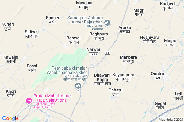
Narwar Map
EDIT Map
Add Your House
 ..
..
Current Corona Virus Infected Patients Count in Ajmer District
| City Name | District Name | Total Covid cases |
|---|---|---|
| Ajmer District | Ajmer | 119 |
| Ajmer | Ajmer | 4 |
Locality Name :
Narwar
( नरवर )
Tehsil Name : Srinagar
District : Ajmer
State : Rajasthan
Division : Ajmer
Language : Rajasthani and Urdu, Rajasthani
Current Time 10:44 AM
Date: Tuesday , Apr 29,2025 (IST)
Time zone: IST (UTC+5:30)
Elevation / Altitude: 466 meters. Above Seal level
Telephone Code / Std Code: 0145
Assembly constituency : Pushkar assembly constituency
Assembly MLA : Suresh Singh Rawat
Lok Sabha constituency : Ajmer parliamentary constituency
Parliament MP : Bhagirath Chaudhary
Serpanch Name :
Pin Code : 305811
Post Office Name : Kuchil
Commodities Prices : Ajmer (Grain) Market / Mandi
Narwar Live Weather
Temperature: 36.3 °C
clear sky
Humidity: 13%
Wind : 2.52 mt/sec towards NW
StationName : "Kishangarh"
observed on Now
Temperature: 36.3 °C
clear sky
Humidity: 13%
Wind : 2.52 mt/sec towards NW
StationName : "Kishangarh"
observed on Now
Narwar Weather Forecast for Next 5 days
30-04-2025
27.6°C to 39.9°C
clear sky
27.6°C to 39.9°C
clear sky
01-05-2025
25.8°C to 41.0°C
clear sky
25.8°C to 41.0°C
clear sky
02-05-2025
27.1°C to 42.5°C
clear sky, scattered clouds, broken clouds, overcast clouds
27.1°C to 42.5°C
clear sky, scattered clouds, broken clouds, overcast clouds
03-05-2025
26.2°C to 40.5°C
broken clouds, overcast clouds
26.2°C to 40.5°C
broken clouds, overcast clouds
04-05-2025
25.8°C to 39.7°C
broken clouds, few clouds, light rain, scattered clouds, clear sky
25.8°C to 39.7°C
broken clouds, few clouds, light rain, scattered clouds, clear sky
Edit below overview about Narwar
Edit below overview about Narwar
OverView of Narwar
Narwar's king was nar and hear is a fort of her.in narwar Rawat population is more than others.narwar is very old village many old temples hear.Edit below overview about Narwar
National Highways Reachable To Narwar
Nationa High Way :NH58
Nationa High Way :NH448
Nationa High Way :NH58
Nationa High Way :NH448
Rivers Near Narwar
Luni
Luni
About Narwar
Narwar is a Village in Srinagar Tehsil in Ajmer District of Rajasthan State, India. It belongs to Ajmer Division . It is located 18 KM towards North from District head quarters Ajmer. 25 KM from Srinagar. 137 KM from State capital Jaipur
Narwar Pin code is 305811 and postal head office is Kuchil .
Chachiyawas ( 3 KM ) , Kayampura ( 4 KM ) , Aradka ( 6 KM ) , Makarwali ( 8 KM ) , Oontra ( 8 KM ) are the nearby Villages to Narwar. Narwar is surrounded by Kishangarh Tehsil towards East , Srinagar Tehsil towards South , Parbatsar Tehsil towards North , Pisangan Tehsil towards South .
Ajmer , Nasirabad , Makrana , Phulera are the near by Cities to Narwar.
Narwar 2011 Census Details
Narwar Local Language is Rajasthani. Narwar Village Total population is 2183 and number of houses are 403. Female Population is 49.0%. Village literacy rate is 61.0% and the Female Literacy rate is 23.8%.
Population
| Census Parameter | Census Data |
| Total Population | 2183 |
| Total No of Houses | 403 |
| Female Population % | 49.0 % ( 1069) |
| Total Literacy rate % | 61.0 % ( 1331) |
| Female Literacy rate | 23.8 % ( 520) |
| Scheduled Tribes Population % | 0.3 % ( 6) |
| Scheduled Caste Population % | 40.6 % ( 887) |
| Working Population % | 34.8 % |
| Child(0 -6) Population by 2011 | 290 |
| Girl Child(0 -6) Population % by 2011 | 50.7 % ( 147) |
Narwar Census More Deatils.
Politics in Narwar
Bharatiya Janata Party , BJP , INC are the major political parties in this area.Polling Stations /Booths near Narwar
1)Govt. Sr. Secondary School (hall 1) Narwar2)Govt . Senior Secondary School (hall) Tilora
3)Govt. Upper Primary School Leela Seori
4)Govt. Senior Secondary School (new Hall) Ramner Dhani
5)Govt. Secondary School Room No. 3 Nakanadar Kiranipura
HOW TO REACH Narwar
By Rail
Makarwadi Halt Rail Way Station is the very nearby railway stations to Narwar.Colleges near Narwar
G.c.a.
Address : Ajmer
Government Engineering College
Address : Nh-8, Badalya Circle, Chouraha,near Nareli Jain Te
Schools in Narwar
Aadarsh Bal Bharti Secondary Shikshan Sansthan
Address : Near bus stand narwar ajmer
Govt Health Centers near Narwar
1) Gangwana , Gangwana , ,2) Zanana Hospital Ajmer , , , Shikar Road
3) Vaishali Nagar , Vaishali Nagar , , Nr Santoshi Mata Temple
Hospitals in Narwar,Srinagar
Zanana Hospital Ajmer
government women's hospital ;Sikar road; Ajmer; 305004; India
10.3 KM distance Detail
more ..
Petrol Bunks in Narwar,Srinagar
Auto LPG Go Gas LPG Filling Station
AJMER; Delhi - Ajmer Expy; Rajasthan 305023; India
10.6 KM distance Detail
Guru NanakFilling Station-Hindustan Petroleum
Kisangarh; Ajmer; NH-8; Ajmer Road; Ajmer; Ajmer; Rajasthan 305801; India
10.9 KM distance Detail
more ..
Colleges in Narwar,Srinagar
Aryabhatta College of Engineering and Research Centre
Chatari Road; Behind Mahila Kalyan Vikas Mandal; Chachiyawas; Ajmer; Rajasthan 305004; India
4.8 KM distance Detail
Aeronautical Engineering Department Bhagwant University
Ajmer; Rajasthan 305023; India
5.7 KM distance Detail
more ..
Schools in Narwar,Srinagar
Govt.Senior Secondary School
; Khatiyon Ka Mohalla; Chachiyawas; Rajasthan 305023; India
4.2 KM distance Detail
Police Stations near Narwar,Srinagar
Shastri Nagar Police Choki
Ajmer;; Shastri Nagar; Ajmer; Rajasthan 305001; India
15.2 KM distance Detail
Governement Offices near Narwar,Srinagar
Atal Seva Kendra; Makadwali; Ajmer
Gram Panchayat; Makadwali; Rajasthan 305004; India
9.2 KM distance Detail
Inspector General; Registraation & Stamps Department
Panjiyan Bhawan; Lohaga roadl;; Rajasthan 305004; India
11.3 KM distance Detail
About Narwar &
History
How to reach Narwar
Tourist Places Near By Narwar
Schools in Narwar
Colleges in Narwar
Temperature & weather of Narwar
places in Narwar
Narwar photos
More Information
How to reach Narwar
Tourist Places Near By Narwar
Schools in Narwar
Colleges in Narwar
Temperature & weather of Narwar
places in Narwar
Narwar photos
More Information
Village Talk
Post News or Events about this Village
Near Cities
Ajmer 18 KM near
Nasirabad 38 KM near
Makrana 55 KM near
Phulera 68 KM near
Ajmer 18 KM near
Nasirabad 38 KM near
Makrana 55 KM near
Phulera 68 KM near
Near By Taluks
Ajmer 17 KM near
Kishangarh 21 KM near
Srinagar 24 KM near
Parbatsar 27 KM near
Ajmer 17 KM near
Kishangarh 21 KM near
Srinagar 24 KM near
Parbatsar 27 KM near
Near By Air Ports
Sanganeer Airport 126 KM near
Jodhpur Airport 187 KM near
Dabok Airport 262 KM near
Surat Gujarat Airport 346 KM near
Sanganeer Airport 126 KM near
Jodhpur Airport 187 KM near
Dabok Airport 262 KM near
Surat Gujarat Airport 346 KM near
Near By Tourist Places
Ajmer 19 KM near
Kishangarh 19 KM near
Pushkar 20 KM near
Kuchaman 71 KM near
Jaipur 129 KM near
Ajmer 19 KM near
Kishangarh 19 KM near
Pushkar 20 KM near
Kuchaman 71 KM near
Jaipur 129 KM near
Near By Districts
Ajmer 18 KM near
Jaipur 128 KM near
Nagaur 129 KM near
Tonk 135 KM near
Ajmer 18 KM near
Jaipur 128 KM near
Nagaur 129 KM near
Tonk 135 KM near
Near By RailWay Station
Makarwadi Halt Rail Way Station 8.9 KM near
Ajmer Junction Rail Way Station 18 KM near
Kishangarh Rail Way Station 18 KM near
Makarwadi Halt Rail Way Station 8.9 KM near
Ajmer Junction Rail Way Station 18 KM near
Kishangarh Rail Way Station 18 KM near