| Home | City Bus | Maps | Villages | Cities | Rail | Tourist Places | School | College | Pin Codes | Corona Cases Count |
| Distance Calculator Bus Services IFSC Codes Trace Mobile Number Weather Search Place Trace IP Available Cash ATM/Banks Locate Polling Booth Report an Error contact People |
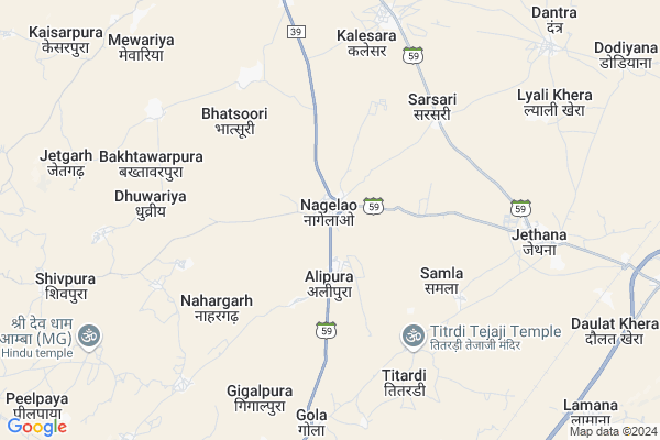
Nagelao Map
EDIT Map
Add Your House
 ..
..
Current Corona Virus Infected Patients Count in Ajmer District
| City Name | District Name | Total Covid cases |
|---|---|---|
| Ajmer District | Ajmer | 119 |
| Ajmer | Ajmer | 4 |
Locality Name :
Nagelao
( नागेलो )
Tehsil Name : Pisangan
District : Ajmer
State : Rajasthan
Division : Ajmer
Language : Rajasthani and Urdu, Rajasthani
Current Time 09:08 AM
Date: Wednesday , Apr 30,2025 (IST)
Time zone: IST (UTC+5:30)
Elevation / Altitude: 438 meters. Above Seal level
Telephone Code / Std Code: 0145
Assembly constituency : Nasirabad assembly constituency
Assembly MLA : Ramswaroop Lamba
Lok Sabha constituency : Ajmer parliamentary constituency
Parliament MP : Bhagirath Chaudhary
Serpanch Name :
Pin Code : 305207
Post Office Name : Jethana
Commodities Prices : Beawar Market / Mandi
Nagelao Live Weather
Temperature: 34.3 °C
clear sky
Humidity: 20%
Wind : 3.45 mt/sec towards S
StationName : "Govindgarh"
observed on Now
Temperature: 34.3 °C
clear sky
Humidity: 20%
Wind : 3.45 mt/sec towards S
StationName : "Govindgarh"
observed on Now
Nagelao Weather Forecast for Next 5 days
01-05-2025
29.3°C to 40.9°C
clear sky
29.3°C to 40.9°C
clear sky
02-05-2025
26.9°C to 42.0°C
clear sky, scattered clouds, few clouds
26.9°C to 42.0°C
clear sky, scattered clouds, few clouds
03-05-2025
27.4°C to 41.0°C
scattered clouds, few clouds, light rain, broken clouds, overcast clouds
27.4°C to 41.0°C
scattered clouds, few clouds, light rain, broken clouds, overcast clouds
04-05-2025
26.9°C to 40.0°C
overcast clouds, broken clouds, scattered clouds
26.9°C to 40.0°C
overcast clouds, broken clouds, scattered clouds
05-05-2025
24.3°C to 38.0°C
broken clouds, clear sky, light rain
24.3°C to 38.0°C
broken clouds, clear sky, light rain
National Highways Reachable To Nagelao
Nationa High Way :NH58
Nationa High Way :NH448
Nationa High Way :NH58
Nationa High Way :NH448
Rivers Near Nagelao
Luni
Sagarmati
Luni
Sagarmati
About Nagelao
Correct below Info and add more info about NagelaoNagelao is a Village in Pisangan Tehsil in Ajmer District of Rajasthan State, India. It belongs to Ajmer Division . It is located 35 KM towards west from District head quarters Ajmer. 16 KM from Peesangan. 183 KM from State capital Jaipur
Nagelao Pin code is 305207 and postal head office is Jethana .
Kalesara ( 6 KM ) , Gola ( 7 KM ) , Jethana ( 7 KM ) , Dantra ( 10 KM ) , Mangaliyawas ( 11 KM ) are the nearby Villages to Nagelao. Nagelao is surrounded by Beawar Tehsil towards South , Masooda Tehsil towards South , Ajmer Tehsil towards East , Jawaja Tehsil towards South .
Beawar , Ajmer , Nasirabad , Jaitaran are the near by Cities to Nagelao.
Nagelao 2011 Census Details
Nagelao Local Language is Rajasthani. Nagelao Village Total population is 4468 and number of houses are 843. Female Population is 50.1%. Village literacy rate is 42.8% and the Female Literacy rate is 14.1%.
Population
| Census Parameter | Census Data |
| Total Population | 4468 |
| Total No of Houses | 843 |
| Female Population % | 50.1 % ( 2239) |
| Total Literacy rate % | 42.8 % ( 1913) |
| Female Literacy rate | 14.1 % ( 628) |
| Scheduled Tribes Population % | 0.6 % ( 29) |
| Scheduled Caste Population % | 10.9 % ( 486) |
| Working Population % | 49.4 % |
| Child(0 -6) Population by 2011 | 815 |
| Girl Child(0 -6) Population % by 2011 | 47.4 % ( 386) |
Nagelao Census More Deatils.
Politics in Nagelao
Bharatiya Janata Party , BJP , INC are the major political parties in this area.Polling Stations /Booths near Nagelao
1)Govt. Adarsh Sr. Secondary School Room No 1 Karnos2)Govt. Adarsh Sr. Secondary School Room No 1 Karnos
3)Govt. Primary School Dhuwariya
4)Govt. Upper Primary School Nayagaon Room No 9
5)Govt. Sajjan Kawar Megraj Khothari Adarsh Sr. Secondary School Room No 1 Nagelav
HOW TO REACH Nagelao
By Rail
Lamana Rail Way Station , Mangaliyawas Rail Way Station are the very nearby railway stations to Nagelao.Colleges near Nagelao
Govt. Iti College Tantoti
Address : Bhinay Road Tantoti
Dayanand College
Address :
Kirnani Technologies
Address :
Sanskar Itc
Address :
G.c.a.
Address : Ajmer
Schools near Nagelao
Tagore Public School Nandala
Address : nandla , peesangan , ajmer , Rajasthan . PIN- 305401 , Post - Bhwani Khera
S.d. Memeorial S. Saradna
Address : saradhna , peesangan , ajmer , Rajasthan . PIN- 305206 , Post - Saradhana
Bbm Shikshan Sansthan
Address : govindgadh , peesangan , ajmer , Rajasthan . PIN- 305201 , Post - Govind Garh
Krishna Keshav Internation Sch
Address : pisangna , peesangan , ajmer , Rajasthan . PIN- 305204 , Post - Pisangan
Govt Health Centers near Nagelao
1) Nagelav , , , Nagelav2) Bhadsuri , , , Bhadsuri
3) Mewadia , , , Mewadia
Hospitals in Nagelao,Pisangan
उप स्वास्थ्य केन्द्र अलीपुरा
Gola - Nagelao Rd; Alipura; Rajasthan 305207; India
1.9 KM distance Detail
more ..
Petrol Bunks in Nagelao,Pisangan
VAIBHAV FILLING STN
PISANGAN; MEWADIA TO PISAN; AJMER; Rajasthan 305204; India
1.0 KM distance Detail
HP PETROL PUMP - HP SHRIJI TREADRES
HPC Dealer Jethana Pisangan Road Jethana; Kota; Rajasthan 305207; India
8.9 KM distance Detail
HP PETROL PUMP - AJMERA TRANSPORT COMPANY
Petrol Pump Division) Village Lamana; NH 8 District Ajmer; Rajasthan 304502; India
11.2 KM distance Detail
more ..
Colleges in Nagelao,Pisangan
Seth Phool Chand Chitarmal Jain Mahavidyalaya; Pisangan
Pisangan; Rajasthan 305204; India
11.7 KM distance Detail
NATIONAL ITI mangaliyawas ajmer
behind sbi bank; Mangliyawas; Rajasthan 305203; India
12.6 KM distance Detail
Seth Phool Chand Chitarmal Jain Mahavidyalaya; Pisangan.
Pisangan; Rajasthan 305204; India
13.3 KM distance Detail
more ..
Schools in Nagelao,Pisangan
govt. school Alipura
Rajasthan State Highway 59; Alipura; Rajasthan 305207; India
1.9 KM distance Detail
FUTURE FOUNDATION SR SEC THE SCHOOL
Pisangan Rd; Beawar; Rajasthan 305204; India
1.9 KM distance Detail
Super Markets in Nagelao,Pisangan
श्री देव मोबाईल गोला
Rajasthan State Highway 59; Gola; Rajasthan 305202; India
7.5 KM distance Detail
Local Parks in Nagelao,Pisangan
Police Stations near Nagelao,Pisangan
Mangliyawas Police Station
Ajmer District; NH 8; Mangliyawas; Rajasthan 305203; India
12.4 KM distance Detail
Governement Offices near Nagelao,Pisangan
Atal Sewa Kendra Mangliyawas
Mangliyawas; Ajmer; Major District Road 39; Mangliyawas; Rajasthan 305203; India
12.0 KM distance Detail
About Nagelao &
History
How to reach Nagelao
Tourist Places Near By Nagelao
Schools in Nagelao
Colleges in Nagelao
Temperature & weather of Nagelao
places in Nagelao
Nagelao photos
More Information
How to reach Nagelao
Tourist Places Near By Nagelao
Schools in Nagelao
Colleges in Nagelao
Temperature & weather of Nagelao
places in Nagelao
Nagelao photos
More Information
Village Talk
Post News or Events about this Village
Near Cities
Beawar 25 KM near
Ajmer 34 KM near
Nasirabad 35 KM near
Jaitaran 52 KM near
Beawar 25 KM near
Ajmer 34 KM near
Nasirabad 35 KM near
Jaitaran 52 KM near
Near By Taluks
Pisangan 15 KM near
Beawar 25 KM near
Masooda 30 KM near
Ajmer 34 KM near
Pisangan 15 KM near
Beawar 25 KM near
Masooda 30 KM near
Ajmer 34 KM near
Near By Air Ports
Jodhpur Airport 150 KM near
Sanganeer Airport 169 KM near
Dabok Airport 215 KM near
Surat Gujarat Airport 378 KM near
Jodhpur Airport 150 KM near
Sanganeer Airport 169 KM near
Dabok Airport 215 KM near
Surat Gujarat Airport 378 KM near
Near By Tourist Places
Pushkar 30 KM near
Ajmer 33 KM near
Kishangarh 62 KM near
Kuchaman 119 KM near
Bhilwara 120 KM near
Pushkar 30 KM near
Ajmer 33 KM near
Kishangarh 62 KM near
Kuchaman 119 KM near
Bhilwara 120 KM near
Near By Districts
Ajmer 34 KM near
Bhilwara 120 KM near
Nagaur 135 KM near
Pali 136 KM near
Ajmer 34 KM near
Bhilwara 120 KM near
Nagaur 135 KM near
Pali 136 KM near
Near By RailWay Station
Beawar Rail Way Station 24 KM near
Ajmer Junction Rail Way Station 33 KM near
Beawar Rail Way Station 24 KM near
Ajmer Junction Rail Way Station 33 KM near