| Home | City Bus | Maps | Villages | Cities | Rail | Tourist Places | School | College | Pin Codes | Corona Cases Count |
| Distance Calculator Bus Services IFSC Codes Trace Mobile Number Weather Search Place Trace IP Available Cash ATM/Banks Locate Polling Booth Report an Error contact People |
Bhairavnathnagar
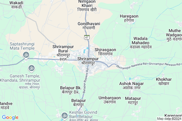
Bhairavnathnagar Map
EDIT Map
Add Your House
 ..
..
Current Corona Virus Infected Patients Count in Ahmednagar District
| City Name | District Name | Total Covid cases |
|---|
Locality Name :
Bhairavnathnagar
( भैरवनाथनगर )
Taluka Name : Shrirampur
District : Ahmednagar
State : Maharashtra
Region : Khandesh and Northern Maharashtra
Division : Nashik
Language : English and Hindi, Marathi, Urdu
Current Time 01:06 PM
Date: Monday , Apr 28,2025 (IST)
Time zone: IST (UTC+5:30)
Elevation / Altitude: 541 meters. Above Seal level
Telephone Code / Std Code: 02422
Assembly constituency : Shrirampur assembly constituency
Assembly MLA : Kanade Lahu Natha
Lok Sabha constituency : Shirdi parliamentary constituency
Parliament MP : SADASHIV KISAN LOKHANDE
Serpanch Name :
Commodities Prices : Shrirampur Market / Mandi
Bhairavnathnagar Live Weather
Temperature: 37.5 °C
clear sky
Humidity: 12%
Wind : 1.88 mt/sec towards N
StationName : "RÄ\u0081huri"
observed on 1 Hours Back
Temperature: 37.5 °C
clear sky
Humidity: 12%
Wind : 1.88 mt/sec towards N
StationName : "RÄ\u0081huri"
observed on 1 Hours Back
Bhairavnathnagar Weather Forecast for Next 5 days
29-04-2025
29.3°C to 39.6°C
clear sky
29.3°C to 39.6°C
clear sky
30-04-2025
27.4°C to 40.7°C
clear sky, broken clouds, scattered clouds
27.4°C to 40.7°C
clear sky, broken clouds, scattered clouds
01-05-2025
27.3°C to 41.3°C
clear sky, few clouds, broken clouds, scattered clouds
27.3°C to 41.3°C
clear sky, few clouds, broken clouds, scattered clouds
02-05-2025
26.9°C to 41.8°C
clear sky, scattered clouds, broken clouds
26.9°C to 41.8°C
clear sky, scattered clouds, broken clouds
03-05-2025
27.3°C to 41.1°C
clear sky, few clouds, broken clouds, scattered clouds
27.3°C to 41.1°C
clear sky, few clouds, broken clouds, scattered clouds
National Highways Reachable To Bhairavnathnagar
Nationa High Way :NH60
Nationa High Way :NH753F
Nationa High Way :NH60
Nationa High Way :NH753F
Rivers Near Bhairavnathnagar
Pravara :प्रवरा
Adula
Pravara :प्रवरा
Adula
About Bhairavnathnagar
Correct below Info and add more info about BhairavnathnagarBhairavnathnagar is a Village in Shrirampur Taluka in Ahmednagar District of Maharashtra State, India. It belongs to Khandesh and Northern Maharashtra region . It belongs to Nashik Division . It is located 66 KM towards North from District head quarters Ahmednagar. 234 KM from State capital Mumbai
Bhairavnathnagar is surrounded by Rahuri Taluka towards South , Rahata Taluka towards west , Nevasa Taluka towards East , Kopargaon Taluka towards North .
Shrirampur , Rahuri , Shirdi , Vaijapur are the near by Cities to Bhairavnathnagar.
Demographics of Bhairavnathnagar
English is the Local Language here.Politics in Bhairavnathnagar
RPI(A) , BJP , Shivsena , SHS , INC are the major political parties in this area.Polling Stations /Booths near Bhairavnathnagar
1)Govardhanpur Z. P. School East-west Building From East Side Room No.1.2)Model English School East West Building From West Side Room No- 1
3)Shrirampur Navin Marthi. Shala South Side East West Building From East Side Room No 3
4)Shrirampur Z P Guest House South North Building From North Side Room No2
5)Shrirampur Wadala Irrigation Sub Division
HOW TO REACH Bhairavnathnagar
By Rail
Belapur Rail Way Station , Nipani Vadgaon Rail Way Station are the very nearby railway stations to Bhairavnathnagar. Taklimiya Rail Way Station (near to Deolali Pravara) are the Rail way stations reachable from near by towns.By Road
Deolali Pravara are the nearby by towns to Bhairavnathnagar having road connectivity to BhairavnathnagarPincodes near Bhairavnathnagar
423701 ( Vaijapur Town ) , 431110 ( Raghunath Nagar (Aurangabad) ) , 423402 ( Andarsul )Colleges near Bhairavnathnagar
Ashok Institute Of Engineering & Technology Polytechnic Nipani Wadgaon
Address :
National Backward Agriculture Education Of Information Technology
Address : At Post Nipani Wadgaon Tal Shrirampur Dist Ahmednagar
Schools in Bhairavnathnagar
Adarsha High Schooll
Address : near mahadev mandir , bhairavnath nagar
Govt Health Centers near Bhairavnathnagar
1) R.H. Shrirampur , , shirsgaon road ,2) Gondhawani , Health Center Gondhawani , Gavthan , Gavthan
3) Shirasgaon , 0 , Shirasgaon-Kukana road , Near BSNL mobile Tower
Petrol Bunks in Bhairavnathnagar,Shrirampur
BHARAT PETROLEUM - RAJ ENTERPRISES
shrirampur puntamba road; Zhirange wasti; Taluka shrirampur; Shrirampur; Maharashtra 413709; India
0.5 KM distance Detail
HP PETROL PUMP - RAMCHAND & SONS
H P Dealers Shrirampur Sangamner Road Shri Rampur; Aurangabad; 413709; India
0.9 KM distance Detail
BHARAT PETROLEUM - RAJ ENTERPRISES
Gondhavani Road; Subhedar Wasti Ward Number 1; Shrirampur; Maharashtra 413709; India
0.9 KM distance Detail
more ..
Colleges in Bhairavnathnagar,Shrirampur
Rayat Shikshan Sanstha's Swami Sahajanand Bharati College of Education
Ahmednagar; Shrirampur; Maharashtra 413709; India
0.1 KM distance Detail
Belapur Education Societys Arts & Commerce College
Belapur; Shrirampur; Ahmednagar; Maharashtra 413709; India
0.1 KM distance Detail
more ..
Schools in Bhairavnathnagar,Shrirampur
Bachpan Play School; Shrirampur
Opp.Joshi Hospital Onion Market;Market Yard;; Shivaji Nagar;Shrirampur;Dist.; Ahmendnagar; Maharashtra 413709; India
0.1 KM distance Detail
Zilla Parishad School Hindola Vasti
Shrirampur; Taluk Deola; Nashik District; Mahalpatane; Maharashtra 423102; India
0.1 KM distance Detail
Electronic Shops in Bhairavnathnagar,Shrirampur
Dell Exclusive Store
Ramchandra Tower; Near Radhika Hotel; Opp Bus stand; Nevasa Road; Shrirampur; Maharashtra 413709; India
0.2 KM distance Detail
Super Markets in Bhairavnathnagar,Shrirampur
Radheshyam Traders
near punjabi tadka; Newasa Rd; Shrirampur; Maharashtra 413709; India
0.1 KM distance Detail
Sanjivani Ayu Care आयुर्वेदीक
near Om gurudev cloths; dawkhar road; Shrirampur; Maharashtra 413709; India
0.2 KM distance Detail
Police Stations near Bhairavnathnagar,Shrirampur
Office Of Additional Superintendent Of Police
Shrirampur; Maharashtra 413709; India
0.2 KM distance Detail
Governement Offices near Bhairavnathnagar,Shrirampur
Sarvadnya Associates.
prasad jwellers; Sonar Ln; Shrirampur; Maharashtra 413709; India
0.4 KM distance Detail
About Bhairavnathnagar &
History
How to reach Bhairavnathnagar
Tourist Places Near By Bhairavnathnagar
Schools in Bhairavnathnagar
Colleges in Bhairavnathnagar
Temperature & weather of Bhairavnathnagar
places in Bhairavnathnagar
Bhairavnathnagar photos
More Information
How to reach Bhairavnathnagar
Tourist Places Near By Bhairavnathnagar
Schools in Bhairavnathnagar
Colleges in Bhairavnathnagar
Temperature & weather of Bhairavnathnagar
places in Bhairavnathnagar
Bhairavnathnagar photos
More Information
Village Talk
Post News or Events about this Village
Near Cities
Shrirampur 0 KM near
Rahuri 28 KM near
Shirdi 30 KM near
Vaijapur 39 KM near
Shrirampur 0 KM near
Rahuri 28 KM near
Shirdi 30 KM near
Vaijapur 39 KM near
Near By Taluks
Shrirampur 0 KM near
Rahuri 21 KM near
Rahata 22 KM near
Nevasa 35 KM near
Shrirampur 0 KM near
Rahuri 21 KM near
Rahata 22 KM near
Nevasa 35 KM near
Near By Air Ports
Chikkalthana Airport 91 KM near
Gandhinagar Airport 108 KM near
Lohegaon Airport 155 KM near
Chhatrapati Shivaji International Airport 219 KM near
Chikkalthana Airport 91 KM near
Gandhinagar Airport 108 KM near
Lohegaon Airport 155 KM near
Chhatrapati Shivaji International Airport 219 KM near
Near By Tourist Places
Shirdi 30 KM near
Ahmednagar 67 KM near
Grishneshwar 78 KM near
Aurangabad 83 KM near
Ozar 98 KM near
Shirdi 30 KM near
Ahmednagar 67 KM near
Grishneshwar 78 KM near
Aurangabad 83 KM near
Ozar 98 KM near
Near By Districts
Ahmednagar 63 KM near
Aurangabad District 85 KM near
Nashik 111 KM near
Jalna 145 KM near
Ahmednagar 63 KM near
Aurangabad District 85 KM near
Nashik 111 KM near
Jalna 145 KM near
Near By RailWay Station
Belapur Rail Way Station 0.0 KM near
Nipani Vadgaon Rail Way Station 6.9 KM near
Puntamba Junction Rail Way Station 18 KM near
Belapur Rail Way Station 0.0 KM near
Nipani Vadgaon Rail Way Station 6.9 KM near
Puntamba Junction Rail Way Station 18 KM near