| Home | City Bus | Maps | Villages | Cities | Rail | Tourist Places | School | College | Pin Codes | Corona Cases Count |
| Distance Calculator Bus Services IFSC Codes Trace Mobile Number Weather Search Place Trace IP Available Cash ATM/Banks Locate Polling Booth Report an Error contact People |
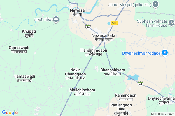
Malichinchore
Malichinchore Map
EDIT Map
Add Your House
 ..
..
Current Corona Virus Infected Patients Count in Ahmednagar District
| City Name | District Name | Total Covid cases |
|---|
Locality Name :
Malichinchore
( मालीचिंचोरे )
Taluka Name : Nevasa
District : Ahmednagar
State : Maharashtra
Region : Khandesh and Northern Maharashtra
Division : Nashik
Language : English and Hindi, Marathi, Urdu
Current Time 09:19 AM
Date: Wednesday , Apr 30,2025 (IST)
Time zone: IST (UTC+5:30)
Elevation / Altitude: 531 meters. Above Seal level
Telephone Code / Std Code: 02427
Assembly constituency : Nevasa assembly constituency
Assembly MLA : Balasaheb Alias Dadasaheb Damodhar Murkute
Lok Sabha constituency : Shirdi parliamentary constituency
Parliament MP : SADASHIV KISAN LOKHANDE
Serpanch Name :
Pin Code : 414602
Post Office Name : Vadalamission
Alternate Village Name : Malichinchora
Commodities Prices : Newasa Market / Mandi
Malichinchore Live Weather
Temperature: 32.5 °C
clear sky
Humidity: 20%
Wind : 6.17 mt/sec towards NW
StationName : "Maharashtra"
observed on 1 Hours Back
Temperature: 32.5 °C
clear sky
Humidity: 20%
Wind : 6.17 mt/sec towards NW
StationName : "Maharashtra"
observed on 1 Hours Back
Malichinchore Weather Forecast for Next 5 days
01-05-2025
30.7°C to 40.8°C
clear sky, broken clouds, scattered clouds
30.7°C to 40.8°C
clear sky, broken clouds, scattered clouds
02-05-2025
28.7°C to 41.5°C
clear sky, few clouds, scattered clouds
28.7°C to 41.5°C
clear sky, few clouds, scattered clouds
03-05-2025
28.2°C to 41.3°C
clear sky, overcast clouds, broken clouds
28.2°C to 41.3°C
clear sky, overcast clouds, broken clouds
04-05-2025
27.3°C to 40.2°C
clear sky, few clouds, scattered clouds, light rain, broken clouds
27.3°C to 40.2°C
clear sky, few clouds, scattered clouds, light rain, broken clouds
05-05-2025
25.4°C to 37.8°C
clear sky, light rain, scattered clouds, broken clouds
25.4°C to 37.8°C
clear sky, light rain, scattered clouds, broken clouds
Edit below overview about Malichinchore
Edit below overview about Malichinchore
OverView of Malichinchore
In Mali chinchora there are many temple.Edit below overview about Malichinchore
National Highways Reachable To Malichinchore
Nationa High Way :NH753F
Nationa High Way :NH753F
Rivers Near Malichinchore
Yirabhadra
Pravara :प्रवरा
Yirabhadra
Pravara :प्रवरा
About Malichinchore
Malichinchore is a Village in Nevasa Taluka in Ahmednagar District of Maharashtra State, India. It belongs to Khandesh and Northern Maharashtra region . It belongs to Nashik Division . It is located 56 KM towards North from District head quarters Ahmednagar. 263 KM from State capital Mumbai
Malichinchore Pin code is 414602 and postal head office is Vadalamission .
Malichinchore is surrounded by Rahuri Taluka towards west , Shrirampur Taluka towards west , Gangapur Taluka towards North , Shevgaon Taluka towards East .
Shrirampur , Rahuri , Pathardi , Paithan are the near by Cities to Malichinchore.
This Place is in the border of the Ahmednagar District and Aurangabad District District. Aurangabad District District Gangapur is North towards this place .
Malichinchora 2011 Census Details
Malichinchore Local Language is English. Malichinchora Village Total population is 5175 and number of houses are 1027. Female Population is 48.7%. Village literacy rate is 63.7% and the Female Literacy rate is 27.3%.
Population
| Census Parameter | Census Data |
| Total Population | 5175 |
| Total No of Houses | 1027 |
| Female Population % | 48.7 % ( 2521) |
| Total Literacy rate % | 63.7 % ( 3299) |
| Female Literacy rate | 27.3 % ( 1414) |
| Scheduled Tribes Population % | 9.3 % ( 479) |
| Scheduled Caste Population % | 31.0 % ( 1606) |
| Working Population % | 56.6 % |
| Child(0 -6) Population by 2011 | 738 |
| Girl Child(0 -6) Population % by 2011 | 46.3 % ( 342) |
Malichinchora Census More Deatils.
Politics in Malichinchore
RPI(A) , BJP , NCP , Shivsena , SHS , INC are the major political parties in this area.Polling Stations /Booths near Malichinchore
1)Handi Nimagaon Zp School East Side Room No.12)Gondegaon Zp School East Side Room No.1
3)Mhasale Zp School East Side Room No.1
4)Mukindpur Zp School West Side Room No.1
5)Mukindpur Zp School West Side Room No.2
HOW TO REACH Malichinchore
By Road
Rahuri is the Nearest Town to Malichinchore. Rahuri is 30 km from Malichinchore. Road connectivity is there from Rahuri to Malichinchore.By Rail
There is no railway station near to Malichinchore in less than 10 km. How ever there are railway Stations from Near By town Rahuri. are the railway Stations near to Rahuri. You can reach from Rahuri to Malichinchore by road after .Colleges near Malichinchore
Trimurty Junier College
Address :
Schools in Malichinchore
New English School Malichinch
Address : malichinchore , newasa , ahmadnagar , Maharashtra . PIN- 414602 , Post - Vadalamission
Govt Health Centers near Malichinchore
1) Usthal Dumala , , Newasa-usthaldumala Road , Gaonthan2) Devgaon , 0 , Gaonthan road , Near Deogaon Society
3) Newasa Kh. , , Newasa-Shrirampur Road , Behind Panchayat Samitee, Newasa
Sub Villages in Malichinchore
Hospitals in Malichinchore,Nevasa
Dhanvantri Hospital
near sai city; Shrirampur Rd; Newasa Fata; Maharashtra; India
3.6 KM distance Detail
more ..
Petrol Bunks in Malichinchore,Nevasa
Indian Oil Petrol Pump
Suresh Nagar; Ahmadnagar; SH-60; Ahmednagar Newasa Road; Newasa; Newasa; Maharashtra 414607; India
0.4 KM distance Detail
Om Shivam Petroleum Services
107/1 ; Handinimgaon ; Nagar; Ahmednagar - Aurangabad Rd; Handinimgaon; Maharashtra 414603; India
0.6 KM distance Detail
more ..
Colleges in Malichinchore,Nevasa
Sulochana Belhekar Samajik & Bahuuddesheeya Shikshan Sanstha Sant Dnyaneshwar B.Ed.College
Newasa Phata; Newasa; Ahmednagar; Maharashtra 414603; India
3.9 KM distance Detail
Shri Dnyaneshwar Mahavidyalaya For Arts
SH60; Newasa Fata; Maharashtra 414603; India
4.0 KM distance Detail
more ..
Schools in Malichinchore,Nevasa
trimurti public school
नेवासा मार्ग; नेवासा फटाttrimrti; Nipunge Wasti; Newasa Fata; Maharashtra 414603; India
3.7 KM distance Detail
Electronic Shops in Malichinchore,Nevasa
Samartha Electrical And Electronics
Nevasa Usthal Rd; Maharashtra 414603; India
2.6 KM distance Detail
About Malichinchore &
History
How to reach Malichinchore
Tourist Places Near By Malichinchore
Schools in Malichinchore
Colleges in Malichinchore
Temperature & weather of Malichinchore
places in Malichinchore
Malichinchore photos
More Information
How to reach Malichinchore
Tourist Places Near By Malichinchore
Schools in Malichinchore
Colleges in Malichinchore
Temperature & weather of Malichinchore
places in Malichinchore
Malichinchore photos
More Information
Village Talk
Post News or Events about this Village
Near Cities
Shrirampur 36 KM near
Rahuri 36 KM near
Pathardi 49 KM near
Paithan 54 KM near
Shrirampur 36 KM near
Rahuri 36 KM near
Pathardi 49 KM near
Paithan 54 KM near
Near By Taluks
Nevasa 0 KM near
Rahuri 35 KM near
Shrirampur 36 KM near
Gangapur 39 KM near
Nevasa 0 KM near
Rahuri 35 KM near
Shrirampur 36 KM near
Gangapur 39 KM near
Near By Air Ports
Chikkalthana Airport 70 KM near
Gandhinagar Airport 144 KM near
Lohegaon Airport 165 KM near
Latur Airport 225 KM near
Chikkalthana Airport 70 KM near
Gandhinagar Airport 144 KM near
Lohegaon Airport 165 KM near
Latur Airport 225 KM near
Near By Tourist Places
Ahmednagar 57 KM near
Aurangabad 64 KM near
Shirdi 65 KM near
Grishneshwar 70 KM near
Ozar 121 KM near
Ahmednagar 57 KM near
Aurangabad 64 KM near
Shirdi 65 KM near
Grishneshwar 70 KM near
Ozar 121 KM near
Near By Districts
Ahmednagar 53 KM near
Aurangabad District 66 KM near
Beed 115 KM near
Jalna 118 KM near
Ahmednagar 53 KM near
Aurangabad District 66 KM near
Beed 115 KM near
Jalna 118 KM near
Near By RailWay Station
Belapur Rail Way Station 36 KM near
Puntamba Junction Rail Way Station 49 KM near
Belapur Rail Way Station 36 KM near
Puntamba Junction Rail Way Station 49 KM near