| Home | City Bus | Maps | Villages | Cities | Rail | Tourist Places | School | College | Pin Codes | Corona Cases Count |
| Distance Calculator Bus Services IFSC Codes Trace Mobile Number Weather Search Place Trace IP Available Cash ATM/Banks Locate Polling Booth Report an Error contact People |
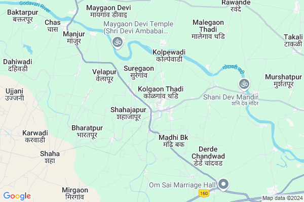
Shahajapur
Shahajapur Map
EDIT Map
Add Your House
 ..
..
Current Corona Virus Infected Patients Count in Ahmednagar District
| City Name | District Name | Total Covid cases |
|---|
Locality Name :
Shahajapur
( शहाजापूर )
Taluka Name : Kopargaon
District : Ahmednagar
State : Maharashtra
Region : Khandesh and Northern Maharashtra
Division : Nashik
Language : English and Hindi, Marathi, Urdu
Current Time 02:08 PM
Date: Wednesday , Feb 05,2025 (IST)
Time zone: IST (UTC+5:30)
Elevation / Altitude: 509 meters. Above Seal level
Telephone Code / Std Code: 02423
Assembly constituency : Kopargaon assembly constituency
Assembly MLA : Aashutosh Ashokrao Kale
Lok Sabha constituency : Shirdi parliamentary constituency
Parliament MP : SADASHIV KISAN LOKHANDE
Serpanch Name :
Pin Code : 423602
Post Office Name : Kolpewadi
Commodities Prices : Kopargaon Market / Mandi
Edit below overview about Shahajapur
Edit below overview about Shahajapur
OverView of Shahajapur
Shahajapur is a small village 20 km away from famous holy Place shirdi. Farming is main source of income here. This village is arranged by Mr Husen Patel 30 years ago; who was Police Patil there. All religions people's i.e. Hindu, Muslim & harijan lives happily together here since long time. Number of youths are increasing but un-employment is crucial problem in village; however some people got educated and doing Job in cities like pune, Nashik, Ahmmednagar, shirdi etc.Edit below overview about Shahajapur
National Highways Reachable To Shahajapur
Nationa High Way :NH60;NH160
Nationa High Way :NH60
Nationa High Way :NH60;NH160
Nationa High Way :NH60
Rivers Near Shahajapur
Darna
Darna
About Shahajapur
Shahajapur is a Village in Kopargaon Taluka in Ahmednagar District of Maharashtra State, India. It belongs to Khandesh and Northern Maharashtra region . It belongs to Nashik Division . It is located 112 KM towards North from District head quarters Ahmednagar. 8 KM from Kopargaon. 216 KM from State capital Mumbai
Shahajapur Pin code is 423602 and postal head office is Kolpewadi .
Kolgaonthadi ( 1 KM ) , Mahegaon Deshmukh ( 3 KM ) , Kolpewadi ( 4 KM ) , Velapur ( 5 KM ) , Kumbhari ( 5 KM ) are the nearby Villages to Shahajapur. Shahajapur is surrounded by Yeola Taluka towards North , Rahata Taluka towards South , Sinnar Taluka towards west , Niphad Taluka towards west .
Shirdi , Yevla , Sinnar , Vaijapur are the near by Cities to Shahajapur.
This Place is in the border of the Ahmednagar District and Nashik District. Nashik District Yeola is North towards this place .
Shahajapur 2011 Census Details
Shahajapur Local Language is English. Shahajapur Village Total population is 2343 and number of houses are 471. Female Population is 48.6%. Village literacy rate is 68.9% and the Female Literacy rate is 31.0%.
Population
| Census Parameter | Census Data |
| Total Population | 2343 |
| Total No of Houses | 471 |
| Female Population % | 48.6 % ( 1139) |
| Total Literacy rate % | 68.9 % ( 1615) |
| Female Literacy rate | 31.0 % ( 726) |
| Scheduled Tribes Population % | 14.8 % ( 346) |
| Scheduled Caste Population % | 4.7 % ( 110) |
| Working Population % | 45.2 % |
| Child(0 -6) Population by 2011 | 317 |
| Girl Child(0 -6) Population % by 2011 | 42.0 % ( 133) |
Shahajapur Census More Deatils.
Politics in Shahajapur
RPI(A) , BJP , NCP , Shivsena , SHS , INC are the major political parties in this area.Polling Stations /Booths near Shahajapur
1)Chatrapti Sambhaji Primary Vidyalayasouth North Building Northern Side Room No. 12)Chasnali Z P School East - West Building Western Side Room No 3
3)Rayat Shikshan Sansthau0027s Shiviji Madhyamik Vidhyalaya East - West Building Eastern Side Room
4)Rayat Shikshan Sansthau0027s Shiviji Madhyamik Vidhyalaya East - West Building Western Side Room
5)Rayat Shikshan Sansthau0027s Shiviji Madhyamik Vidhyalaya East - West Building Western Side Room
HOW TO REACH Shahajapur
By Road
Kopargaon is the Nearest Town to Shahajapur. Kopargaon is 18 km from Shahajapur. Road connectivity is there from Kopargaon to Shahajapur.By Rail
There is no railway station near to Shahajapur in less than 10 km. How ever there are railway Stations from Near By town Kopargaon. are the railway Stations near to Kopargaon. You can reach from Kopargaon to Shahajapur by road after .Colleges near Shahajapur
S.s.g.m.college , Kopargaon
Address :
Gautam Polytachnic Instut
Address :
K B Rohamare Scince And Commers Jr College
Address : Godhavari Complex
Sres Sanjivani K.b.p.polytechnic, Kopargaon
Address : Sahajanandnagar
Sanjivani College Of Pharmaceuitcal Education & Research,sahajanandnagar
Address : Sahajanandnagar, Shingnapur,tal-kopargaon
Schools in Shahajapur
Gautam Public School
Address : shahajapur , kopargaon , ahmadnagar , Maharashtra . PIN- 423602 , Post - Kolpewadi
Govt Health Centers near Shahajapur
1) Kolpewadi , , , Near Grampanchyat2) Sangavi Bhusar , , Near Bus Stop ,
3) madhi Bu. , , Gavthan ,
Petrol Bunks in Shahajapur,Kopargaon
Indian Oil Petrol & Diesel Pump
Shirdi - Lasalgaon Rd; Kolgaon Thadi; Maharashtra 423602; India
1.1 KM distance Detail
B B KOLPE Petroleum
Shirdi - Lasalgaon Rd; Shahajapur; Maharashtra 423602; India
1.7 KM distance Detail
more ..
Colleges in Shahajapur,Kopargaon
Gautam Polytechnic Institute
Gautamnagar; Kolpewadi; Kopargaon; Ahmednagar; Maharashtra 423602; India
1.8 KM distance Detail
Dr. Kolpe Institute of Pharmacy
A/P: Kolpewadi- Madhi Road;Tal: Kopargaon Dist:; Maharashtra 423602; India
3.5 KM distance Detail
Sai Tej generic aushadhi seva
Badade complex bank road; Kopargoan; Maharashtra 423601; India
15.7 KM distance Detail
ITI College (Under Construction)
MH SH 10; Vidya Nagar; Kopargaon; Maharashtra 423601; India
15.8 KM distance Detail
more ..
Schools in Shahajapur,Kopargaon
Rayat Shikshan Sanstha's Educational Campus; Kolpewadi
Kolgaon Thadi; Maharashtra 423602; India
0.5 KM distance Detail
Chhatrapati Shivaji Vidyalaya & Junior College;Gautamnagar
Suregaon; Maharashtra 423602; India
0.5 KM distance Detail
कर्मवीर शंकरराव काले सहकार सभागृह; गौतमनगर.
गौतमनगर;; Kolgaon Thadi; Maharashtra 423602; India
0.5 KM distance Detail
Super Markets in Shahajapur,Kopargaon
Mahalaxmi Kirana Store;suregaon(motinagar)po.kolpewadi
Suregaon; Maharashtra 423602; India
0.7 KM distance Detail
Local Parks in Shahajapur,Kopargaon
New Idgah Maidan
105; New Kabristan Raod Indira Nagar;; Kopargaon; Maharashtra 423601; India
15.2 KM distance Detail
Police Stations near Shahajapur,Kopargaon
Kolpewadi Police Station
Kolgaon Thadi; Kolpewadi; Mahegaon Deshmukh; Maharashtra 423602; India
1.4 KM distance Detail
Kopargaon Taluka Police Station
Mahadevnagar; Kopargaon; Maharashtra 423601; India
16.1 KM distance Detail
Shahar Vahtuk Niyamak Shakha
Shirdi - Puntamba Rd; Mauli Nagar; Shirdi; Maharashtra 423109; India
22.5 KM distance Detail
About Shahajapur &
History
How to reach Shahajapur
Tourist Places Near By Shahajapur
Schools in Shahajapur
Colleges in Shahajapur
Temperature & weather of Shahajapur
places in Shahajapur
Shahajapur photos
More Information
How to reach Shahajapur
Tourist Places Near By Shahajapur
Schools in Shahajapur
Colleges in Shahajapur
Temperature & weather of Shahajapur
places in Shahajapur
Shahajapur photos
More Information
Village Talk
Post News or Events about this Village
Near Cities
Shirdi 19 KM near
Yevla 24 KM near
Sinnar 41 KM near
Vaijapur 42 KM near
Shirdi 19 KM near
Yevla 24 KM near
Sinnar 41 KM near
Vaijapur 42 KM near
Near By Taluks
Kopargaon 8 KM near
Yeola 26 KM near
Rahata 30 KM near
Sinnar 36 KM near
Kopargaon 8 KM near
Yeola 26 KM near
Rahata 30 KM near
Sinnar 36 KM near
Near By Air Ports
Gandhinagar Airport 63 KM near
Chikkalthana Airport 122 KM near
Lohegaon Airport 171 KM near
Chhatrapati Shivaji International Airport 200 KM near
Gandhinagar Airport 63 KM near
Chikkalthana Airport 122 KM near
Lohegaon Airport 171 KM near
Chhatrapati Shivaji International Airport 200 KM near
Near By Tourist Places
Shirdi 19 KM near
Nasik 66 KM near
Ratanwadi 90 KM near
Igatpuri 95 KM near
Trimbakeshwar 96 KM near
Shirdi 19 KM near
Nasik 66 KM near
Ratanwadi 90 KM near
Igatpuri 95 KM near
Trimbakeshwar 96 KM near
Near By Districts
Nashik 65 KM near
Ahmednagar 107 KM near
Aurangabad District 115 KM near
Dang 131 KM near
Nashik 65 KM near
Ahmednagar 107 KM near
Aurangabad District 115 KM near
Dang 131 KM near
Near By RailWay Station
Kopargaon Rail Way Station 17 KM near
Sainagar Shirdi Rail Way Station 21 KM near
Kopargaon Rail Way Station 17 KM near
Sainagar Shirdi Rail Way Station 21 KM near