| Home | City Bus | Maps | Villages | Cities | Rail | Tourist Places | School | College | Pin Codes | Corona Cases Count |
| Distance Calculator Bus Services IFSC Codes Trace Mobile Number Weather Search Place Trace IP Available Cash ATM/Banks Locate Polling Booth Report an Error contact People |
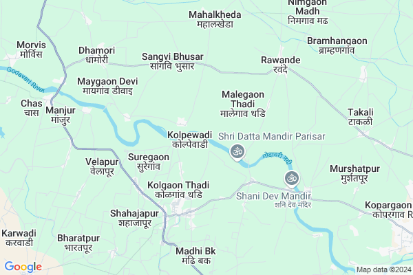
Kolpewadi
Kolpewadi Map
EDIT Map
Add Your House
 ..
..
Current Corona Virus Infected Patients Count in Ahmednagar District
| City Name | District Name | Total Covid cases |
|---|
Locality Name :
Kolpewadi
( कोळपेवाडी )
Taluka Name : Kopargaon
District : Ahmednagar
State : Maharashtra
Region : Khandesh and Northern Maharashtra
Division : Nashik
Language : English and Hindi, Marathi, Urdu
Current Time 12:30 PM
Date: Tuesday , Apr 29,2025 (IST)
Time zone: IST (UTC+5:30)
Elevation / Altitude: 509 meters. Above Seal level
Telephone Code / Std Code: 02423
Assembly constituency : Kopargaon assembly constituency
Assembly MLA : Aashutosh Ashokrao Kale
Lok Sabha constituency : Shirdi parliamentary constituency
Parliament MP : SADASHIV KISAN LOKHANDE
Serpanch Name :
Pin Code : 423602
Post Office Name : Kolpewadi
Alternate Village Name : Kolapewadi
Commodities Prices : Kopargaon Market / Mandi
Edit below overview about Kolpewadi
Edit below overview about Kolpewadi
OverView of Kolpewadi
1)Gramdevta:Shri Maheswar Maharaj Gudpadvaya has a yatra festival.2)Shri Chhatrapati Shivaji Vidyalya(Semi English and Gurkul 5th to 10th stabdard) And Juniors College Largest Schools Boys School And Colleges In District Ahilyadevinagar.3)Shri Chhatrapati Sambhaji vidaylaya (1st to 4th standard with semienglish). 4)Radhabaikale Kanisht Mahavidylaya And Juniors College (5th to 10th Standard And 11th 12th junior college)5)Gautam Public Schools And Gautam Polytechnic Institute.6)Dr.Kolpe Nursing And D-Pharmacy B- Pharmacy College7)Sushila Mai BA/BCOM/BSC College8) Government Veterinary Hospital9)Sub Government Hospital Center10)10 Hospitals and 15 Medicals Stores11)Dr.Kolpe Multi-speciality And Aruvedic Hospital12) Library's13) Union Bank Of India/Sanjavani Banks14)Krushi Seva Kendra 15) Malls.Edit below overview about Kolpewadi
National Highways Reachable To Kolpewadi
Nationa High Way :NH60;NH160
Nationa High Way :NH60
Nationa High Way :NH60;NH160
Nationa High Way :NH60
Rivers Near Kolpewadi
Darna
Darna
About Kolpewadi
Kolpewadi is a Village in Kopargaon Taluka in Ahmednagar District of Maharashtra State, India. It belongs to Khandesh and Northern Maharashtra region . It belongs to Nashik Division . It is located 114 KM towards North from District head quarters Ahmednagar. 8 KM from Kopargaon. 220 KM from State capital Mumbai
Kolpewadi Pin code is 423602 and postal head office is Kolpewadi .
Kolgaonthadi ( 3 KM ) , Malegaon Thadi ( 3 KM ) , Shahajapur ( 4 KM ) , Shahajapur ( 4 KM ) , Kumbhari ( 4 KM ) are the nearby Villages to Kolpewadi. Kolpewadi is surrounded by Yeola Taluka towards North , Rahata Taluka towards South , Niphad Taluka towards west , Sinnar Taluka towards west .
Yevla , Shirdi , Vaijapur , Manmad are the near by Cities to Kolpewadi.
This Place is in the border of the Ahmednagar District and Nashik District. Nashik District Yeola is North towards this place .
Kolpewadi 2011 Census Details
Kolpewadi Local Language is English. Kolpewadi Village Total population is 5449 and number of houses are 1075. Female Population is 48.9%. Village literacy rate is 62.8% and the Female Literacy rate is 26.5%.
Population
| Census Parameter | Census Data |
| Total Population | 5449 |
| Total No of Houses | 1075 |
| Female Population % | 48.9 % ( 2662) |
| Total Literacy rate % | 62.8 % ( 3422) |
| Female Literacy rate | 26.5 % ( 1443) |
| Scheduled Tribes Population % | 6.4 % ( 348) |
| Scheduled Caste Population % | 6.1 % ( 332) |
| Working Population % | 42.5 % |
| Child(0 -6) Population by 2011 | 742 |
| Girl Child(0 -6) Population % by 2011 | 46.8 % ( 347) |
Kolpewadi Census More Deatils.
Politics in Kolpewadi
RPI(A) , BJP , NCP , Shivsena , SHS , INC are the major political parties in this area.Polling Stations /Booths near Kolpewadi
1)Ogadi Z P School South - North Building Northern Side Room No. 12)Malegaonthadi Badadhe Wasti Z P Primary School North - South Building Northern Side Room No.1
3)Sade Z P School East - West Building Eastern Side Room No. 1
4)Sangavibhusar Z P School East - West Building Eastern Room No. 1
5)Mahegaon Deshmukh Z P School East - West Building Eastern Room No 2
HOW TO REACH Kolpewadi
By Road
Kopargaon is the Nearest Town to Kolpewadi. Kopargaon is 20 km from Kolpewadi. Road connectivity is there from Kopargaon to Kolpewadi.By Rail
There is no railway station near to Kolpewadi in less than 10 km. How ever there are railway Stations from Near By town Kopargaon. are the railway Stations near to Kopargaon. You can reach from Kopargaon to Kolpewadi by road after .Colleges near Kolpewadi
Gautam Polytachnic Instut
Address :
Schools in Kolpewadi
Radhabai Kale Kanya V.gautamna
Address : kolpewadi , kopargaon , ahmadnagar , Maharashtra . PIN- 423602 , Post - Kolpewadi
Govt Health Centers near Kolpewadi
1) Kolpewadi , , , Near Grampanchyat2) Sangavi Bhusar , , Near Bus Stop ,
3) Rawanda , , , Near Main Road
Petrol Bunks in Kolpewadi,Kopargaon
Indian Oil Petrol & Diesel Pump
Shirdi - Lasalgaon Rd; Kolgaon Thadi; Maharashtra 423602; India
5.7 KM distance Detail
B B KOLPE Petroleum
Shirdi - Lasalgaon Rd; Shahajapur; Maharashtra 423602; India
6.2 KM distance Detail
more ..
Colleges in Kolpewadi,Kopargaon
Gautam Polytechnic Institute
Gautamnagar; Kolpewadi; Kopargaon; Ahmednagar; Maharashtra 423602; India
6.4 KM distance Detail
Dr. Kolpe Institute of Pharmacy
A/P: Kolpewadi- Madhi Road;Tal: Kopargaon Dist:; Maharashtra 423602; India
7.1 KM distance Detail
ITI College (Under Construction)
MH SH 10; Vidya Nagar; Kopargaon; Maharashtra 423601; India
13.7 KM distance Detail
Sai Tej generic aushadhi seva
Badade complex bank road; Kopargoan; Maharashtra 423601; India
14.5 KM distance Detail
more ..
Schools in Kolpewadi,Kopargaon
Z. P Primary SCHOOL NIKAMVASTI SUREGAON
Suregaon Road; Suregaon; Maharashtra 423602; India
2.4 KM distance Detail
Ashadeep English Medium School ; Suregaon
SUreaon Raod; Maharashtra 423602; India
3.7 KM distance Detail
Electronic Shops in Kolpewadi,Kopargaon
shree datt auto garage
pathan cycle main road kolpewadi koprgaon; Kolpewadi; Maharashtra; India
3.9 KM distance Detail
SAI MAULI HERO ELETRIC BAKE SHOW ROOM
NEAR; Marketyard; Kopargaon; Maharashtra; India
4.4 KM distance Detail
Super Markets in Kolpewadi,Kopargaon
Kolpewadi Bazaar
Kolgaon Thadi; Kolpewadi; Mahegaon Deshmukh; Maharashtra 423602; India
4.8 KM distance Detail
Police Stations near Kolpewadi,Kopargaon
Kolpewadi Police Station
Kolgaon Thadi; Kolpewadi; Mahegaon Deshmukh; Maharashtra 423602; India
4.8 KM distance Detail
Kopargaon Taluka Police Station
Mahadevnagar; Kopargaon; Maharashtra 423601; India
14.9 KM distance Detail
Governement Offices near Kolpewadi,Kopargaon
Aarya Tax Counsultancy & Online Services
Chas Nali; Kopargoan; Ahmadnagar; Maharashtra 423604; India
9.8 KM distance Detail
About Kolpewadi &
History
How to reach Kolpewadi
Tourist Places Near By Kolpewadi
Schools in Kolpewadi
Colleges in Kolpewadi
Temperature & weather of Kolpewadi
places in Kolpewadi
Kolpewadi photos
More Information
How to reach Kolpewadi
Tourist Places Near By Kolpewadi
Schools in Kolpewadi
Colleges in Kolpewadi
Temperature & weather of Kolpewadi
places in Kolpewadi
Kolpewadi photos
More Information
Village Talk
Post News or Events about this Village
Near Cities
Yevla 19 KM near
Shirdi 21 KM near
Vaijapur 40 KM near
Manmad 40 KM near
Yevla 19 KM near
Shirdi 21 KM near
Vaijapur 40 KM near
Manmad 40 KM near
Near By Taluks
Kopargaon 8 KM near
Yeola 22 KM near
Rahata 33 KM near
Niphad 37 KM near
Kopargaon 8 KM near
Yeola 22 KM near
Rahata 33 KM near
Niphad 37 KM near
Near By Air Ports
Gandhinagar Airport 65 KM near
Chikkalthana Airport 120 KM near
Lohegaon Airport 176 KM near
Chhatrapati Shivaji International Airport 203 KM near
Gandhinagar Airport 65 KM near
Chikkalthana Airport 120 KM near
Lohegaon Airport 176 KM near
Chhatrapati Shivaji International Airport 203 KM near
Near By Tourist Places
Shirdi 21 KM near
Nasik 68 KM near
Grishneshwar 94 KM near
Ratanwadi 94 KM near
Trimbakeshwar 98 KM near
Shirdi 21 KM near
Nasik 68 KM near
Grishneshwar 94 KM near
Ratanwadi 94 KM near
Trimbakeshwar 98 KM near
Near By Districts
Nashik 67 KM near
Ahmednagar 110 KM near
Aurangabad District 113 KM near
Dhule 130 KM near
Nashik 67 KM near
Ahmednagar 110 KM near
Aurangabad District 113 KM near
Dhule 130 KM near
Near By RailWay Station
Kopargaon Rail Way Station 15 KM near
Sainagar Shirdi Rail Way Station 22 KM near
Kopargaon Rail Way Station 15 KM near
Sainagar Shirdi Rail Way Station 22 KM near