| Home | City Bus | Maps | Villages | Cities | Rail | Tourist Places | School | College | Pin Codes | Corona Cases Count |
| Distance Calculator Bus Services IFSC Codes Trace Mobile Number Weather Search Place Trace IP Available Cash ATM/Banks Locate Polling Booth Report an Error contact People |
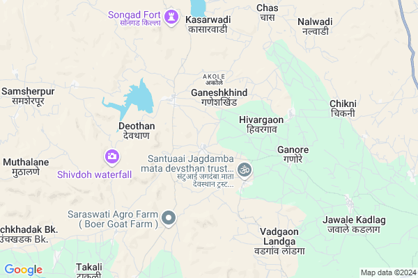
Virgaon
Virgaon Map
EDIT Map
Add Your House
 ..
..
Current Corona Virus Infected Patients Count in Ahmednagar District
| City Name | District Name | Total Covid cases |
|---|
Locality Name :
Virgaon
( वीरगळ )
Taluka Name : Akole
District : Ahmednagar
State : Maharashtra
Region : Khandesh and Northern Maharashtra
Division : Nashik
Language : English and Hindi, Marathi, Urdu
Current Time 07:08 AM
Date: Saturday , Apr 26,2025 (IST)
Time zone: IST (UTC+5:30)
Elevation / Altitude: 587 meters. Above Seal level
Telephone Code / Std Code: 02424
Assembly constituency : Akole assembly constituency
Assembly MLA : Dr. Kiran Yamaji Lahamate
Lok Sabha constituency : Shirdi parliamentary constituency
Parliament MP : SADASHIV KISAN LOKHANDE
Serpanch Name :
Pin Code : 422605
Post Office Name : Sangamner
Commodities Prices : Akole Market / Mandi
Virgaon Live Weather
Temperature: 25.9 °C
scattered clouds
Humidity: 34%
Wind : 3.82 mt/sec towards W
StationName : "Sangamner"
observed on 2 Hours Back
Temperature: 25.9 °C
scattered clouds
Humidity: 34%
Wind : 3.82 mt/sec towards W
StationName : "Sangamner"
observed on 2 Hours Back
Virgaon Weather Forecast for Next 5 days
27-04-2025
25.7°C to 37.8°C
scattered clouds, few clouds, broken clouds, clear sky
25.7°C to 37.8°C
scattered clouds, few clouds, broken clouds, clear sky
28-04-2025
24.6°C to 39.2°C
clear sky, few clouds
24.6°C to 39.2°C
clear sky, few clouds
29-04-2025
25.3°C to 39.4°C
clear sky, scattered clouds, few clouds
25.3°C to 39.4°C
clear sky, scattered clouds, few clouds
30-04-2025
25.8°C to 39.9°C
clear sky
25.8°C to 39.9°C
clear sky
National Highways Reachable To Virgaon
Nationa High Way :NH61
Nationa High Way :NH160
Nationa High Way :NH61
Nationa High Way :NH160
Rivers Near Virgaon
Bhairangi
Kalu
Bhairangi
Kalu
About Virgaon
Correct below Info and add more info about VirgaonVirgaon is a Village in Akole Taluka in Ahmednagar District of Maharashtra State, India. It belongs to Khandesh and Northern Maharashtra region . It belongs to Nashik Division . It is located 105 KM towards west from District head quarters Ahmednagar. 19 KM from Akole. 166 KM from State capital Mumbai
Virgaon Pin code is 422605 and postal head office is Sangamner .
Tambhol ( 4 KM ) , Ganore ( 5 KM ) , Dongargaon ( 5 KM ) , Gardani ( 7 KM ) , Sawargaonpat ( 8 KM ) are the nearby Villages to Virgaon. Virgaon is surrounded by Sangamner Taluka towards East , Sinnar Taluka towards North , Igatpuri Taluka towards west , Rahata Taluka towards East .
Sangamner , Sinnar , Shirdi , Junnar are the near by Cities to Virgaon.
Virgaon 2011 Census Details
Virgaon Local Language is English. Virgaon Village Total population is 3545 and number of houses are 766. Female Population is 49.2%. Village literacy rate is 69.4% and the Female Literacy rate is 30.4%.
Population
| Census Parameter | Census Data |
| Total Population | 3545 |
| Total No of Houses | 766 |
| Female Population % | 49.2 % ( 1743) |
| Total Literacy rate % | 69.4 % ( 2459) |
| Female Literacy rate | 30.4 % ( 1077) |
| Scheduled Tribes Population % | 24.7 % ( 877) |
| Scheduled Caste Population % | 3.8 % ( 136) |
| Working Population % | 59.5 % |
| Child(0 -6) Population by 2011 | 432 |
| Girl Child(0 -6) Population % by 2011 | 48.1 % ( 208) |
Virgaon Census More Deatils.
Politics in Virgaon
RPI(A) , NCP , Shivsena , SHS , INC are the major political parties in this area.Polling Stations /Booths near Virgaon
1)Virgaon Z.p.school East West New Building Room No.2 From West2)Vashere Z.p.school East West Building Room No.2
3)Pimpalgaon Nipani Z.p.school East West Building West Room No.23from East
4)Pimpalgaon Nakwinda Z.p.school North South Building Room No.2 From North
5)Devgaon Z.p.school Southern Side East West Building Room No.2 From East
HOW TO REACH Virgaon
By Road
Sangamner is the Nearest Town to Virgaon. Sangamner is 25 km from Virgaon. Road connectivity is there from Sangamner to Virgaon.By Rail
There is no railway station near to Virgaon in less than 10 km.Colleges near Virgaon
Bhau Daji Patil D.ed College ,kotul
Address :
Govt.junior College Of Keli Kotul
Address :
Govt. Jr. College Kelirumhanwadi
Address :
Adv.mn.deshmukh College Rajur Akole
Address : At.post.rajur Tal. Akole
Schools in Virgaon
Dv Aanand Dhige English Pry Sch
Address : virgaon , akole , ahmadnagar , Maharashtra . PIN- 422601 , Post - Akole
Swami Vivekanand V
Address : virgaon , akole , ahmadnagar , Maharashtra . PIN- 422601 , Post - Akole
Z.p.p.school Virgaon
Address : virgaon , akole , ahmadnagar , Maharashtra . PIN- 422605 , Post - Sangamner
Govt Health Centers near Virgaon
1) Virgaon , Sub Center Virgaon , ,2) Hiwargaon , Sub Center Hiwargaon , 0 , 0
3) Devathan , PHC Devthan , Devthan Road , Near Adhala Dam
Sub Villages in Virgaon
Petrol Bunks in Virgaon,Akole
सागर किराणा आॅड जनरल स्टोर्स सागर जाधव
Devthan Sinnar Rd; Maharashtra 422601; India
2.4 KM distance Detail
more ..
Colleges in Virgaon,Akole
Mahatma Jyotiba Phule Junior Collage
At Ganore Tel; Akole; Maharashtra; India
4.1 KM distance Detail
ABHINS Office
Jawale Kadlag- Nimgaon Bhojapur Road; Maharashtra 422605; India
9.4 KM distance Detail
Modern High School and Jr. College
At Post Akole; Ahmednagar; Akole; Maharashtra 422601; India
11.6 KM distance Detail
more ..
Schools in Virgaon,Akole
Dharmvir Anandrao Dighe English Medium School
Ahmednagar; Maharashtra 422605; India
1.4 KM distance Detail
Electronic Shops in Virgaon,Akole
Sai Treding & Spark Enterprise
Ganore Road; Ganore; Maharashtra 422605; India
5.2 KM distance Detail
Super Markets in Virgaon,Akole
SANIYA BANGLES STORE & GENERAL STORE (LATIF AHMAD MANIYAR)
old gram panchayat ganor; India
5.2 KM distance Detail
Local Parks in Virgaon,Akole
Govind Garden.
Satsanganagar; in front of golden city entrance; near; NH50; Sangamner; Maharashtra; India
16.7 KM distance Detail
Police Stations near Virgaon,Akole
Akole Police Station
Dhumalwadi Road; Amrut Nagar; Akole; Maharashtra 422601; India
12.5 KM distance Detail
Ghulewadi Police Quarters
sangamner nashik road;Sangamner; Maharashtra 422605; India
15.6 KM distance Detail
About Virgaon &
History
How to reach Virgaon
Tourist Places Near By Virgaon
Schools in Virgaon
Colleges in Virgaon
Temperature & weather of Virgaon
places in Virgaon
Virgaon photos
More Information
How to reach Virgaon
Tourist Places Near By Virgaon
Schools in Virgaon
Colleges in Virgaon
Temperature & weather of Virgaon
places in Virgaon
Virgaon photos
More Information
Village Talk
Post News or Events about this Village
Near Cities
Sangamner 18 KM near
Sinnar 28 KM near
Shirdi 51 KM near
Junnar 56 KM near
Sangamner 18 KM near
Sinnar 28 KM near
Shirdi 51 KM near
Junnar 56 KM near
Near By Taluks
Akole 19 KM near
Sangamner 20 KM near
Sinnar 24 KM near
Rahata 50 KM near
Akole 19 KM near
Sangamner 20 KM near
Sinnar 24 KM near
Rahata 50 KM near
Near By Air Ports
Gandhinagar Airport 52 KM near
Lohegaon Airport 130 KM near
Chhatrapati Shivaji International Airport 153 KM near
Chikkalthana Airport 159 KM near
Gandhinagar Airport 52 KM near
Lohegaon Airport 130 KM near
Chhatrapati Shivaji International Airport 153 KM near
Chikkalthana Airport 159 KM near
Near By Tourist Places
Ratanwadi 44 KM near
Malshej Ghat 48 KM near
Shirdi 51 KM near
Ozar 54 KM near
Junnar 56 KM near
Ratanwadi 44 KM near
Malshej Ghat 48 KM near
Shirdi 51 KM near
Ozar 54 KM near
Junnar 56 KM near
Near By Districts
Nashik 55 KM near
Ahmednagar 101 KM near
Pune 138 KM near
Thane 142 KM near
Nashik 55 KM near
Ahmednagar 101 KM near
Pune 138 KM near
Thane 142 KM near
Near By RailWay Station
Devlali Rail Way Station 43 KM near
Nasik Road Rail Way Station 48 KM near
Devlali Rail Way Station 43 KM near
Nasik Road Rail Way Station 48 KM near