| Home | City Bus | Maps | Villages | Cities | Rail | Tourist Places | School | College | Pin Codes | Corona Cases Count |
| Distance Calculator Bus Services IFSC Codes Trace Mobile Number Weather Search Place Trace IP Available Cash ATM/Banks Locate Polling Booth Report an Error contact People |
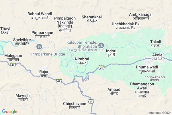
Nimbral
Nimbral Map
EDIT Map
Add Your House
 ..
..
Current Corona Virus Infected Patients Count in Ahmednagar District
| City Name | District Name | Total Covid cases |
|---|
Locality Name :
Nimbral
( निम्ब्रॉ )
Taluka Name : Akole
District : Ahmednagar
State : Maharashtra
Region : Khandesh and Northern Maharashtra
Division : Nashik
Language : English and Hindi, Marathi, Urdu
Current Time 11:08 AM
Date: Tuesday , Apr 29,2025 (IST)
Time zone: IST (UTC+5:30)
Elevation / Altitude: 587 meters. Above Seal level
Telephone Code / Std Code: 02424
Assembly constituency : Akole assembly constituency
Assembly MLA : Dr. Kiran Yamaji Lahamate
Lok Sabha constituency : Shirdi parliamentary constituency
Parliament MP : SADASHIV KISAN LOKHANDE
Serpanch Name :
Pin Code : 422604
Post Office Name : Rajur
Commodities Prices : Akole Market / Mandi
Nimbral Live Weather
Temperature: 31.8 °C
clear sky
Humidity: 23%
Wind : 3.54 mt/sec towards NW
StationName : "Junnar"
observed on 1 Hours Back
Temperature: 31.8 °C
clear sky
Humidity: 23%
Wind : 3.54 mt/sec towards NW
StationName : "Junnar"
observed on 1 Hours Back
Nimbral Weather Forecast for Next 5 days
30-04-2025
24.9°C to 37.5°C
clear sky, broken clouds, scattered clouds
24.9°C to 37.5°C
clear sky, broken clouds, scattered clouds
01-05-2025
24.0°C to 39.5°C
clear sky, few clouds
24.0°C to 39.5°C
clear sky, few clouds
02-05-2025
23.5°C to 39.3°C
clear sky
23.5°C to 39.3°C
clear sky
03-05-2025
23.8°C to 39.2°C
clear sky
23.8°C to 39.2°C
clear sky
04-05-2025
22.4°C to 36.8°C
clear sky, scattered clouds, broken clouds, light rain, few clouds
22.4°C to 36.8°C
clear sky, scattered clouds, broken clouds, light rain, few clouds
Edit below overview about Nimbral
Edit below overview about Nimbral
OverView of Nimbral
Nimbral village has a big ambika Mata temple and some common surnames are dawre and naikwadi. It has a big river called pravara and close by is the khandoba mandir and agasti rushi mandir.Edit below overview about Nimbral
National Highways Reachable To Nimbral
Nationa High Way :NH61
Nationa High Way :NH160
Nationa High Way :NH61
Nationa High Way :NH160
Rivers Near Nimbral
Bhairangi
Kalu
Bhairangi
Kalu
About Nimbral
Nimbral is a Village in Akole Taluka in Ahmednagar District of Maharashtra State, India. It belongs to Khandesh and Northern Maharashtra region . It belongs to Nashik Division . It is located 114 KM towards west from District head quarters Ahmednagar. 1 KM from Akole. 146 KM from State capital Mumbai
Nimbral Pin code is 422604 and postal head office is Rajur .
Mhaladevi ( 2 KM ) , Chitalwedhe ( 2 KM ) , Rumbhodi ( 4 KM ) , Mehenduri ( 4 KM ) , Indori ( 4 KM ) are the nearby Villages to Nimbral. Nimbral is surrounded by Sangamner Taluka towards East , Sinnar Taluka towards North , Igatpuri Taluka towards west , Junnar Taluka towards South .
Sangamner , Sinnar , Junnar , Nashik are the near by Cities to Nimbral.
Nimbral 2011 Census Details
Nimbral Local Language is English. Nimbral Village Total population is 2226 and number of houses are 512. Female Population is 49.2%. Village literacy rate is 66.9% and the Female Literacy rate is 29.2%.
Population
| Census Parameter | Census Data |
| Total Population | 2226 |
| Total No of Houses | 512 |
| Female Population % | 49.2 % ( 1096) |
| Total Literacy rate % | 66.9 % ( 1489) |
| Female Literacy rate | 29.2 % ( 649) |
| Scheduled Tribes Population % | 26.6 % ( 593) |
| Scheduled Caste Population % | 5.0 % ( 111) |
| Working Population % | 56.7 % |
| Child(0 -6) Population by 2011 | 270 |
| Girl Child(0 -6) Population % by 2011 | 44.1 % ( 119) |
Nimbral Census More Deatils.
Politics in Nimbral
RPI(A) , NCP , Shivsena , SHS , INC are the major political parties in this area.Polling Stations /Booths near Nimbral
1)Nimbral Z.p.school East West Building Room No.1 From West2)Nilwande Z.p.school East West Building Room No.2 From West
3)Virgaon Z.p.school East West New Building Room No.4 From West
4)Nawlewadi Z.p.school East West New Building Room No.2 From East
5)Ratanwadi Ashram School East West Building Room No 1 From East
HOW TO REACH Nimbral
By Road
Sangamner is the Nearest Town to Nimbral. Sangamner is 33 km from Nimbral. Road connectivity is there from Sangamner to Nimbral.By Rail
There is no railway station near to Nimbral in less than 10 km.Colleges near Nimbral
Bhau Daji Patil D.ed College ,kotul
Address :
Govt.junior College Of Keli Kotul
Address :
Govt. Jr. College Kelirumhanwadi
Address :
Adv.mn.deshmukh College Rajur Akole
Address : At.post.rajur Tal. Akole
Schools in Nimbral
New English Scl Nimbral
Address : nimbral , akole , ahmadnagar , Maharashtra . PIN- 422601 , Post - Akole
Govt Health Centers near Nimbral
1) Nibral , Sub Center Nimbral , 0 , Garmpanchyat Office2) Vitha , subcenter Vitha , , vividh Karyakari Society Office
3) Vitha , PHC Vitha , 0 , Near Pravar Rivar
Sub Villages in Nimbral
Hospitals in Nimbral,Akole
Samarth Hospital
SH44; Kolahar Ghoti Road; Aurangpur Phata;; MH SH 44; Maharashtra 422601; India
6.3 KM distance Detail
more ..
Petrol Bunks in Nimbral,Akole
SaiSiddhant Petroleum
Unchakhadak Road; Unchkhadak Kh.; Maharashtra 422601; India
6.2 KM distance Detail
Hindustan Petroleum
Rajur; Ahmadnagar; SH-44; Rahuri Sangamner Road; Akola; Akola; 422604; India
6.3 KM distance Detail
HP PETROL PUMP - SHRINIWAS SERVICE STN
AT Rajur TQ Akole Dist; Aurangabad; Maharashtra 422601; India
6.5 KM distance Detail
more ..
Colleges in Nimbral,Akole
Satya Niketan Sansthas Adv Manoharrao Nanaheb Deshmukh Arts; Science & Commerce College
Ahmednagar; Rajur; Akole; Maharashtra 422604; India
5.6 KM distance Detail
Royal Snooker Game Zone
FOOD JUNCTION; Kempegowda Rd; NEAR HOTEL; Akole; Maharashtra; India
9.1 KM distance Detail
more ..
Schools in Nimbral,Akole
आंगनवाड़ी केंद्र सावंतवाड़ी
nali road; sawantwadi; Nimbral; Maharashtra 422601; India
0.3 KM distance Detail
जिल्हा प्राथमिक शाळा सावंतवाड़ी
422601; Sawantwadi Bypass Rd; Maharashtra 422604; India
0.4 KM distance Detail
Super Markets in Nimbral,Akole
Shri Chatrapati Shivaji Maharaj Supermarket
Unchkhadak kd.;; Maharashtra 422601; India
7.1 KM distance Detail
Chatrapati Shivaji Maharaj Supermarket 2
Unchkhadak Kh.; Maharashtra 422601; India
7.1 KM distance Detail
Police Stations near Nimbral,Akole
Akole Police Station
Dhumalwadi Road; Amrut Nagar; Akole; Maharashtra 422601; India
10.4 KM distance Detail
About Nimbral &
History
How to reach Nimbral
Tourist Places Near By Nimbral
Schools in Nimbral
Colleges in Nimbral
Temperature & weather of Nimbral
places in Nimbral
Nimbral photos
More Information
How to reach Nimbral
Tourist Places Near By Nimbral
Schools in Nimbral
Colleges in Nimbral
Temperature & weather of Nimbral
places in Nimbral
Nimbral photos
More Information
Village Talk
Post News or Events about this Village
Near Cities
Sangamner 33 KM near
Sinnar 39 KM near
Junnar 42 KM near
Nashik 59 KM near
Sangamner 33 KM near
Sinnar 39 KM near
Junnar 42 KM near
Nashik 59 KM near
Near By Taluks
Akole 1 KM near
Sangamner 34 KM near
Sinnar 38 KM near
Igatpuri 40 KM near
Akole 1 KM near
Sangamner 34 KM near
Sinnar 38 KM near
Igatpuri 40 KM near
Near By Air Ports
Gandhinagar Airport 54 KM near
Lohegaon Airport 119 KM near
Chhatrapati Shivaji International Airport 134 KM near
Chikkalthana Airport 177 KM near
Gandhinagar Airport 54 KM near
Lohegaon Airport 119 KM near
Chhatrapati Shivaji International Airport 134 KM near
Chikkalthana Airport 177 KM near
Near By Tourist Places
Ratanwadi 26 KM near
Malshej Ghat 30 KM near
Junnar 42 KM near
Ozar 44 KM near
Igatpuri 46 KM near
Ratanwadi 26 KM near
Malshej Ghat 30 KM near
Junnar 42 KM near
Ozar 44 KM near
Igatpuri 46 KM near
Near By Districts
Nashik 57 KM near
Ahmednagar 109 KM near
Thane 123 KM near
Pune 126 KM near
Nashik 57 KM near
Ahmednagar 109 KM near
Thane 123 KM near
Pune 126 KM near
Near By RailWay Station
Devlali Rail Way Station 45 KM near
Igatpuri Rail Way Station 46 KM near
Devlali Rail Way Station 45 KM near
Igatpuri Rail Way Station 46 KM near