| Home | City Bus | Maps | Villages | Cities | Rail | Tourist Places | School | College | Pin Codes | Corona Cases Count |
| Distance Calculator Bus Services IFSC Codes Trace Mobile Number Weather Search Place Trace IP Available Cash ATM/Banks Locate Polling Booth Report an Error contact People |
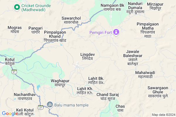
Lingdev
Lingdev Map
EDIT Map
Add Your House
 ..
..
Current Corona Virus Infected Patients Count in Ahmednagar District
| City Name | District Name | Total Covid cases |
|---|
Locality Name :
Lingdev
( लिंगदेव )
Taluka Name : Akole
District : Ahmednagar
State : Maharashtra
Region : Khandesh and Northern Maharashtra
Division : Nashik
Language : English and Hindi, Marathi, Urdu
Current Time 11:52 AM
Date: Wednesday , Apr 30,2025 (IST)
Time zone: IST (UTC+5:30)
Elevation / Altitude: 587 meters. Above Seal level
Telephone Code / Std Code: 02424
Assembly constituency : Akole assembly constituency
Assembly MLA : Dr. Kiran Yamaji Lahamate
Lok Sabha constituency : Shirdi parliamentary constituency
Parliament MP : SADASHIV KISAN LOKHANDE
Serpanch Name :
Pin Code : 422610
Post Office Name : Kotul
Alternate Village Name : Lingdeo
Commodities Prices : Akole Market / Mandi
Lingdev Live Weather
Temperature: 33.7 °C
clear sky
Humidity: 15%
Wind : 5.23 mt/sec towards NW
StationName : "Sangamner"
observed on 2 Hours Back
Temperature: 33.7 °C
clear sky
Humidity: 15%
Wind : 5.23 mt/sec towards NW
StationName : "Sangamner"
observed on 2 Hours Back
Lingdev Weather Forecast for Next 5 days
01-05-2025
26.1°C to 38.0°C
clear sky, few clouds
26.1°C to 38.0°C
clear sky, few clouds
02-05-2025
24.3°C to 38.5°C
clear sky, broken clouds, scattered clouds
24.3°C to 38.5°C
clear sky, broken clouds, scattered clouds
03-05-2025
24.5°C to 38.4°C
clear sky, few clouds, scattered clouds
24.5°C to 38.4°C
clear sky, few clouds, scattered clouds
04-05-2025
22.5°C to 36.5°C
clear sky, few clouds
22.5°C to 36.5°C
clear sky, few clouds
05-05-2025
21.0°C to 35.2°C
clear sky, few clouds, scattered clouds
21.0°C to 35.2°C
clear sky, few clouds, scattered clouds
National Highways Reachable To Lingdev
Nationa High Way :NH61
Nationa High Way :NH160
Nationa High Way :NH61
Nationa High Way :NH160
Rivers Near Lingdev
Bhairangi
Kalu
Bhairangi
Kalu
About Lingdev
Correct below Info and add more info about LingdevLingdev is a Village in Akole Taluka in Ahmednagar District of Maharashtra State, India. It belongs to Khandesh and Northern Maharashtra region . It belongs to Nashik Division . It is located 93 KM towards west from District head quarters Ahmednagar. 19 KM from Akole. 157 KM from State capital Mumbai
Lingdev Pin code is 422610 and postal head office is Kotul .
Pimpalgaon Khand ( 5 KM ) , Sawarchol ( 5 KM ) , Jawale Baleshwar ( 6 KM ) , Kalas Budruk ( 7 KM ) , Pangari ( 8 KM ) are the nearby Villages to Lingdev. Lingdev is surrounded by Sangamner Taluka towards East , Junnar Taluka towards South , Sinnar Taluka towards North , Ambegaon Taluka towards South .
Sangamner , Junnar , Sinnar , Manchar are the near by Cities to Lingdev.
Lingdev 2011 Census Details
Lingdev Local Language is English. Lingdev Village Total population is 2637 and number of houses are 566. Female Population is 47.3%. Village literacy rate is 70.0% and the Female Literacy rate is 28.6%.
Population
| Census Parameter | Census Data |
| Total Population | 2637 |
| Total No of Houses | 566 |
| Female Population % | 47.3 % ( 1247) |
| Total Literacy rate % | 70.0 % ( 1845) |
| Female Literacy rate | 28.6 % ( 754) |
| Scheduled Tribes Population % | 5.0 % ( 133) |
| Scheduled Caste Population % | 6.8 % ( 180) |
| Working Population % | 51.2 % |
| Child(0 -6) Population by 2011 | 254 |
| Girl Child(0 -6) Population % by 2011 | 43.7 % ( 111) |
Lingdev Census More Deatils.
Politics in Lingdev
RPI(A) , NCP , Shivsena , SHS , INC are the major political parties in this area.Polling Stations /Booths near Lingdev
1)Lavhali Otur Z.p.school2)Lingdev Z.p.school South Parteast West Building Room No.3 From West
3)Ladgaon Z.p.school Building Which Has One Room
4)Sherankhel Z.p.school North South Building Room No.3 From South
5)Wagdari Z.p.school North South Building Room No.1 From South
HOW TO REACH Lingdev
By Road
Sangamner is the Nearest Town to Lingdev. Sangamner is 45 km from Lingdev. Road connectivity is there from Sangamner to Lingdev.By Rail
There is no railway station near to Lingdev in less than 10 km.Colleges near Lingdev
Bhau Daji Patil D.ed College ,kotul
Address :
Govt.junior College Of Keli Kotul
Address :
Govt. Jr. College Kelirumhanwadi
Address :
Adv.mn.deshmukh College Rajur Akole
Address : At.post.rajur Tal. Akole
Schools near Lingdev
Anu. M.a.u. A. School Manher
Address : manhere , akole , ahmadnagar , Maharashtra . PIN- 422604 , Post - Rajur
Sarvodaya V M. Khirvire
Address : khirvire , akole , ahmadnagar , Maharashtra . PIN- 422601 , Post - Akole
M.v.pimperkane ,akole
Address : pimparkane , akole , ahmadnagar , Maharashtra . PIN- 422604 , Post - Rajur
Mahalakshmi High School P Nakv
Address : pimpalgaon nakvinde , akole , ahmadnagar , Maharashtra . PIN- 422604 , Post - Rajur
Govt Health Centers near Lingdev
1) Lingdev , Sub Center Lingdev , 0 , 02) Pemgiri , Pemgiri , 0 , Near zp school Road
3) Chapadgaon , SC CHAPADGAON , IN VILLAGE , NEAR PRIMARY SCHOOL
Hospitals in Lingdev,Akole
Dr. Bhujbal Samrath Hospital Kotul
राज्य महामार्ग २१; Kotul; Maharashtra 422610; India
11.3 KM distance Detail
Samarth Hospital Kotul Near Maruti Temple Tal-Akole
Kotul; Maharashtra 422610; India
11.4 KM distance Detail
more ..
Petrol Bunks in Lingdev,Akole
BPCL M/S. Deshmukh Petroleum
Near Pwd guest house; Akole Rd; Kotul; Maharashtra 422610; India
10.4 KM distance Detail
Indian Oil Petrol Pump
Ahmadnagar; SH-44; Rahuri Sangamner Road; Akola; Akola; Maharashtra 422601; India
11.4 KM distance Detail
Indian Oil Petrol Pump
Ahmadnagar; SH-44; Rahuri Sangamner Road; Akola; Akola; Maharashtra 422601; India
11.8 KM distance Detail
more ..
Colleges in Lingdev,Akole
Rajmudra Computers; Akole
Near ST Bus Stand; Behind Matoshri Medical;; Akole; Maharashtra 422601; India
14.5 KM distance Detail
more ..
Super Markets in Lingdev,Akole
Shaikh Gurujis Aapli Dukan
Manyale; Sangamner; 64 GAVTHAN; Other; Akole; Maharashtra 422601; India
11.3 KM distance Detail
Police Stations near Lingdev,Akole
Akole Police Station
Dhumalwadi Road; Amrut Nagar; Akole; Maharashtra 422601; India
14.6 KM distance Detail
Governement Offices near Lingdev,Akole
ग्रामपंचायत कार्यालय केळी ओतूर
केळी ओतूर ता; जि; Akole; Maharashtra 422610; India
14.1 KM distance Detail
About Lingdev &
History
How to reach Lingdev
Tourist Places Near By Lingdev
Schools in Lingdev
Colleges in Lingdev
Temperature & weather of Lingdev
places in Lingdev
Lingdev photos
More Information
How to reach Lingdev
Tourist Places Near By Lingdev
Schools in Lingdev
Colleges in Lingdev
Temperature & weather of Lingdev
places in Lingdev
Lingdev photos
More Information
Village Talk
Post News or Events about this Village
Near Cities
Sangamner 22 KM near
Junnar 36 KM near
Sinnar 50 KM near
Manchar 56 KM near
Sangamner 22 KM near
Junnar 36 KM near
Sinnar 50 KM near
Manchar 56 KM near
Near By Taluks
Akole 18 KM near
Sangamner 22 KM near
Junnar 34 KM near
Sinnar 47 KM near
Akole 18 KM near
Sangamner 22 KM near
Junnar 34 KM near
Sinnar 47 KM near
Near By Air Ports
Gandhinagar Airport 71 KM near
Lohegaon Airport 108 KM near
Chhatrapati Shivaji International Airport 145 KM near
Chikkalthana Airport 165 KM near
Gandhinagar Airport 71 KM near
Lohegaon Airport 108 KM near
Chhatrapati Shivaji International Airport 145 KM near
Chikkalthana Airport 165 KM near
Near By Tourist Places
Ozar 33 KM near
Junnar 36 KM near
Malshej Ghat 36 KM near
Ratanwadi 42 KM near
Shirdi 64 KM near
Ozar 33 KM near
Junnar 36 KM near
Malshej Ghat 36 KM near
Ratanwadi 42 KM near
Shirdi 64 KM near
Near By Districts
Nashik 74 KM near
Ahmednagar 89 KM near
Pune 116 KM near
Thane 136 KM near
Nashik 74 KM near
Ahmednagar 89 KM near
Pune 116 KM near
Thane 136 KM near
Near By RailWay Station
Devlali Rail Way Station 62 KM near
Sainagar Shirdi Rail Way Station 65 KM near
Devlali Rail Way Station 62 KM near
Sainagar Shirdi Rail Way Station 65 KM near