| Home | City Bus | Maps | Villages | Cities | Rail | Tourist Places | School | College | Pin Codes | Corona Cases Count |
| Distance Calculator Bus Services IFSC Codes Trace Mobile Number Weather Search Place Trace IP Available Cash ATM/Banks Locate Polling Booth Report an Error contact People |
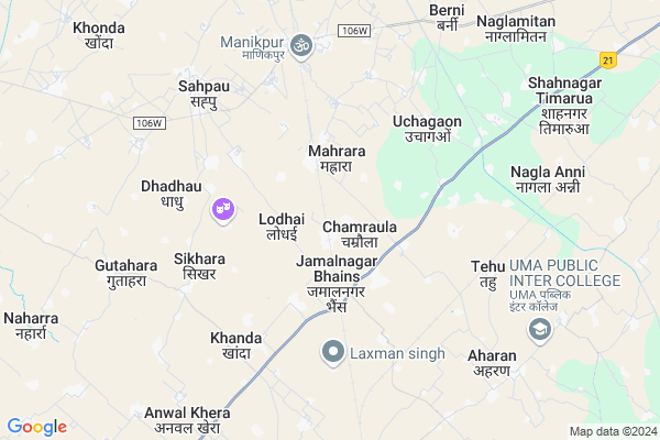
Jampur
Jampur Map
EDIT Map
Add Your House
 ..
..
Current Corona Virus Infected Patients Count in Agra District
| City Name | District Name | Total Covid cases |
|---|---|---|
| Agra District | Agra | 366 |
| Agra | Agra | 9 |
Locality Name :
Jampur
( जमपुर )
Block Name : Etmadpur
District : Agra
State : Uttar Pradesh
Division : Agra
Language : Hindi and Urdu
Current Time 04:51 AM
Date: Saturday , Apr 26,2025 (IST)
Time zone: IST (UTC+5:30)
Elevation / Altitude: 166 meters. Above Seal level
Telephone Code / Std Code: 0562
Assembly constituency : Etmadpur assembly constituency
Assembly MLA : Dr. Dharmpal Singh
Lok Sabha constituency : Agra parliamentary constituency
Parliament MP : Satyapal Singh Baghel
Serpanch Name :
Pin Code : 283201
Post Office Name : Barhan
Commodities Prices : Shadabad Market / Mandi
Jampur Live Weather
Temperature: 30.1 °C
scattered clouds
Humidity: 7%
Wind : 1.06 mt/sec towards S
StationName : "Jalesar"
observed on 2 Hours Back
Temperature: 30.1 °C
scattered clouds
Humidity: 7%
Wind : 1.06 mt/sec towards S
StationName : "Jalesar"
observed on 2 Hours Back
Jampur Weather Forecast for Next 5 days
27-04-2025
29.6°C to 42.3°C
scattered clouds, broken clouds, overcast clouds
29.6°C to 42.3°C
scattered clouds, broken clouds, overcast clouds
28-04-2025
31.1°C to 41.6°C
overcast clouds, broken clouds
31.1°C to 41.6°C
overcast clouds, broken clouds
29-04-2025
29.3°C to 43.8°C
broken clouds, clear sky
29.3°C to 43.8°C
broken clouds, clear sky
30-04-2025
28.7°C to 43.4°C
clear sky, few clouds, broken clouds
28.7°C to 43.4°C
clear sky, few clouds, broken clouds
National Highways Reachable To Jampur
Nationa High Way :NH509
Nationa High Way :NH21
Nationa High Way :NH509
Nationa High Way :NH21
Rivers Near Jampur
यमुना (Yamuna) :Yamuna :यमुना
यमुना (Yamuna) :Yamuna :यमुना
यमुना (Yamuna) :Yamuna :यमुना
यमुना (Yamuna) :Yamuna :यमुना
About Jampur
Correct below Info and add more info about JampurJampur is a Village in Etmadpur Block in Agra District of Uttar Pradesh State, India. It belongs to Agra Division . It is located 34 KM towards North from District head quarters Agra. 10 KM from Etmadpur. 328 KM from State capital Lucknow
Jampur Pin code is 283201 and postal head office is Barhan .
Jamalnagar Bhains ( 2 KM ) , Amanabad ( 2 KM ) , Biruni ( 4 KM ) , Khanda ( 5 KM ) , Tehu ( 6 KM ) are the nearby Villages to Jampur. Jampur is surrounded by Etmadpur Block towards South , Jalesar Block towards East , Khandauli Block towards South , Sadabad Block towards west .
Sadabad , Tundla , Hathras , Agra are the near by Cities to Jampur.
This Place is in the border of the Agra District and Firozabad District. Firozabad District Tundla is South towards this place .
Jampur 2011 Census Details
Jampur Local Language is Hindi. Jampur Village Total population is 1959 and number of houses are 339. Female Population is 46.9%. Village literacy rate is 68.1% and the Female Literacy rate is 26.4%.
Population
| Census Parameter | Census Data |
| Total Population | 1959 |
| Total No of Houses | 339 |
| Female Population % | 46.9 % ( 919) |
| Total Literacy rate % | 68.1 % ( 1335) |
| Female Literacy rate | 26.4 % ( 517) |
| Scheduled Tribes Population % | 0.0 % ( 0) |
| Scheduled Caste Population % | 15.5 % ( 304) |
| Working Population % | 28.6 % |
| Child(0 -6) Population by 2011 | 300 |
| Girl Child(0 -6) Population % by 2011 | 45.3 % ( 136) |
Jampur Census More Deatils.
Politics in Jampur
BJP , RLD , SP , BSP are the major political parties in this area.Polling Stations /Booths near Jampur
1)Pra Vi. Jampur K N.-12)Pra Vi. Nagala Darvesh K N.-1
3)Pra Vi. Nagala Pachori K N.-1
4)Pra Vi. Garapur K N.-1
5)Pra Vi. Gohila K N.-1
HOW TO REACH Jampur
By Rail
Chamrola Rail Way Station , Shivwala Tehu Rail Way Station are the very nearby railway stations to Jampur.Colleges near Jampur
Kishori Devi Girls Inter College
Address : Rawat Colony
Babu Bhola Singh Inter College
Address :
Schools in Jampur
J.h.s.jampur
Address : jampur , etmadpur , agra , Uttar Pradesh . PIN- 283201 , Post - Barhan
Govt Health Centers near Jampur
1) SARAYNEEM , , ,2) Bandhanu) , SubCenter , ,
3) SHAH NAGAR TIMRUA , , ,
Hospitals in Jampur,Etmadpur
Shree Ram Hospital And College Sahpau
Sahpau Road; Sadabad; Uttar Pradesh 204101; India
5.2 KM distance Detail
more ..
Petrol Bunks in Jampur,Etmadpur
BP PETROL PUMP Ashok Automobiles Agra
Jamal Nagar Bhains; Jamalnagar Bhains; Uttar Pradesh 283201; India
2.7 KM distance Detail
more ..
Colleges in Jampur,Etmadpur
M S Public Inter College
Agra District; Jamalnagar Bhains; Uttar Pradesh 272259; India
1.8 KM distance Detail
AWADHESH KUMAR MAHAVIDYALAYA JAMALNAGAR BHAINS; AGRA
Jamalnagar Bhains; Uttar Pradesh 283201; India
2.7 KM distance Detail
Moti Lal Degree College
Jalesar Road; Near Maa Parvathi Colod Storage; Chamrolia; Tehsil Ettmadpur; District Agra; Jamalnagar Bhains; Uttar Pradesh 283204; India
2.8 KM distance Detail
more ..
Schools in Jampur,Etmadpur
Ramroop Vidyapeeth Junior High School
Jamalnagar Bhains; Uttar Pradesh 283201; India
1.4 KM distance Detail
Lord Krishna Public School
Near Chamrola Railway Station; Agra District; Nagla Amar Singh; Uttar Pradesh 283201; India
1.7 KM distance Detail
Electronic Shops in Jampur,Etmadpur
bala ji computer sale & service
Agra - Jalesar Rd; Jamalnagar Bhains; Uttar Pradesh 283201; India
2.7 KM distance Detail
Super Markets in Jampur,Etmadpur
gautam market
Jalesar Road Railway Station;; MDR 106W; Jalesar Road; Nagla Salem; Uttar Pradesh 281104; India
6.1 KM distance Detail
About Jampur &
History
How to reach Jampur
Tourist Places Near By Jampur
Schools in Jampur
Colleges in Jampur
Temperature & weather of Jampur
places in Jampur
Jampur photos
More Information
How to reach Jampur
Tourist Places Near By Jampur
Schools in Jampur
Colleges in Jampur
Temperature & weather of Jampur
places in Jampur
Jampur photos
More Information
Village Talk
Post News or Events about this Village
Near Cities
Sadabad 16 KM near
Tundla 23 KM near
Hathras 28 KM near
Agra 33 KM near
Sadabad 16 KM near
Tundla 23 KM near
Hathras 28 KM near
Agra 33 KM near
Near By Taluks
Sehpau 9 KM near
Etmadpur 10 KM near
Jalesar 13 KM near
Khandauli 17 KM near
Sehpau 9 KM near
Etmadpur 10 KM near
Jalesar 13 KM near
Khandauli 17 KM near
Near By Air Ports
Kheria Airport 38 KM near
Gwalior Airport 137 KM near
Indira Gandhi International Airport 186 KM near
Pantnagar Airport 247 KM near
Kheria Airport 38 KM near
Gwalior Airport 137 KM near
Indira Gandhi International Airport 186 KM near
Pantnagar Airport 247 KM near
Near By Tourist Places
Agra 33 KM near
Mathura 57 KM near
Vrindavan 58 KM near
Aligarh 60 KM near
Fatehpur Sikri 68 KM near
Agra 33 KM near
Mathura 57 KM near
Vrindavan 58 KM near
Aligarh 60 KM near
Fatehpur Sikri 68 KM near
Near By Districts
Mahamaya Nagar 16 KM near
Agra 33 KM near
Firozabad 39 KM near
Etah 56 KM near
Mahamaya Nagar 16 KM near
Agra 33 KM near
Firozabad 39 KM near
Etah 56 KM near
Near By RailWay Station
Chamrola Rail Way Station 1.4 KM near
Shivwala Tehu Rail Way Station 5.5 KM near
Shahanagar Timarua Rail Way Station 5.7 KM near
Tundla Junction Rail Way Station 24 KM near
Hathras Junction Rail Way Station 28 KM near
Chamrola Rail Way Station 1.4 KM near
Shivwala Tehu Rail Way Station 5.5 KM near
Shahanagar Timarua Rail Way Station 5.7 KM near
Tundla Junction Rail Way Station 24 KM near
Hathras Junction Rail Way Station 28 KM near