| Home | City Bus | Maps | Villages | Cities | Rail | Tourist Places | School | College | Pin Codes | Corona Cases Count |
| Distance Calculator Bus Services IFSC Codes Trace Mobile Number Weather Search Place Trace IP Available Cash ATM/Banks Locate Polling Booth Report an Error contact People |
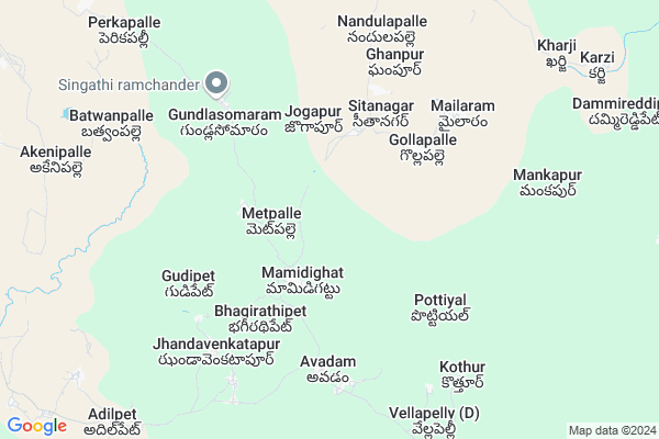
Kothagudem Map
EDIT Map
Add Your House
 ..
..
Current Corona Virus Infected Patients Count in Adilabad District
| City Name | District Name | Total Covid cases |
|---|---|---|
| Adilabad District | Adilabad | 18 |
| Nirmal District | Nirmal | 17 |
Locality Name :
Kothagudem
( కొత్తగూడెం )
Mandal Name : Nennel
District : Adilabad
State : Telangana
Region : Telangana
Language : Telugu and Urdu
Current Time 10:32 AM
Date: Wednesday , Apr 30,2025 (IST)
Time zone: IST (UTC+5:30)
Elevation / Altitude: 210 meters. Above Seal level
Telephone Code / Std Code: 08735
Assembly constituency : Bellampalli assembly constituency
Assembly MLA : Gaddam Vinod
Lok Sabha constituency : Peddapalli parliamentary constituency
Parliament MP : Venkatesh Netha Borlakunta
Serpanch Name :
Pin Code : 504251
Post Office Name : Bellampalli
Main Village Name : Chittapur
Commodities Prices : Sironcha Market / Mandi
Kothagudem Live Weather
Temperature: 34.5 °C
few clouds
Humidity: 38%
Wind : 6.62 mt/sec towards S
StationName : "Bellampalli"
observed on 45 Mins Back
Temperature: 34.5 °C
few clouds
Humidity: 38%
Wind : 6.62 mt/sec towards S
StationName : "Bellampalli"
observed on 45 Mins Back
Kothagudem Weather Forecast for Next 5 days
01-05-2025
29.5°C to 42.9°C
few clouds, scattered clouds, broken clouds
29.5°C to 42.9°C
few clouds, scattered clouds, broken clouds
02-05-2025
27.7°C to 43.3°C
scattered clouds, few clouds, clear sky
27.7°C to 43.3°C
scattered clouds, few clouds, clear sky
03-05-2025
28.5°C to 43.2°C
scattered clouds, broken clouds, clear sky
28.5°C to 43.2°C
scattered clouds, broken clouds, clear sky
04-05-2025
27.7°C to 43.5°C
few clouds, clear sky, light rain
27.7°C to 43.5°C
few clouds, clear sky, light rain
05-05-2025
29.9°C to 39.7°C
moderate rain, scattered clouds, few clouds, overcast clouds, broken clouds
29.9°C to 39.7°C
moderate rain, scattered clouds, few clouds, overcast clouds, broken clouds
National Highways Reachable To Kothagudem
Nationa High Way :NH363
Nationa High Way :NH363
Rivers Near Kothagudem
Raja Vagu
Panjar Vegu
Raja Vagu
Panjar Vegu
About Kothagudem
Correct below Info and add more info about KothagudemKothagudem is a small Village/hamlet in Nennel Mandal in Adilabad District of Telangana State, India. It comes under Chittapur Panchayath. It belongs to Telangana region . It is located 158 KM towards East from District head quarters Adilabad. 6 KM from Nennal.
Kothagudem Pin code is 504251 and postal head office is Bellampalli .
Kothagudem is surrounded by Bellampally Mandal towards west , Mandamarri Mandal towards west , Jaipur Mandal towards South , Bheemini Mandal towards North .
Mandamarri , Bellampalle , Mancherial , Ramagundam are the near by Cities to Kothagudem.
Demographics of Kothagudem
Telugu is the Local Language here. Total population of Kothagudem is 1504 .Males are 758 and Females are 746 living in 340 Houses. Total area of Kothagudem is 815 hectares.Polling Stations /Booths near Kothagudem
1)Chinna Venkatapur2)Narsapur
3)Jillada
4)Ghan Pur
5)Annaram
HOW TO REACH Kothagudem
By Road
Mandamarri is the Nearest Town to Kothagudem. Mandamarri is 20 km from Kothagudem. Road connectivity is there from Mandamarri to Kothagudem.By Rail
There is no railway station near to Kothagudem in less than 10 km. How ever there are railway Stations from Near By town Mandamarri. are the railway Stations near to Mandamarri. You can reach from Mandamarri to Kothagudem by road after .Colleges near Kothagudem
Govt. Polytechnic Bellampalli
Address :
Viveka Vardhini Degree&pg Clg
Address :
Rebbena Arts & Science Degree College
Address :
Govt Junior College
Address :
Kakathiya Junior Collage
Address :
Schools in Kothagudem
Mpups Chittapur
Address : chittapur , nennel , adilabad , Andhra Pradesh . PIN- 504251 , Post - Bellampalli
Aups Chittapur
Address : chittapur , nennel , adilabad , Andhra Pradesh . PIN- 504251 , Post - Bellampalli
Govt Health Centers near Kothagudem
1) SubCentre, Chittapur , , BC Colony , Near Hanuman Temple2) SubCentre, Awadam , , NBC Colony , Near Anganwadi Centre
3) Primary Health Centre, Nennal , , Beside MPDO Office , Beside MPDO Office
Hospitals in Kothagudem,Nennel
KK Dispensary
Saibaba Temple Back Ln; Mandamarri Market; Mandamarri; Telangana 504231; India
15.6 KM distance Detail
more ..
Petrol Bunks in Kothagudem,Nennel
proposed limra filling station
sy.no5/19A peddanapalli mandalAdilabad;; Kasipet; Telangana; India
16.3 KM distance Detail
more ..
Colleges in Kothagudem,Nennel
Govt.PolyTechnic College
Telangana Region; Mandamarri; Telangana 504251; India
15.3 KM distance Detail
more ..
Governement Offices near Kothagudem,Nennel
MeeSeva Center
Uma Mahesh Inter Net; Market Area; Andhra Bank Link;; 52; Mee Seva Ln; Sripathi Nagar; Mandamarri; Telangana 504231; India
15.8 KM distance Detail
About Kothagudem &
History
How to reach Kothagudem
Tourist Places Near By Kothagudem
Schools in Kothagudem
Colleges in Kothagudem
Temperature & weather of Kothagudem
places in Kothagudem
Kothagudem photos
More Information
How to reach Kothagudem
Tourist Places Near By Kothagudem
Schools in Kothagudem
Colleges in Kothagudem
Temperature & weather of Kothagudem
places in Kothagudem
Kothagudem photos
More Information
Village Talk
Post News or Events about this Village
Near Cities
Mandamarri 14 KM near
Bellampalle 15 KM near
Mancherial 23 KM near
Ramagundam 33 KM near
Mandamarri 14 KM near
Bellampalle 15 KM near
Mancherial 23 KM near
Ramagundam 33 KM near
Near By Taluks
Nennel 5 KM near
Bellampally 13 KM near
Mandamarri 17 KM near
Jaipur 21 KM near
Nennel 5 KM near
Bellampally 13 KM near
Mandamarri 17 KM near
Jaipur 21 KM near
Near By Air Ports
Rajiv Gandhi International Airport 260 KM near
Sonegaon Airport 268 KM near
Nanded Airport 270 KM near
Vijayawada Airport 338 KM near
Rajiv Gandhi International Airport 260 KM near
Sonegaon Airport 268 KM near
Nanded Airport 270 KM near
Vijayawada Airport 338 KM near
Near By Tourist Places
Sirpur 59 KM near
Medaram 112 KM near
Chandrapur 123 KM near
Warangal 125 KM near
Bhamragarh Wildlife Sanctuary 126 KM near
Sirpur 59 KM near
Medaram 112 KM near
Chandrapur 123 KM near
Warangal 125 KM near
Bhamragarh Wildlife Sanctuary 126 KM near
Near By Districts
Karimnagar 90 KM near
Chandrapur 123 KM near
Warangal 126 KM near
Bijapur 143 KM near
Karimnagar 90 KM near
Chandrapur 123 KM near
Warangal 126 KM near
Bijapur 143 KM near
Near By RailWay Station
Bellampalli Rail Way Station 16 KM near
Manchiryal Rail Way Station 24 KM near
Bellampalli Rail Way Station 16 KM near
Manchiryal Rail Way Station 24 KM near