| Home | City Bus | Maps | Villages | Cities | Rail | Tourist Places | School | College | Pin Codes | Corona Cases Count |
| Distance Calculator Bus Services IFSC Codes Trace Mobile Number Weather Search Place Trace IP Available Cash ATM/Banks Locate Polling Booth Report an Error contact People |
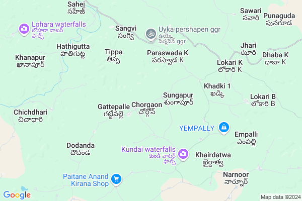
Mathuratanda Map
EDIT Map
Add Your House
 ..
..
Current Corona Virus Infected Patients Count in Adilabad District
| City Name | District Name | Total Covid cases |
|---|---|---|
| Adilabad District | Adilabad | 18 |
| Nirmal District | Nirmal | 17 |
Locality Name :
Mathuratanda
( మథురతండా )
Mandal Name : Narnoor
District : Adilabad
State : Telangana
Region : Telangana
Language : Telugu and Urdu
Current Time 02:48 PM
Date: Tuesday , Apr 29,2025 (IST)
Time zone: IST (UTC+5:30)
Elevation / Altitude: 227 meters. Above Seal level
Telephone Code / Std Code: 08731
Assembly constituency : Asifabad assembly constituency
Assembly MLA : Kova Laxmi
Lok Sabha constituency : Adilabad parliamentary constituency
Parliament MP : SOYAM BAPU RAO
Serpanch Name :
Pin Code : 504346
Post Office Name : Indervelli
Main Village Name : Chorgaon
Commodities Prices : Jainoor Market / Mandi
Rivers Near Mathuratanda
Kaddam
Wardha
Kaddam
Wardha
About Mathuratanda
Correct below Info and add more info about MathuratandaMathuratanda is a small Village/hamlet in Narnoor Mandal in Adilabad District of Telangana State, India. It comes under Chorgaon Panchayath. It belongs to Telangana region . It is located 34 KM towards East from District head quarters Adilabad. 7 KM from Narnoor.
Mathuratanda Pin code is 504346 and postal head office is Indervelli .
Mathuratanda is surrounded by Utnoor Mandal towards South , Indervelly Mandal towards west , Bela Mandal towards North , Jainoor Mandal towards South .
Adilabad , Pandharkaoda , Wani , Rajura are the near by Cities to Mathuratanda.
Demographics of Mathuratanda
Telugu is the Local Language here. Total population of Mathuratanda is 815 .Males are 429 and Females are 386 living in 145 Houses. Total area of Mathuratanda is 1043 hectares.Politics in Mathuratanda
TDP , TRS , CPI , INC are the major political parties in this area.Polling Stations /Booths near Mathuratanda
1)Chirrakunta2)Sungapur
3)Babapur
4)Janakapur
5)Kerameri
HOW TO REACH Mathuratanda
By Road
Adilabad is the Nearest Town to Mathuratanda. Adilabad is 38 km from Mathuratanda. Road connectivity is there from Adilabad to Mathuratanda.By Rail
There is no railway station near to Mathuratanda in less than 10 km. How ever there are railway Stations from Near By town Adilabad. are the railway Stations near to Adilabad. You can reach from Adilabad to Mathuratanda by road after .Colleges near Mathuratanda
A P T W R Jr College Narnoor
Address : A P T W R Jr College Narnoor
Schools in Mathuratanda
Twps Gangu Guda
Address : chorgaon , narnoor , adilabad , Andhra Pradesh . PIN- 504311 , Post - Ootnur
Twps Chorgaon
Address : chorgaon , narnoor , adilabad , Andhra Pradesh . PIN- 504329
Govt Health Centers near Mathuratanda
1) SubCentre, Arjuni , , , Near Ashrama High School Girls2) SubCentre, Lokari , Jan-59 , , Near Bus stand
3) Primary Health Centre, Narnoor , , , Near Police Station
Petrol Bunks in Mathuratanda,Narnoor
HP PETROL PUMP - NARAYAN & CO. FILLING CEN. UTNOOR
Sy.no.74/2/a/1 Mancherial TO Gudihathnoor Road Utnoor Mandal; Warangal; 504311; India
19.6 KM distance Detail
Sri Venkateshwara Filling Station
Utnur Rd; X-Road; Nagapur; Telangana 504311; India
19.7 KM distance Detail
more ..
Colleges in Mathuratanda,Narnoor
Telangana Welfare Residential Jr College (Laltekdi)
Nagapur; Telangana 504311; India
18.8 KM distance Detail
more ..
Schools in Mathuratanda,Narnoor
harish sony dance studio
near grampanchayth house no 4-170; Narnoor; Telangana; India
9.6 KM distance Detail
Electronic Shops in Mathuratanda,Narnoor
Babu Bhai Mechanic Auto Mobiles
Noorani JAMA masjid; Narnoor; Telangana 504311; India
9.8 KM distance Detail
Local Parks in Mathuratanda,Narnoor
Parakappi water Sanctuary And Animal Protection Place
Adilabad; Telangana 504311; India
12.5 KM distance Detail
About Mathuratanda &
History
How to reach Mathuratanda
Tourist Places Near By Mathuratanda
Schools in Mathuratanda
Colleges in Mathuratanda
Temperature & weather of Mathuratanda
places in Mathuratanda
Mathuratanda photos
More Information
How to reach Mathuratanda
Tourist Places Near By Mathuratanda
Schools in Mathuratanda
Colleges in Mathuratanda
Temperature & weather of Mathuratanda
places in Mathuratanda
Mathuratanda photos
More Information
Village Talk
Post News or Events about this Village
Near Cities
Adilabad 32 KM near
Pandharkaoda 65 KM near
Wani 65 KM near
Rajura 68 KM near
Adilabad 32 KM near
Pandharkaoda 65 KM near
Wani 65 KM near
Rajura 68 KM near
Near By Taluks
Narnoor 7 KM near
Utnoor 17 KM near
Indervelly 19 KM near
Bela 19 KM near
Narnoor 7 KM near
Utnoor 17 KM near
Indervelly 19 KM near
Bela 19 KM near
Near By Air Ports
Nanded Airport 179 KM near
Sonegaon Airport 194 KM near
Rajiv Gandhi International Airport 290 KM near
Latur Airport 308 KM near
Nanded Airport 179 KM near
Sonegaon Airport 194 KM near
Rajiv Gandhi International Airport 290 KM near
Latur Airport 308 KM near
Near By Tourist Places
Chandrapur 77 KM near
Sirpur 93 KM near
Tadoba 114 KM near
Sevagram 149 KM near
Hingoli 193 KM near
Chandrapur 77 KM near
Sirpur 93 KM near
Tadoba 114 KM near
Sevagram 149 KM near
Hingoli 193 KM near
Near By Districts
Adilabad 33 KM near
Chandrapur 80 KM near
Yavatmal 130 KM near
Nizamabad 136 KM near
Adilabad 33 KM near
Chandrapur 80 KM near
Yavatmal 130 KM near
Nizamabad 136 KM near
Near By RailWay Station
Adilabad Rail Way Station 33 KM near
Kinwat Rail Way Station 69 KM near
Adilabad Rail Way Station 33 KM near
Kinwat Rail Way Station 69 KM near