| Home | City Bus | Maps | Villages | Cities | Rail | Tourist Places | School | College | Pin Codes | Corona Cases Count |
| Distance Calculator Bus Services IFSC Codes Trace Mobile Number Weather Search Place Trace IP Available Cash ATM/Banks Locate Polling Booth Report an Error contact People |
Pothepalle
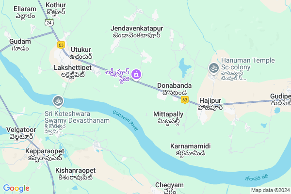
Pothepalle Map
EDIT Map
Add Your House
 ..
..
Current Corona Virus Infected Patients Count in Adilabad District
| City Name | District Name | Total Covid cases |
|---|---|---|
| Adilabad District | Adilabad | 18 |
| Nirmal District | Nirmal | 17 |
Locality Name :
Pothepalle
( పోతేపల్లె )
Mandal Name : Luxettipet
District : Adilabad
State : Telangana
Region : Telangana
Language : Telugu and Urdu
Current Time 12:49 PM
Date: Saturday , Apr 26,2025 (IST)
Time zone: IST (UTC+5:30)
Elevation / Altitude: 159 meters. Above Seal level
Telephone Code / Std Code: 08627
Assembly constituency : Mancherial assembly constituency
Assembly MLA : Kokkirala Premsagar Rao
Lok Sabha constituency : Peddapalli parliamentary constituency
Parliament MP : Venkatesh Netha Borlakunta
Serpanch Name :
Pin Code : 504215
Post Office Name : Luxettipet
Alternate Village Name : Pothapally , Pothepali
Commodities Prices : Gollapally Market / Mandi
National Highways Reachable To Pothepalle
Nationa High Way :NH363
Nationa High Way :NH363
Rivers Near Pothepalle
Godavari :गोदावरी :ಗೋದಾವರಿ :गोदावरी :கோதாவரி :గోదావరి
Peddayya VAgu
Godavari :गोदावरी :ಗೋದಾವರಿ :गोदावरी :கோதாவரி :గోదావరి
Peddayya VAgu
About Pothepalle
Correct below Info and add more info about PothepallePothepalle is a Village in Luxettipet Mandal in Adilabad District of Telangana State, India. It belongs to Telangana region . It is located 136 KM towards South from District head quarters Adilabad. 6 KM from Luxettipet.
Pothepalle Pin code is 504215 and postal head office is Luxettipet .
Itkyal ( 2 KM ) , Donabanda ( 2 KM ) , Laxmipur ( 3 KM ) , Thimmapur ( 4 KM ) , Jendavenkatapur ( 5 KM ) are the nearby Villages to Pothepalle. Pothepalle is surrounded by Velgatoor Mandal towards South , Dandepally Mandal towards North , Dharmaram Mandal towards South , Dharmapuri Mandal towards west .
Mancherial , Ramagundam , Mandamarri , Bellampalle are the near by Cities to Pothepalle.
This Place is in the border of the Adilabad District and Karimnagar District. Karimnagar District Velgatoor is South towards this place .
Pothepalle 2011 Census Details
Pothepalle Local Language is Telugu. Pothepalle Village Total population is 1700 and number of houses are 474. Female Population is 48.4%. Village literacy rate is 55.2% and the Female Literacy rate is 22.4%.
Population
| Census Parameter | Census Data |
| Total Population | 1700 |
| Total No of Houses | 474 |
| Female Population % | 48.4 % ( 823) |
| Total Literacy rate % | 55.2 % ( 938) |
| Female Literacy rate | 22.4 % ( 381) |
| Scheduled Tribes Population % | 0.2 % ( 3) |
| Scheduled Caste Population % | 40.2 % ( 683) |
| Working Population % | 51.4 % |
| Child(0 -6) Population by 2011 | 109 |
| Girl Child(0 -6) Population % by 2011 | 47.7 % ( 52) |
Pothepalle Census More Deatils.
Politics in Pothepalle
TDP , TRS , INC are the major political parties in this area.Polling Stations /Booths near Pothepalle
1)Peddapet2)Gudirevu
3)Gullakota
4)Laxmikanthapur
5)Laxmipur
HOW TO REACH Pothepalle
By Road
Mancherial is the Nearest Town to Pothepalle. Mancherial is 26 km from Pothepalle. Road connectivity is there from Mancherial to Pothepalle.By Rail
There is no railway station near to Pothepalle in less than 10 km. How ever there are railway Stations from Near By town Mancherial. are the railway Stations near to Mancherial. You can reach from Mancherial to Pothepalle by road after .Colleges near Pothepalle
Vageshwari Degree College Utkoor,luxettipet,dist.mancherial
Address : Near Utkoor Chourastha Luxettipet
Junior College
Address :
Sri Badavathi Degree College
Address :
Karimala Sai Degree College
Address :
Vaishnavi Women's Degree College
Address :
Schools in Pothepalle
Mpps Shantapur
Address : pothepalle , laxettipet , adilabad , Andhra Pradesh . PIN- 504215 , Post - Luxettipet
Mpps Ankatpally
Address : pothepalle , laxettipet , adilabad , Andhra Pradesh . PIN- 504215 , Post - Luxettipet
Mpps Pothepalle
Address : pothepalle , laxettipet , adilabad , Andhra Pradesh . PIN- 504215 , Post - Luxettipet
Govt Health Centers near Pothepalle
1) SubCentre, Gullakota , 4-118/9 , GP. Road , Nr. Community Hall2) SubCentre, Donabanda , , Main Road , GP Office
3) SubCentre, Timmapur , 5-71/A/1 , Main Road , Near School
Sub Villages in Pothepalle
Hospitals in Pothepalle,Luxettipet
AKSHAYA HOSPITAL
Dr. M. SURESH - MBBS; Beet Bazaar Road; Suraram; Lakshettipet; Telangana 504215; India
7.0 KM distance Detail
more ..
Petrol Bunks in Pothepalle,Luxettipet
Shankar Fuel Point - Essar Petrol Pump/Bunk
3/114; Kannepally (V); Dandepally (M);; Telangana 504215; India
10.0 KM distance Detail
more ..
Colleges in Pothepalle,Luxettipet
Sri Bhagavathi Degree College
Lakshettipet; Adilabad; NH-16; Nirmal Mancherial Road; Mancherial; Mancherial; Telangana 504215; India
7.0 KM distance Detail
UmaMaheshwara Junior & Vocational college
Beet Bazaar Road; Suraram; Lakshettipet; Telangana 504215; India
7.0 KM distance Detail
Government Degree College Luxettipet
Suraram; Lakshettipet; Telangana 504215; India
7.1 KM distance Detail
Shankari Degree College
Lakshettipet; Adilabad; NH-16; Nirmal Mancherial Road; Mancherial; Mancherial; Telangana 504215; India
7.6 KM distance Detail
more ..
Electronic Shops in Pothepalle,Luxettipet
Srinivasa Electronics
Near govt junior college. dist. 504215; Luxettipet; Telangana; India
7.0 KM distance Detail
Super Markets in Pothepalle,Luxettipet
Mallikarjuna Genral & Book Stall
Nizamabad - Mancherial - Jagdalpur Rd; Utukur; Telangana 504215; India
6.0 KM distance Detail
Sri Krishna Kiranam and General Stores
; Kapparaopet; Telangana 505526; India
10.3 KM distance Detail
Police Stations near Pothepalle,Luxettipet
Police Station Luxettipet
Sri Sathya Sai Nagar; Utukur; Telangana 504215; India
6.6 KM distance Detail
About Pothepalle &
History
How to reach Pothepalle
Tourist Places Near By Pothepalle
Schools in Pothepalle
Colleges in Pothepalle
Temperature & weather of Pothepalle
places in Pothepalle
Pothepalle photos
More Information
How to reach Pothepalle
Tourist Places Near By Pothepalle
Schools in Pothepalle
Colleges in Pothepalle
Temperature & weather of Pothepalle
places in Pothepalle
Pothepalle photos
More Information
Village Talk
Post News or Events about this Village
Near Cities
Mancherial 23 KM near
Ramagundam 28 KM near
Mandamarri 30 KM near
Bellampalle 35 KM near
Mancherial 23 KM near
Ramagundam 28 KM near
Mandamarri 30 KM near
Bellampalle 35 KM near
Near By Taluks
Luxettipet 6 KM near
Velgatoor 10 KM near
Dharmaram 21 KM near
Dandepally 21 KM near
Luxettipet 6 KM near
Velgatoor 10 KM near
Dharmaram 21 KM near
Dandepally 21 KM near
Near By Air Ports
Rajiv Gandhi International Airport 225 KM near
Nanded Airport 232 KM near
Sonegaon Airport 277 KM near
Latur Airport 334 KM near
Rajiv Gandhi International Airport 225 KM near
Nanded Airport 232 KM near
Sonegaon Airport 277 KM near
Latur Airport 334 KM near
Near By Tourist Places
Sirpur 84 KM near
Warangal 116 KM near
Medaram 134 KM near
Chandrapur 134 KM near
Medak 155 KM near
Sirpur 84 KM near
Warangal 116 KM near
Medaram 134 KM near
Chandrapur 134 KM near
Medak 155 KM near
Near By Districts
Karimnagar 56 KM near
Warangal 116 KM near
Adilabad 131 KM near
Chandrapur 135 KM near
Karimnagar 56 KM near
Warangal 116 KM near
Adilabad 131 KM near
Chandrapur 135 KM near
Near By RailWay Station
Manchiryal Rail Way Station 22 KM near
Ramagundam Rail Way Station 24 KM near
Manchiryal Rail Way Station 22 KM near
Ramagundam Rail Way Station 24 KM near