| Home | City Bus | Maps | Villages | Cities | Rail | Tourist Places | School | College | Pin Codes | Corona Cases Count |
| Distance Calculator Bus Services IFSC Codes Trace Mobile Number Weather Search Place Trace IP Available Cash ATM/Banks Locate Polling Booth Report an Error contact People |
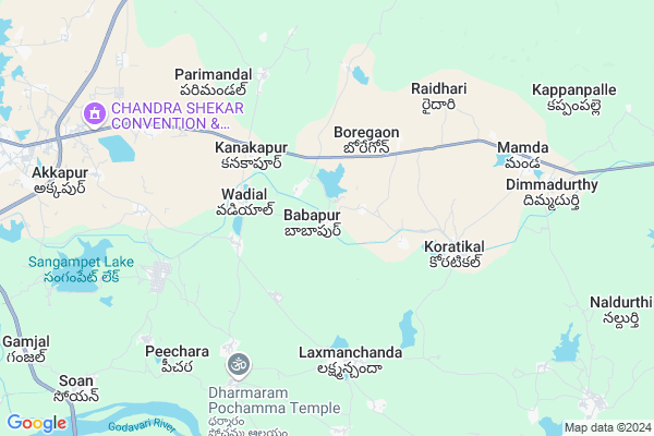
Babapur
Babapur Map
EDIT Map
Add Your House
 ..
..
Current Corona Virus Infected Patients Count in Adilabad District
| City Name | District Name | Total Covid cases |
|---|---|---|
| Adilabad District | Adilabad | 18 |
| Nirmal District | Nirmal | 17 |
Locality Name :
Babapur
( బాబాపూర్ )
Mandal Name : Laxmanchanda
District : Adilabad
State : Telangana
Region : Telangana
Language : Telugu and Urdu
Current Time 12:08 PM
Date: Tuesday , Apr 29,2025 (IST)
Time zone: IST (UTC+5:30)
Elevation / Altitude: 293 meters. Above Seal level
Telephone Code / Std Code: 08734
Assembly constituency : Nirmal assembly constituency
Assembly MLA : Alleti Maheshwar Reddy
Lok Sabha constituency : Adilabad parliamentary constituency
Parliament MP : SOYAM BAPU RAO
Serpanch Name :
Pin Code : 504106
Post Office Name : Nirmal (Adilabad)
Commodities Prices : Nirmal Market / Mandi
Rivers Near Babapur
Pedda Vagu
Gudi Vagu
Pedda Vagu
Gudi Vagu
About Babapur
Correct below Info and add more info about BabapurBabapur is a Village in Laxmanchanda Mandal in Adilabad District of Telangana State, India. It belongs to Telangana region . It is located 80 KM towards South from District head quarters Adilabad. 5 KM from Laxmanchanda.
Babapur Pin code is 504106 and postal head office is Nirmal (Adilabad).
Waddyal ( 3 KM ) , Rachapur ( 3 KM ) , Ratnapur Kondli ( 4 KM ) , Koratikal ( 5 KM ) , Parimandal ( 6 KM ) are the nearby Villages to Babapur. Babapur is surrounded by Mamda Mandal towards East , Nirmal Mandal towards west , Balkonda Mandal towards South , Ibrahimpatnam Mandal towards South .
Nirmal , Koratla , Bhainsa , Jagtial are the near by Cities to Babapur.
This Place is in the border of the Adilabad District and Karimnagar District. Karimnagar District Ibrahimpatnam is South towards this place .
Babapur 2011 Census Details
Babapur Local Language is Telugu. Babapur Village Total population is 1154 and number of houses are 332. Female Population is 53.1%. Village literacy rate is 42.6% and the Female Literacy rate is 17.9%.
Population
| Census Parameter | Census Data |
| Total Population | 1154 |
| Total No of Houses | 332 |
| Female Population % | 53.1 % ( 613) |
| Total Literacy rate % | 42.6 % ( 492) |
| Female Literacy rate | 17.9 % ( 207) |
| Scheduled Tribes Population % | 9.8 % ( 113) |
| Scheduled Caste Population % | 21.5 % ( 248) |
| Working Population % | 58.3 % |
| Child(0 -6) Population by 2011 | 111 |
| Girl Child(0 -6) Population % by 2011 | 51.4 % ( 57) |
Babapur Census More Deatils.
Politics in Babapur
TDP , TRS , PRAP , BSP , INC are the major political parties in this area.Polling Stations /Booths near Babapur
1)Arepalli2)Narsapur G
3)Kanjar
4)Venkatapur
5)Wadyal
HOW TO REACH Babapur
By Road
Nirmal is the Nearest Town to Babapur. Nirmal is 15 km from Babapur. Road connectivity is there from Nirmal to Babapur.By Rail
There is no railway station near to Babapur in less than 10 km.Colleges near Babapur
Sahakara Jr College Laxmanchanda
Address : Sahakara Jr College Laxmanchanda
Schools in Babapur
Zphs Babapur
Address : babapur , laxmanchanda , adilabad , Andhra Pradesh . PIN- 504106 , Post - Nirmal (Adilabad)
Govt Health Centers near Babapur
1) SubCentre, Vadyal , , , Old School Beside AWC, Wadyal2) SubCentre, Kortikal , 25-Apr , BC Colony, , G.P.
3) SubCentre, Parimandal , , S.C Colony , G.P.
Sub Villages in Babapur
Colleges in Babapur,Laxmanchanda
Sahakara Junior College & SVG Degree College
Thirupalli Road; Laxmanchanda; Telangana 504106; India
5.8 KM distance Detail
Government Degree College
AP Housing Board Colony; Nirmal; Telangana 504105; India
12.2 KM distance Detail
Govt. Degree College; Nirmal
Nirmal - Mancherial Rd; AP Housing Board Colony; Venkatapur Rural; Telangana 504105; India
12.3 KM distance Detail
more ..
Electronic Shops in Babapur,Laxmanchanda
Lucky Cable TV Network
New kanjar laxmanchandha; Nirmal; Telangana 504310; India
1.3 KM distance Detail
Local Parks in Babapur,Laxmanchanda
మున్నూర్ కాపు సంఘం బాగులవాడ
Indira Nagar Road; Indira Nagar; Nirmal; Telangana 504106; India
14.6 KM distance Detail
Police Stations near Babapur,Laxmanchanda
District Police Office
Police Station Rd; Nirmal Nagar Colony; AP Housing Board Colony; Hyderabad; Telangana 504105; India
12.3 KM distance Detail
1town Police Station
Besthawar Pet; Brahmapuri; Nirmal; Telangana 504106; India
14.8 KM distance Detail
About Babapur &
History
How to reach Babapur
Tourist Places Near By Babapur
Schools in Babapur
Colleges in Babapur
Temperature & weather of Babapur
places in Babapur
Babapur photos
More Information
How to reach Babapur
Tourist Places Near By Babapur
Schools in Babapur
Colleges in Babapur
Temperature & weather of Babapur
places in Babapur
Babapur photos
More Information
Village Talk
Post News or Events about this Village
Near Cities
Nirmal 14 KM near
Koratla 42 KM near
Bhainsa 58 KM near
Jagtial 62 KM near
Nirmal 14 KM near
Koratla 42 KM near
Bhainsa 58 KM near
Jagtial 62 KM near
Near By Taluks
Laxmanchanda 4 KM near
Mamda 5 KM near
Nirmal 13 KM near
Ibrahimpatnam 21 KM near
Laxmanchanda 4 KM near
Mamda 5 KM near
Nirmal 13 KM near
Ibrahimpatnam 21 KM near
Near By Air Ports
Nanded Airport 135 KM near
Rajiv Gandhi International Airport 226 KM near
Latur Airport 248 KM near
Sonegaon Airport 262 KM near
Nanded Airport 135 KM near
Rajiv Gandhi International Airport 226 KM near
Latur Airport 248 KM near
Sonegaon Airport 262 KM near
Near By Tourist Places
Medak 127 KM near
Sirpur 141 KM near
Chandrapur 148 KM near
Hingoli 174 KM near
Bidar 180 KM near
Medak 127 KM near
Sirpur 141 KM near
Chandrapur 148 KM near
Hingoli 174 KM near
Bidar 180 KM near
Near By Districts
Nizamabad 64 KM near
Adilabad 77 KM near
Karimnagar 111 KM near
Nanded 135 KM near
Nizamabad 64 KM near
Adilabad 77 KM near
Karimnagar 111 KM near
Nanded 135 KM near
Near By RailWay Station
Nizamabad Junction Rail Way Station 63 KM near
Basar Rail Way Station 65 KM near
Nizamabad Junction Rail Way Station 63 KM near
Basar Rail Way Station 65 KM near