| Home | City Bus | Maps | Villages | Cities | Rail | Tourist Places | School | College | Pin Codes | Corona Cases Count |
| Distance Calculator Bus Services IFSC Codes Trace Mobile Number Weather Search Place Trace IP Available Cash ATM/Banks Locate Polling Booth Report an Error contact People |
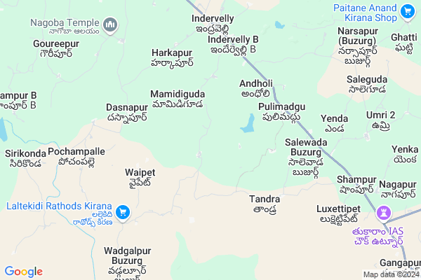
Jaithram Tanda
Jaithram Tanda Map
EDIT Map
Add Your House
 ..
..
Current Corona Virus Infected Patients Count in Adilabad District
| City Name | District Name | Total Covid cases |
|---|---|---|
| Adilabad District | Adilabad | 18 |
| Nirmal District | Nirmal | 17 |
Locality Name :
Jaithram Tanda
( జైత్రమ్ తండా )
Mandal Name : Indervelly
District : Adilabad
State : Telangana
Region : Telangana
Language : Telugu and Urdu
Current Time 03:14 PM
Date: Wednesday , Apr 30,2025 (IST)
Time zone: IST (UTC+5:30)
Elevation / Altitude: 248 meters. Above Seal level
Telephone Code / Std Code: 08731
Assembly constituency : Khanapur assembly constituency
Assembly MLA : Vedma Bhojju
Lok Sabha constituency : Adilabad parliamentary constituency
Parliament MP : SOYAM BAPU RAO
Serpanch Name :
Pin Code : 504346
Post Office Name : Indervelli
Main Village Name : Wadgoan
Commodities Prices : Jainoor Market / Mandi
Jaithram Tanda Live Weather
Temperature: 41.4 °C
clear sky
Humidity: 11%
Wind : 4.34 mt/sec towards N
StationName : "Adilabad"
observed on 2 Hours Back
Temperature: 41.4 °C
clear sky
Humidity: 11%
Wind : 4.34 mt/sec towards N
StationName : "Adilabad"
observed on 2 Hours Back
Jaithram Tanda Weather Forecast for Next 5 days
01-05-2025
31.7°C to 41.5°C
few clouds, scattered clouds
31.7°C to 41.5°C
few clouds, scattered clouds
02-05-2025
27.4°C to 42.3°C
scattered clouds, clear sky, overcast clouds, broken clouds
27.4°C to 42.3°C
scattered clouds, clear sky, overcast clouds, broken clouds
03-05-2025
28.0°C to 42.9°C
broken clouds, scattered clouds, few clouds, clear sky
28.0°C to 42.9°C
broken clouds, scattered clouds, few clouds, clear sky
04-05-2025
27.9°C to 42.2°C
few clouds, scattered clouds, clear sky, broken clouds
27.9°C to 42.2°C
few clouds, scattered clouds, clear sky, broken clouds
05-05-2025
27.6°C to 40.4°C
broken clouds, scattered clouds, few clouds
27.6°C to 40.4°C
broken clouds, scattered clouds, few clouds
Rivers Near Jaithram Tanda
Sikkumanu
Nakdaha
Sikkumanu
Nakdaha
About Jaithram Tanda
Correct below Info and add more info about Jaithram TandaJaithram Tanda is a small Village/hamlet in Indervelly Mandal in Adilabad District of Telangana State, India. It comes under Wadgoan Panchayath. It belongs to Telangana region . It is located 34 KM towards South from District head quarters Adilabad. 6 KM from Indervelly B.
Jaithram Tanda Pin code is 504346 and postal head office is Indervelli .
Jaithram Tanda is surrounded by Utnoor Mandal towards East , Gudihatnur Mandal towards west , Ichoda Mandal towards west , Narnoor Mandal towards East .
Adilabad , Nirmal , Pandharkaoda , Koratla are the near by Cities to Jaithram Tanda.
Demographics of Jaithram Tanda
Telugu is the Local Language here. Total population of Jaithram Tanda is 1913 .Males are 924 and Females are 989 living in 352 Houses. Total area of Jaithram Tanda is 1327 hectares.Politics in Jaithram Tanda
INC , TDP , TD , TRS , INC are the major political parties in this area.Polling Stations /Booths near Jaithram Tanda
1)Utnoor2)Venkampochampad
3)Ambaripet
4)Dongapalli
5)Ponkal
HOW TO REACH Jaithram Tanda
By Road
Adilabad is the Nearest Town to Jaithram Tanda. Adilabad is 43 km from Jaithram Tanda. Road connectivity is there from Adilabad to Jaithram Tanda.By Rail
There is no railway station near to Jaithram Tanda in less than 10 km. How ever there are railway Stations from Near By town Adilabad. are the railway Stations near to Adilabad. You can reach from Adilabad to Jaithram Tanda by road after .Colleges near Jaithram Tanda
Krishnaveni Jr College, Dasnapur
Address : Dasnapur
Schools in Jaithram Tanda
Aups Wadagaon
Address : wadagaon , indervelly , adilabad , Andhra Pradesh . PIN- 504346 , Post - Indervelli
Govt Health Centers near Jaithram Tanda
1) SubCentre, Mamidiguda , , Mamidiguda , Ashram High School2) SubCentre, Mamidiguda , 14-Feb , Street.No.1 , School Road
3) SubCentre, Eshwarnagar , , ,
Petrol Bunks in Jaithram Tanda,Indervelly
HP PETROL PUMP - NARAYAN & CO. FILLING CEN. UTNOOR
Sy.no.74/2/a/1 Mancherial TO Gudihathnoor Road Utnoor Mandal; Warangal; 504311; India
11.3 KM distance Detail
Sri Venkateshwara Filling Station
Utnur Rd; X-Road; Nagapur; Telangana 504311; India
11.4 KM distance Detail
more ..
Colleges in Jaithram Tanda,Indervelly
Telangana Welfare Residential Jr College (Laltekdi)
Nagapur; Telangana 504311; India
12.6 KM distance Detail
more ..
Schools in Jaithram Tanda,Indervelly
MPPS Mamidiguda
Vill: Mamidiguda; Mdl: Indravelly; Dist:; Telangana 504346; India
2.5 KM distance Detail
Wagaitanda Primary School
village wagaitanda; Indervelly; Telangana 504346; India
5.7 KM distance Detail
Police Stations near Jaithram Tanda,Indervelly
police station utnoor
Mominpura; Sevadas Nagar; Utnoor; Telangana 504311; India
15.9 KM distance Detail
About Jaithram Tanda &
History
How to reach Jaithram Tanda
Tourist Places Near By Jaithram Tanda
Schools in Jaithram Tanda
Colleges in Jaithram Tanda
Temperature & weather of Jaithram Tanda
places in Jaithram Tanda
Jaithram Tanda photos
More Information
How to reach Jaithram Tanda
Tourist Places Near By Jaithram Tanda
Schools in Jaithram Tanda
Colleges in Jaithram Tanda
Temperature & weather of Jaithram Tanda
places in Jaithram Tanda
Jaithram Tanda photos
More Information
Village Talk
Post News or Events about this Village
Near Cities
Adilabad 31 KM near
Nirmal 57 KM near
Pandharkaoda 73 KM near
Koratla 77 KM near
Adilabad 31 KM near
Nirmal 57 KM near
Pandharkaoda 73 KM near
Koratla 77 KM near
Near By Taluks
Indervelly 5 KM near
Utnoor 13 KM near
Gudihatnur 20 KM near
Ichoda 22 KM near
Indervelly 5 KM near
Utnoor 13 KM near
Gudihatnur 20 KM near
Ichoda 22 KM near
Near By Air Ports
Nanded Airport 162 KM near
Sonegaon Airport 210 KM near
Rajiv Gandhi International Airport 275 KM near
Latur Airport 289 KM near
Nanded Airport 162 KM near
Sonegaon Airport 210 KM near
Rajiv Gandhi International Airport 275 KM near
Latur Airport 289 KM near
Near By Tourist Places
Chandrapur 97 KM near
Sirpur 107 KM near
Tadoba 133 KM near
Sevagram 161 KM near
Medak 179 KM near
Chandrapur 97 KM near
Sirpur 107 KM near
Tadoba 133 KM near
Sevagram 161 KM near
Medak 179 KM near
Near By Districts
Adilabad 33 KM near
Chandrapur 99 KM near
Nizamabad 117 KM near
Yavatmal 135 KM near
Adilabad 33 KM near
Chandrapur 99 KM near
Nizamabad 117 KM near
Yavatmal 135 KM near
Near By RailWay Station
Adilabad Rail Way Station 33 KM near
Kinwat Rail Way Station 59 KM near
Adilabad Rail Way Station 33 KM near
Kinwat Rail Way Station 59 KM near