| Home | City Bus | Maps | Villages | Cities | Rail | Tourist Places | School | College | Pin Codes | Corona Cases Count |
| Distance Calculator Bus Services IFSC Codes Trace Mobile Number Weather Search Place Trace IP Available Cash ATM/Banks Locate Polling Booth Report an Error contact People |
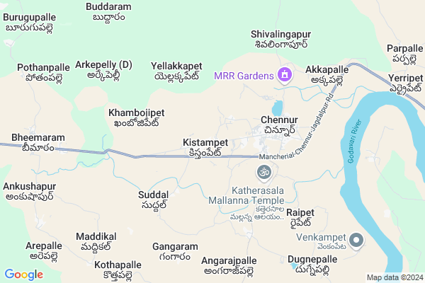
Kistampet Map
EDIT Map
Add Your House
 ..
..
Current Corona Virus Infected Patients Count in Adilabad District
| City Name | District Name | Total Covid cases |
|---|---|---|
| Adilabad District | Adilabad | 18 |
| Nirmal District | Nirmal | 17 |
Locality Name :
Kistampet
( కిష్టంపేట )
Mandal Name : Chennur
District : Adilabad
State : Telangana
Region : Telangana
Language : Telugu and Urdu
Current Time 12:49 PM
Date: Monday , Apr 28,2025 (IST)
Time zone: IST (UTC+5:30)
Elevation / Altitude: 169 meters. Above Seal level
Telephone Code / Std Code: 08729
Assembly constituency : Chennur assembly constituency
Assembly MLA : Gaddam Vivekanand
Lok Sabha constituency : Peddapalli parliamentary constituency
Parliament MP : Venkatesh Netha Borlakunta
Serpanch Name :
Pin Code : 504204
Post Office Name : Bheemaram
Commodities Prices : Sironcha Market / Mandi
Kistampet Live Weather
Temperature: 36.4 °C
clear sky
Humidity: 35%
Wind : 4.25 mt/sec towards S
StationName : "Manthani"
observed on 2 Hours Back
Temperature: 36.4 °C
clear sky
Humidity: 35%
Wind : 4.25 mt/sec towards S
StationName : "Manthani"
observed on 2 Hours Back
Kistampet Weather Forecast for Next 5 days
29-04-2025
29.8°C to 41.4°C
clear sky, scattered clouds, few clouds
29.8°C to 41.4°C
clear sky, scattered clouds, few clouds
30-04-2025
28.0°C to 43.1°C
clear sky, few clouds, scattered clouds
28.0°C to 43.1°C
clear sky, few clouds, scattered clouds
01-05-2025
28.4°C to 44.4°C
clear sky, few clouds, scattered clouds
28.4°C to 44.4°C
clear sky, few clouds, scattered clouds
02-05-2025
28.2°C to 43.9°C
clear sky, few clouds, scattered clouds
28.2°C to 43.9°C
clear sky, few clouds, scattered clouds
03-05-2025
29.0°C to 43.9°C
broken clouds, scattered clouds, clear sky, few clouds, light rain
29.0°C to 43.9°C
broken clouds, scattered clouds, clear sky, few clouds, light rain
National Highways Reachable To Kistampet
Nationa High Way :NH63
Nationa High Way :NH363
Nationa High Way :NH63
Nationa High Way :NH363
Rivers Near Kistampet
Godavari :गोदावरी :ಗೋದಾವರಿ :गोदावरी :கோதாவரி :గోదావరి
Raja Vagu
Godavari :गोदावरी :ಗೋದಾವರಿ :गोदावरी :கோதாவரி :గోదావరి
Raja Vagu
About Kistampet
Correct below Info and add more info about KistampetKistampet is a Village in Chennur Mandal in Adilabad District of Telangana State, India. It belongs to Telangana region . It is located 184 KM towards East from District head quarters Adilabad. 2 KM from Chennur.
Kistampet Pin code is 504204 and postal head office is Bheemaram .
Suddal ( 4 KM ) , Gangaram ( 6 KM ) , Dugnepalle ( 7 KM ) , Angarajpalle ( 7 KM ) , Maddikal ( 8 KM ) are the nearby Villages to Kistampet. Kistampet is surrounded by Jaipur Mandal towards west , Kotapally Mandal towards East , Nennel Mandal towards North , Sironcha Mandal towards East .
Mancherial , Ramagundam , Mandamarri , Bellampalle are the near by Cities to Kistampet.
This Place is in the border of the Adilabad District and Gadchiroli District. Gadchiroli District Sironcha is East towards this place . It is near to the Maharashtra State Border.
Kistampet 2011 Census Details
Kistampet Local Language is Telugu. Kistampet Village Total population is 2572 and number of houses are 672. Female Population is 50.3%. Village literacy rate is 51.1% and the Female Literacy rate is 21.0%.
Population
| Census Parameter | Census Data |
| Total Population | 2572 |
| Total No of Houses | 672 |
| Female Population % | 50.3 % ( 1293) |
| Total Literacy rate % | 51.1 % ( 1315) |
| Female Literacy rate | 21.0 % ( 540) |
| Scheduled Tribes Population % | 9.5 % ( 245) |
| Scheduled Caste Population % | 33.9 % ( 873) |
| Working Population % | 54.2 % |
| Child(0 -6) Population by 2011 | 236 |
| Girl Child(0 -6) Population % by 2011 | 47.5 % ( 112) |
Kistampet Census More Deatils.
Politics in Kistampet
TDP , TRS , INC are the major political parties in this area.Polling Stations /Booths near Kistampet
1)Venkatapur2)Katherasala
3)Kishtampeta
4)Bejjal
5)Kachanpalli
HOW TO REACH Kistampet
By Road
Mancherial is the Nearest Town to Kistampet. Mancherial is 35 km from Kistampet. Road connectivity is there from Mancherial to Kistampet.By Rail
There is no railway station near to Kistampet in less than 10 km. How ever there are railway Stations from Near By town Mancherial. are the railway Stations near to Mancherial. You can reach from Mancherial to Kistampet by road after .Colleges near Kistampet
Govt Degree &pg College
Address : Opposite To State Bank Of Hydarabad.....
Schools in Kistampet
Vagdevi High School
Address : kistampet , chennur , adilabad , Andhra Pradesh . PIN- 504204 , Post - Bheemaram
Zphs Kistampet
Address : kistampet , chennur , adilabad , Andhra Pradesh . PIN- 504204 , Post - Bheemaram
R.e.s Public School
Address : kistampet , chennur , adilabad , Andhra Pradesh . PIN- 504201 , Post - Chinnoor
Govt Health Centers near Kistampet
1) SubCentre, Chennur , , , Katterasala2) Community Health Centre,Chennur , , Bank Lane , Opp; Post Office
3) SubCentre, Asnad , , MAIN ROAD , NEAR PRIMARY SCHOOL
Hospitals in Kistampet,Chennur
SRI KIRAN CHILDREN HOSPITAL
7-165; SC Colony; Chinnur; Telangana 504201; India
3.1 KM distance Detail
SURYA CHILDREN HOSPITAL
NEAR NEW BUSSTAND; Asanad Rd; Chinnur; Telangana 504201; India
3.2 KM distance Detail
more ..
Colleges in Kistampet,Chennur
Chanakya Jr. College
Chinnur;; Kothagudem Colony; Chinnur; Telangana 504201; India
3.3 KM distance Detail
more ..
Super Markets in Kistampet,Chennur
Ss Supermarket
Nizamabad - Mancherial - Jagdalpur Rd; Telangana 504201; India
2.2 KM distance Detail
Ravichandra Kirana Store
; Kothagudem Colony; Chinnur; Telangana 504201; India
3.2 KM distance Detail
Governement Offices near Kistampet,Chennur
Krystal Soft Solutions
H NO: 2-64; Opposite Chaitanya Jr college; Mancheriyal road; Chennur Mancherial district; Telangana- 504201 Adarsh nagar; Chinnur; Telangana 504201; India
3.0 KM distance Detail
About Kistampet &
History
How to reach Kistampet
Tourist Places Near By Kistampet
Schools in Kistampet
Colleges in Kistampet
Temperature & weather of Kistampet
places in Kistampet
Kistampet photos
More Information
How to reach Kistampet
Tourist Places Near By Kistampet
Schools in Kistampet
Colleges in Kistampet
Temperature & weather of Kistampet
places in Kistampet
Kistampet photos
More Information
Village Talk
Post News or Events about this Village
Near Cities
Mancherial 35 KM near
Ramagundam 35 KM near
Mandamarri 36 KM near
Bellampalle 40 KM near
Mancherial 35 KM near
Ramagundam 35 KM near
Mandamarri 36 KM near
Bellampalle 40 KM near
Near By Taluks
Chennur 2 KM near
Kotapally 17 KM near
Jaipur 17 KM near
Nennel 26 KM near
Chennur 2 KM near
Kotapally 17 KM near
Jaipur 17 KM near
Nennel 26 KM near
Near By Air Ports
Rajiv Gandhi International Airport 255 KM near
Nanded Airport 290 KM near
Sonegaon Airport 290 KM near
Vijayawada Airport 314 KM near
Rajiv Gandhi International Airport 255 KM near
Nanded Airport 290 KM near
Sonegaon Airport 290 KM near
Vijayawada Airport 314 KM near
Near By Tourist Places
Sirpur 80 KM near
Medaram 87 KM near
Warangal 107 KM near
Bhamragarh Wildlife Sanctuary 120 KM near
Chandrapur 147 KM near
Sirpur 80 KM near
Medaram 87 KM near
Warangal 107 KM near
Bhamragarh Wildlife Sanctuary 120 KM near
Chandrapur 147 KM near
Near By Districts
Karimnagar 90 KM near
Warangal 110 KM near
Bijapur 124 KM near
Chandrapur 146 KM near
Karimnagar 90 KM near
Warangal 110 KM near
Bijapur 124 KM near
Chandrapur 146 KM near
Near By RailWay Station
Manchiryal Rail Way Station 36 KM near
Ramagundam Rail Way Station 39 KM near
Manchiryal Rail Way Station 36 KM near
Ramagundam Rail Way Station 39 KM near