| Home | City Bus | Maps | Villages | Cities | Rail | Tourist Places | School | College | Pin Codes | Corona Cases Count |
| Distance Calculator Bus Services IFSC Codes Trace Mobile Number Weather Search Place Trace IP Available Cash ATM/Banks Locate Polling Booth Report an Error contact People |
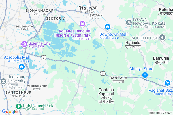
Bamanghata
Bamanghata Map
EDIT Map
Add Your House
 ..
..
Current Corona Virus Infected Patients Count in 24 Paraganas South District
| City Name | District Name | Total Covid cases |
|---|---|---|
| Tollygugne | South 24 Parganas | 1 |
Locality Name :
Bamanghata
( বামনঘাটা )
Block Name : Bhangar-ii
District : 24 Paraganas South
State : West Bengal
Division : Presidency
Language : Bengali and English
Current Time 12:38 PM
Date: Tuesday , Apr 29,2025 (IST)
Time zone: IST (UTC+5:30)
Elevation / Altitude: 6 meters. Above Seal level
Telephone Code / Std Code: 03218
Assembly constituency : Bhangore assembly constituency
Assembly MLA : Md. Nawsad Siddique
Lok Sabha constituency : Jadavpur parliamentary constituency
Parliament MP : MIMI CHAKRABORTY
Serpanch Name :
Pin Code : 743338
Post Office Name : Nimpith Ashram
Commodities Prices : Sealdah Koley Market Market / Mandi
Bamanghata Live Weather
Temperature: 30.0 °C
haze
Humidity: 54%
Wind : 2.57 mt/sec towards N
StationName : "Raypur"
observed on 5 Mins Back
Temperature: 30.0 °C
haze
Humidity: 54%
Wind : 2.57 mt/sec towards N
StationName : "Raypur"
observed on 5 Mins Back
Bamanghata Weather Forecast for Next 5 days
30-04-2025
22.4°C to 37.1°C
scattered clouds, moderate rain, heavy intensity rain, light rain, overcast clouds
22.4°C to 37.1°C
scattered clouds, moderate rain, heavy intensity rain, light rain, overcast clouds
01-05-2025
25.2°C to 35.1°C
overcast clouds, clear sky, light rain, broken clouds
25.2°C to 35.1°C
overcast clouds, clear sky, light rain, broken clouds
02-05-2025
25.5°C to 36.0°C
broken clouds, clear sky, scattered clouds, moderate rain, overcast clouds
25.5°C to 36.0°C
broken clouds, clear sky, scattered clouds, moderate rain, overcast clouds
03-05-2025
25.8°C to 35.1°C
overcast clouds, scattered clouds, light rain, few clouds, clear sky, broken clouds
25.8°C to 35.1°C
overcast clouds, scattered clouds, light rain, few clouds, clear sky, broken clouds
04-05-2025
25.4°C to 35.5°C
light rain, few clouds, broken clouds, moderate rain, heavy intensity rain, scattered clouds
25.4°C to 35.5°C
light rain, few clouds, broken clouds, moderate rain, heavy intensity rain, scattered clouds
Edit below overview about Bamanghata
Edit below overview about Bamanghata
OverView of Bamanghata
from kolkata Bus No 213/Dhamakhali Express/Basanti Express/SD 24/CTC Ghatakpukur , Leather Complex , T2 T10 T9 / ETC.Edit below overview about Bamanghata
National Highways Reachable To Bamanghata
Nationa High Way :NH12
Nationa High Way :NH12
Rivers Near Bamanghata
Hooghly :হুগলী :Hugli :Hooghly :Hugli :胡格利河
Dansa
Hooghly :হুগলী :Hugli :Hooghly :Hugli :胡格利河
Dansa
About Bamanghata
Bamanghata is a Village in Bhangar-ii Block in 24 Paraganas South District of West Bengal State, India. It belongs to Presidency Division . It is located 14 KM towards East from District head quarters Alipore. 16 KM from Bhangar-Ii. 14 KM from State capital Kolkata
Bamanghata Pin code is 743338 and postal head office is Nimpith Ashram .
Kamrabad ( 11 KM ) , Pratapnagar ( 12 KM ) , Polerhat-ii ( 12 KM ) , Buta ( 13 KM ) , Kalikapur-i ( 13 KM ) are the nearby Villages to Bamanghata. Bamanghata is surrounded by Sonar Pur Block towards South , Alipore Block towards west , Bhangar-Ii Block towards East , Bhangar-I Block towards East .
Bidhan Nagar , Kolkata , South Dumdum , Rajpur Sonarpur are the near by Cities to Bamanghata.
This Place is in the border of the 24 Paraganas South District and 24 Paraganas North District. 24 Paraganas North District Minakhan is East towards this place .
Demographics of Bamanghata
Bengali is the Local Language here.Politics in Bamanghata
CPM , AITC , All India Trinamool Congress are the major political parties in this area.Polling Stations /Booths near Bamanghata
1)Kulberia Vivekananda F.p.s (r-2)2)Kulti No.1 G.s F.p.s (r-1)
3)Bairampur Fp School(r-2)
4)Chinipukur S.s.k (r-2)
5)Dakshin Bamanghata F.p.s (r-1)
HOW TO REACH Bamanghata
By Rail
Garia Rail Way Station , Narendrapur Halt Rail Way Station are the very nearby railway stations to Bamanghata.Colleges near Bamanghata
Sukanta College
Address :
Falta Group Of Colleges
Address :
Sukata College
Address : Sonakhale
Schools near Bamanghata
Bcti Computer Center
Address : NOTUN BRIDGE, AUTO STAND, UTTAR KANTALIA, PO - BHANGAR, PS - KASHIPUR, DIST - S 24 PGS, PIN 743502
Govt Health Centers near Bamanghata
1) Kheadaha I , Kheadaha Health Sub Centre , Kheadaha Bantala Main Road , Kheadaha High School, Kheadaha PHC2) Bhagabanpur , Bhagabanpur Health Sub Centre , Kheadaha Anandapur Road , Opposite of Kheadaha II GP Office
3) Ranabhutia , Ranabhutia Health Sub Centre , Ranabhutia Kantipota Road , Ranabhutia 1 no. Ala
Hospitals in Bamanghata,Bhangar-ii
Dharmatala Panchuria Uposhastho Kendra
Newtown; Dharmatala Pachuria; West Bengal 743502; India
3.6 KM distance Detail
Kheyada Hospital
Sonarpur Bamanghata Rd; Kheyadah; Bagdoba; Kolkata; West Bengal 700150; India
4.1 KM distance Detail
Rupsa clinic
Dharamatala Pachuria Road; Action Area III; Newtown; Kulberia; West Bengal 743502; India
4.4 KM distance Detail
more ..
Petrol Bunks in Bamanghata,Bhangar-ii
HP Gas Godown
HP Gas Godown; Hathacha; Newtown; Kolkata; West Bengal 700156; India
3.5 KM distance Detail
Smart RO COCO Indian Oil Corporation Limited
Newtown; Kulberia; West Bengal 700135; India
5.1 KM distance Detail
BPCL Petrol Pump
DJ Block(Newtown); Action Area I; Newtown; New Town; West Bengal 700135; India
5.8 KM distance Detail
more ..
Colleges in Bamanghata,Bhangar-ii
Bengal Institute Of Technology
No. 1; Govt Colony; Basanti Road; Kolkata; West Bengal 700150; India
1.5 KM distance Detail
West Bengal Judicial Academy
AA II; Newtown; New Town; West Bengal 700156; India
4.5 KM distance Detail
University of Engineering & Management; New Town
University Area; Plot No. III - B/5; New Town; Action Area - III; Kolkata; West Bengal 700156; India
4.6 KM distance Detail
St. Xavier's University
Newtown; Action Area III B; Kolkata; West Bengal 700160; India
4.6 KM distance Detail
more ..
Schools in Bamanghata,Bhangar-ii
Bamanghata High School (H.S)
Science City Malancha Rd; Bamanghata; Hatgachha; Hadia; West Bengal 700150; India
1.2 KM distance Detail
Bamanghata Progoti Sangha
k.l.c;; Sonarpur Bamanghata Rd; Bamanghata; Bagdoba; Hadia; West Bengal 700150; India
1.3 KM distance Detail
Hatgacha Sorodar Para Primary School
Hatgacha 24 south East Wetlands; Kolkata; West Bengal; India
1.4 KM distance Detail
Howra Bilridze
Sonarpur - Kheyadah - Bantala Road; Bamanghata; Bagdoba; Hadia; West Bengal 700150; India
1.4 KM distance Detail
Electronic Shops in Bamanghata,Bhangar-ii
Jharna Telecom;Prop-Arannya
Newtown; Dharmatala Pachuria; West Bengal 743502; India
3.7 KM distance Detail
Jharna Telecom (Arannya Naskar)
Newtown; Dharmatala Pachuria; West Bengal 743502; India
3.8 KM distance Detail
Super Markets in Bamanghata,Bhangar-ii
Rosedale Plaza
BLK-3; Action Area III; Newtown; Kolkata; West Bengal 700160; India
4.7 KM distance Detail
Chitto Mondal Tee & Roti Shop
7FS Galaxy; DJ Block(Newtown); Action Area I; Newtown; Kolkata; West Bengal 743502; India
4.8 KM distance Detail
Reliance Smart (Rosedale Plaza)
Ground Floor; Rosedale Plaza;; Rosedale Plaza Complex; Action Area III; Newtown; Kolkata; West Bengal 700156; India
4.8 KM distance Detail
Local Parks in Bamanghata,Bhangar-ii
P. K. Nursery
(W.B.) Near; Kheyadah High School; Kheyadah; Kheyadah Village; Goalapota; West Bengal 700150; India
4.1 KM distance Detail
Shilla Garden
Dharamatala Pachuria Road; Newtown; Kulberia; West Bengal 743502; India
4.3 KM distance Detail
Police Stations near Bamanghata,Bhangar-ii
Bamanghata Road
Sonarpur Bamanghata Rd; Bamanghata; Manpur; Bagdoba; Kolkata; West Bengal 700150; India
1.4 KM distance Detail
Konchpukur Police Camp
Jodthbhim; Newtown; New Town; West Bengal 743502; India
3.6 KM distance Detail
Governement Offices near Bamanghata,Bhangar-ii
Bamanghata Panchayat
North K.L.C; Bamanghata; Manpur; Bagdoba; Kolkata; West Bengal 700150; India
0.5 KM distance Detail
West Bengal State Council of Technical Education
Plot B-7; AA-III; 4th Floor; Opposite to Uniworld City; Newtown; Rajarhat; Kolkata; West Bengal 700156; India
4.6 KM distance Detail
About Bamanghata &
History
How to reach Bamanghata
Tourist Places Near By Bamanghata
Schools in Bamanghata
Colleges in Bamanghata
Temperature & weather of Bamanghata
places in Bamanghata
Bamanghata photos
More Information
How to reach Bamanghata
Tourist Places Near By Bamanghata
Schools in Bamanghata
Colleges in Bamanghata
Temperature & weather of Bamanghata
places in Bamanghata
Bamanghata photos
More Information
Village Talk
Post News or Events about this Village
Near Cities
Bidhan Nagar 8 KM near
Kolkata 12 KM near
South Dumdum 12 KM near
Rajpur Sonarpur 14 KM near
Bidhan Nagar 8 KM near
Kolkata 12 KM near
South Dumdum 12 KM near
Rajpur Sonarpur 14 KM near
Near By Taluks
Kolkata 10 KM near
Sonar Pur 13 KM near
Alipore 14 KM near
Bhangar-Ii 16 KM near
Kolkata 10 KM near
Sonar Pur 13 KM near
Alipore 14 KM near
Bhangar-Ii 16 KM near
Near By Air Ports
Netaji Subhas Chandra Bose Airport 14 KM near
Singerbhil Airport 360 KM near
Ranchi Airport 374 KM near
Bhubaneswar Airport 418 KM near
Netaji Subhas Chandra Bose Airport 14 KM near
Singerbhil Airport 360 KM near
Ranchi Airport 374 KM near
Bhubaneswar Airport 418 KM near
Near By Tourist Places
Kolkata 13 KM near
Alipore 16 KM near
Howrah 25 KM near
Raichak 56 KM near
Haldia 71 KM near
Kolkata 13 KM near
Alipore 16 KM near
Howrah 25 KM near
Raichak 56 KM near
Haldia 71 KM near
Near By Districts
Kolkata 14 KM near
24 Paraganas South 14 KM near
Howrah 19 KM near
24 Paraganas North 23 KM near
Kolkata 14 KM near
24 Paraganas South 14 KM near
Howrah 19 KM near
24 Paraganas North 23 KM near
Near By RailWay Station
Sealdah Rail Way Station 11 KM near
Bidhan Nagar Road Rail Way Station 11 KM near
Sealdah Rail Way Station 11 KM near
Bidhan Nagar Road Rail Way Station 11 KM near